Enable Location

We need your location to show you interesting places around you

Discover nearby places

Find interesting locations and hidden gems around you

Precise directions

Get accurate directions and distances to places

Your location is never shared with other users. It's only used when you tap the location button.

Point Pinos Lighthouse

Log in to your account

Start exploring — it's free

Trusted by 61,372 travelers worldwide

Continue with Google
Continue with Apple
or

We will send you a code to connect

By continuing, you accept our Terms and Conditions and our Privacy Policy

Check your inbox

We've sent a pincode in your inbox. Please enter the code below.

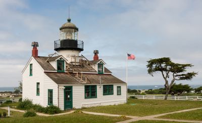
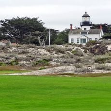
Point Pinos Lighthouse, Historic lighthouse in Pacific Grove, California, US

Description

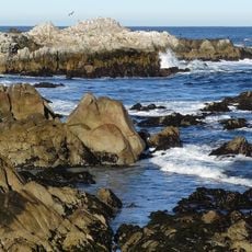
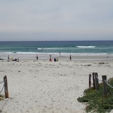
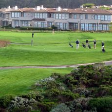
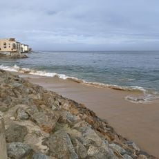
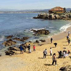
Point Pinos Lighthouse is a white cylindrical tower with a black lantern perched on the Pacific Grove coastline, rising 13 m (43 ft) above ground. The structure sits in a park setting next to municipal golf links, offering views of the ocean and rocky shore.

History

The light was built in 1855 as one of the first to be funded after California became a state. It remains the oldest continuously operating light on the West Coast and marks a key moment in early American coastal navigation history.

Culture

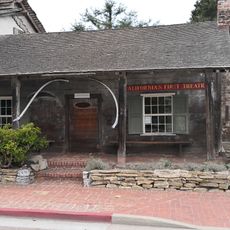
The lighthouse has served as a gathering place woven into local memory and community identity over generations. This role as a social hub remains visible in how people connect with the place today.

Practical

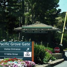
Visiting works best on weekdays and offers straightforward access through a coastal park with walking paths. Bring a jacket since ocean breezes can be strong, and check opening times before visiting since hours are limited.

Did you know?

Inside, the structure preserves an original French-made Fresnel lens from the 1800s, an optical device that bent light over vast distances. This antique technology still works today and shows how engineers solved complex maritime problems more than 150 years ago.

Location
Inception
1855
Height
13 m
Made from material
concrete
GPS coordinates
36.63339,-121.93374
Latest update
December 8, 2025 19:58

AroundUs brings together thousands of curated places, local tips, and hidden gems, enriched daily by 60,000 contributors worldwide. Discover all places nearby (Pacific Grove).

Around this place
Monterey Bay Aquarium
United States of America

Monterey Bay Aquarium

3.3 km
Asilomar State Beach
United States of America

Asilomar State Beach

1.5 km
Asilomar Conference Grounds
United States of America

Asilomar Conference Grounds

1.5 km
Monterey State Historic Park
United States of America

Monterey State Historic Park

4.9 km
Pacific Biological Laboratories
United States of America

Pacific Biological Laboratories

3.5 km
Fisherman's Wharf, Monterey, California
United States of America

Fisherman's Wharf, Monterey, California

4.9 km
Old Customhouse
United States of America

Old Customhouse

4.9 km
Asilomar State Marine Reserve
United States of America

Asilomar State Marine Reserve

1.6 km
California's First Theatre
United States of America

California's First Theatre

4.8 km
Edward F. Ricketts State Marine Conservation Area
United States of America

Edward F. Ricketts State Marine Conservation Area

4.8 km
Pacific Grove Museum of Natural History
United States of America

Pacific Grove Museum of Natural History

2 km
Pacific Grove Municipal Golf Links
United States of America

Pacific Grove Municipal Golf Links

156 m
Wharf Theater
United States of America

Wharf Theater

4.9 km
James W. Finch House
United States of America

James W. Finch House

4.7 km
Chautauqua Hall
United States of America

Chautauqua Hall

1.9 km
Trimmer Hill
United States of America

Trimmer Hill

2.7 km
Lou Ellen Parmelee House
United States of America

Lou Ellen Parmelee House

3.6 km
Frank LaVerne Buck House
United States of America

Frank LaVerne Buck House

2.2 km
Josiah Merritt Adobe
United States of America

Josiah Merritt Adobe

5 km
Monterey Bay Aquarium
United States of America

Monterey Bay Aquarium

3.3 km
Cannery Row Monument
United States of America

Cannery Row Monument

3.6 km
North Moss Beach
United States of America

North Moss Beach

1.9 km
The Links at Spanish Bay
United States of America

The Links at Spanish Bay

2.5 km
Aeneas Beach
United States of America

Aeneas Beach

4 km
Macabee Beach
United States of America

Macabee Beach

3.6 km
Pacific Grove Gate
United States of America

Pacific Grove Gate

2.3 km
San Carlos Beach
United States of America

San Carlos Beach

4.3 km
McAbee Beach
United States of America

McAbee Beach

3.6 km
Show the full map
« Point Pinos Lighthouse - Historic lighthouse in Pacific Grove, California, US » is provided by Around Us (aroundus.com). Images and texts are derived from Wikimedia project under a Creative Commons license. You are allowed to copy, distribute, and modify copies of this page, under the conditions set by the license, as long as this note is clearly visible.

Discover hidden gems everywhere you go!

From secret cafés to breathtaking viewpoints, skip the crowded tourist spots and find places that match your style. Our app makes it easy with voice search, smart filtering, route optimization, and insider tips from travelers worldwide. Download now for the complete mobile experience.

Around Us App Screenshot

A unique approach to discovering new places

Le Figaro

All the places worth exploring

France Info

A tailor-made excursion in just a few clicks

20 Minutes

Around Us
Travel Guide & Maps
Download

Send to your phone

QR Code
1

Open the camera app on your mobile.

2

Point at the QR code with your camera. A notification will appear.

3

Tap the notification to open the link.