Chest opened
+${chestReward.xp} XP
Explorer
NOUVEAU ×${chestReward.collectible.quantity}
tapez pour fermer
Chest locked

Open chests in the app

Around Us is built for your phone — chests unlock when you walk, explore and capture nearby places.

Enable Location

We need your location to show you interesting places around you

Discover nearby places

Find interesting locations and hidden gems around you

Precise directions

Get accurate directions and distances to places

Your location is never shared with other users. It's only used when you tap the location button.

Mendota

Log in to your account

Start exploring — it's free

Trusted by 72,890 travelers worldwide

Continue with Google
Continue with Apple
or

We will send you a code to connect

By continuing, you accept our Terms and Conditions and our Privacy Policy

Check your inbox

We've sent a pincode in your inbox. Please enter the code below.

Discussion Reviews 1 Photos
19.3k Popularity

Mendota, city in California, United States

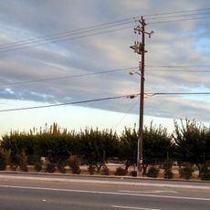
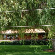
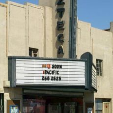
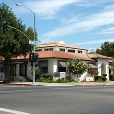
Mendota is a small city in the center of California's Central Valley, surrounded by fields and open spaces. It is known for growing cantaloupes and has simple, practical buildings with shops, homes, and community centers that form the core of local life.

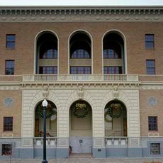
The city began as a railroad stop in the late 1800s and later developed into an agricultural center. The first post office opened in 1892, and the city officially became part of California in 1942.

Mendota has a strong Hispanic community that shapes daily life throughout the town. Traditional celebrations, regional food, and Spanish street names are visible everywhere, reflecting the cultural identity of residents.

The city is small and flat, easy to explore on foot or by car since distances are short and roads are straightforward. The climate is warm year-round with hot summers and mild winters, making spring and fall the best times to visit.

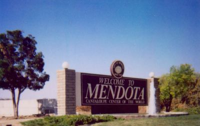
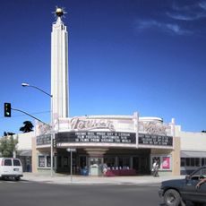
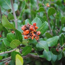
Mendota calls itself the Cantaloupe Center of the World and celebrates this connection to the fruit through local markets and events. This specialty has given the city a distinct identity that sets it apart from other farming communities.

The community of curious travelers

AroundUs brings together thousands of curated places, local tips, and hidden gems, enriched daily by 60,000 contributors worldwide.

Start exploring
Location
Inception
June 17, 1942
Elevation above the sea
53 m
GPS coordinates
36.75361,-120.38167
Latest update
March 2, 2026 22:23
Around this place
Valley State Prison
United States of America

Valley State Prison

44 km
Forestiere Underground Gardens
United States of America

Forestiere Underground Gardens

45 km
Chukchansi Park
United States of America

Chukchansi Park

52.8 km
United States of America

Fresno City College

52.1 km
Fresno Chaffee Zoo
United States of America

Fresno Chaffee Zoo

49.8 km
Warnors Theatre
United States of America

Warnors Theatre

52.4 km
Randall Fawcett House
United States of America

Randall Fawcett House

48.4 km
Tower Theatre
United States of America

Tower Theatre

51.8 km
Fresno Metropolitan Museum of Art and Science
United States of America

Fresno Metropolitan Museum of Art and Science

52.3 km
San Benito mountain
United States of America

San Benito mountain

48.8 km
Fresno City Hall
United States of America

Fresno City Hall

53.2 km
Old Fresno Water Tower
United States of America

Old Fresno Water Tower

53 km
Fresno River Viaduct
United States of America

Fresno River Viaduct

40.5 km
San Joaquin River Viaduct
United States of America

San Joaquin River Viaduct

41.3 km
Bank of Italy
United States of America

Bank of Italy

52.4 km
Kearney Park
United States of America

Kearney Park

41.3 km
Azteca Theater
United States of America

Azteca Theater

52.6 km
Fresno County Courthouse
United States of America

Fresno County Courthouse

52.9 km
Fresno Bee Building
United States of America

Fresno Bee Building

52.4 km
San Joaquin Light and Power Corporation Building
United States of America

San Joaquin Light and Power Corporation Building

52.4 km
M. Young Botanic Garden
United States of America

M. Young Botanic Garden

28.9 km
Madera County Courthouse
United States of America

Madera County Courthouse

36.6 km
The William Saroyan House Museum
United States of America

The William Saroyan House Museum

48.2 km
Fresno Memorial Auditorium
United States of America

Fresno Memorial Auditorium

53 km
Einstein House
United States of America

Einstein House

52.5 km
Physicians Building
United States of America

Physicians Building

53.2 km
Golden State County Plaza
United States of America

Golden State County Plaza

53.1 km
Fig Garden Regional Library
United States of America

Fig Garden Regional Library

48.4 km
Show the full map
Reviews
Share your experience

No review yet

Discussions
Start a discussion...

No discussion yet

« Mendota - city in California, United States » is provided by Around Us (aroundus.com). Images and texts are derived from Wikimedia project under a Creative Commons license. You are allowed to copy, distribute, and modify copies of this page, under the conditions set by the license, as long as this note is clearly visible.

Discover hidden gems everywhere you go!

From secret cafés to breathtaking viewpoints, skip the crowded tourist spots and find places that match your style. Our app makes it easy with voice search, smart filtering, route optimization, and insider tips from travelers worldwide. Download now for the complete mobile experience.

Around Us App Screenshot

A unique approach to discovering new places

Le Figaro

All the places worth exploring

France Info

A tailor-made excursion in just a few clicks

20 Minutes

Around Us
Travel Guide & Maps
Download

Send to your phone

QR Code
1

Open the camera app on your mobile.

2

Point at the QR code with your camera. A notification will appear.

3

Tap the notification to open the link.