San Benito mountain

Log in to your account

AroundUs is a community-driven map of interesting places, built by curious explorers like you. It grows with every review, story, and photo you share.
Connect to save your favorite spots, contribute locations, and create personalized routes.
Continue with Google
Continue with Apple
Continue with X
Continue with Facebook
Continue with email
By continuing, you accept our Terms and Conditions and our Privacy Policy
Create an account
Add to collection
Map
Suggest a change
Share

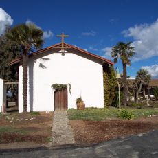
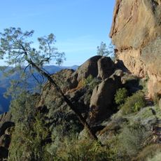
San Benito mountain, Mountain summit in Diablo Range, California

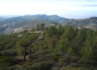
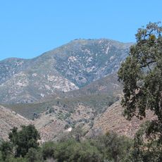
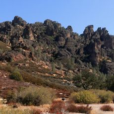
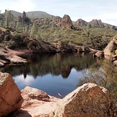
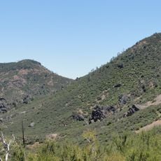
San Benito Mountain is a summit in California's Diablo Range that rises to about 5,267 feet above sea level. The peak stands out as the tallest point in this mountain range spanning central California.

The mountain sits within an area that was historically mined for minerals like cinnabar and chromite, with operations continuing until the early 2010s. These extractive activities left marks on the surrounding landscape and land use patterns.

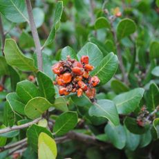
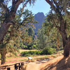
The San Benito Mountain Research Natural Area protects a collection of rare plant species adapted to the mountain's serpentine soil conditions.

Access to certain areas requires special permits due to naturally occurring asbestos in the soil and rock. Visitors should check regulations before planning a visit and follow all guidance provided by local authorities.

The serpentine rock formations create unusual soil conditions that support plant species found nowhere else, adapted specifically to the mineral-rich environment. These rare plant communities are now protected as part of a research natural area.

Location: California

GPS coordinates: 36.36968,-120.64434

Latest update: December 11, 2025 11:09

Photos
Around this place
Avenal State Prison
United States of America

Avenal State Prison

64.4 km
Pleasant Valley State Prison
United States of America

Pleasant Valley State Prison

44.3 km
Lake Nacimiento
United States of America

Lake Nacimiento

75.3 km
Mission Nuestra Señora de la Soledad
United States of America

Mission Nuestra Señora de la Soledad

63.9 km
Lake San Antonio
United States of America

Lake San Antonio

64.7 km
Junipero Serra Peak
United States of America

Junipero Serra Peak

73.9 km
United States of America

Chalone Vineyard

53.6 km
Randall Fawcett House
United States of America

Randall Fawcett House

69.7 km
Kettleman Hills Hazardous Waste Facility
United States of America

Kettleman Hills Hazardous Waste Facility

72.8 km
Laguna Mountain Recreation Area
United States of America

Laguna Mountain Recreation Area

18.7 km
Dos Amigos Pumping Plant
United States of America

Dos Amigos Pumping Plant

63.7 km
Hernandez Reservoir
United States of America

Hernandez Reservoir

16.1 km
Rios-Caledonia Adobe
United States of America

Rios-Caledonia Adobe

70.5 km
King City High School Auditorium
United States of America

King City High School Auditorium

47.2 km
M. Young Botanic Garden
United States of America

M. Young Botanic Garden

65.4 km
Pinnacles National Forest
United States of America

Pinnacles National Forest

51.8 km
1 (Las Cruces - San Francisco)
United States of America

1 (Las Cruces - San Francisco)

69.5 km
United States of America

Parkfield Interventional EQ Fieldwork

55.7 km
Odd Fellows Hall
United States of America

Odd Fellows Hall

73.1 km
Mission Soledad Museum
United States of America

Mission Soledad Museum

63.9 km
Bear Gulch Reservoir
United States of America

Bear Gulch Reservoir

50.1 km
Juniper Canyon Trail
United States of America

Juniper Canyon Trail

51.5 km
Fort Hunter Liggett
United States of America

Fort Hunter Liggett

70.3 km
Balconies Trail
United States of America

Balconies Trail

52.1 km
Bear Valley School
United States of America

Bear Valley School

48.6 km
Chalone Peak Lookout
United States of America

Chalone Peak Lookout

50.2 km
Camp Roberts Historical Museum
United States of America

Camp Roberts Historical Museum

64.6 km
Manzoni Estate Vineyard
United States of America

Manzoni Estate Vineyard

74.6 km
Show the full map
Reviews

Visited this place? Tap the stars to rate it and share your experience / photos with the community! Try now! You can cancel it anytime.

« San Benito mountain - Mountain summit in Diablo Range, California » is provided by Around Us (aroundus.com). Images and texts are derived from Wikimedia project under a Creative Commons license. You are allowed to copy, distribute, and modify copies of this page, under the conditions set by the license, as long as this note is clearly visible.

Discover hidden gems everywhere you go!

From secret cafés to breathtaking viewpoints, skip the crowded tourist spots and find places that match your style. Our app makes it easy with voice search, smart filtering, route optimization, and insider tips from travelers worldwide. Download now for the complete mobile experience.

Around Us App Screenshot

A unique approach to discovering new places

Le Figaro

All the places worth exploring

France Info

A tailor-made excursion in just a few clicks

20 Minutes