Chest opened
+${chestReward.xp} XP
Explorer
NOUVEAU ×${chestReward.collectible.quantity}
tapez pour fermer
Chest locked

Open chests in the app

Around Us is built for your phone — chests unlock when you walk, explore and capture nearby places.

Enable Location

We need your location to show you interesting places around you

Discover nearby places

Find interesting locations and hidden gems around you

Precise directions

Get accurate directions and distances to places

Your location is never shared with other users. It's only used when you tap the location button.

Bayview-Hunters Point

Log in to your account

Start exploring — it's free

Trusted by 72,882 travelers worldwide

Continue with Google
Continue with Apple
or

We will send you a code to connect

By continuing, you accept our Terms and Conditions and our Privacy Policy

Check your inbox

We've sent a pincode in your inbox. Please enter the code below.

Discussion Reviews 3 Photos
1.3k Popularity

Bayview-Hunters Point, Residential and industrial district in southeastern San Francisco, US

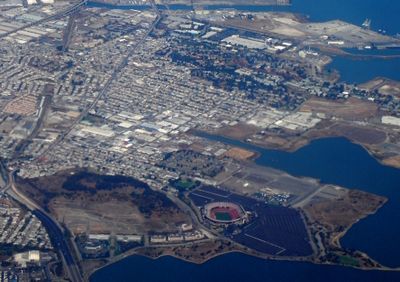
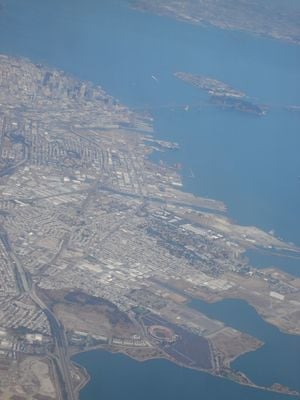
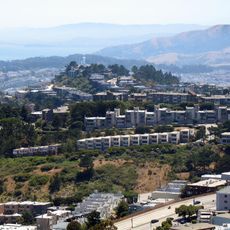
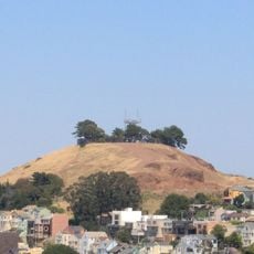
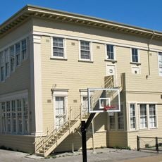
Bayview-Hunters Point is a residential and industrial neighborhood in southeastern San Francisco that stretches from Cesar Chavez Boulevard to Bayview Hill. The area sits between Highway 101 and San Francisco Bay, with a mix of older homes and new housing projects reshaping its character.

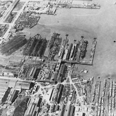
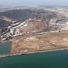
The area began as a butcher reservation in the 1860s before shifting to a naval shipyard during World War II. This industrial past shaped the economic character of the neighborhood for many decades.

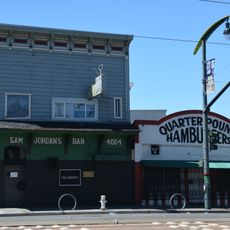
African American residents have shaped the social fabric here since the 1930s, with community spaces centered around churches and local shops. The neighborhood carries a strong sense of people keeping their roots and supporting one another.

The neighborhood is well connected by the Third Street Light Rail, which links it to other parts of San Francisco. The best time to explore is during warmer months when the weather is clearer and more comfortable for walking.

The neighborhood has a higher homeownership rate compared to other parts of the city, reflecting deeper community stability. This ownership level shows that many residents remain long-term and invest in their properties.

The community of curious travelers

AroundUs brings together thousands of curated places, local tips, and hidden gems, enriched daily by 60,000 contributors worldwide.

Start exploring
Location
GPS coordinates
37.72687,-122.38873
Latest update
December 14, 2025 18:07
Around this place
Candlestick Point State Recreation Area
United States of America

Candlestick Point State Recreation Area

1.9 km
McLaren Park
United States of America

McLaren Park

2.8 km
Sam Jordan's Bar
United States of America

Sam Jordan's Bar

1.6 km
Bernal Heights Summit
United States of America

Bernal Heights Summit

3 km
Potrero Point
United States of America

Potrero Point

3.5 km
Alamo Drafthouse New Mission Cinema
United States of America

Alamo Drafthouse New Mission Cinema

4.2 km
Bayview Opera House
United States of America

Bayview Opera House

930 m
Brisbane Baylands development
United States of America

Brisbane Baylands development

2.6 km
Albion Brewery
United States of America

Albion Brewery

1.3 km
Jerry Garcia Amphitheatre
United States of America

Jerry Garcia Amphitheatre

2.6 km
Kadist Art Foundation
United States of America

Kadist Art Foundation

4.2 km
Institute of Contemporary Art San Francisco
United States of America

Institute of Contemporary Art San Francisco

3.6 km
Potrero Hill Neighborhood House
United States of America

Potrero Hill Neighborhood House

3.7 km
Minnesota Street Project
United States of America

Minnesota Street Project

3.1 km
Building 101
United States of America

Building 101

3.8 km
Quinn House, San Francisco
United States of America

Quinn House, San Francisco

1 km
Frank G. Edwards House
United States of America

Frank G. Edwards House

3.9 km
Cow Palace
United States of America

Cow Palace

3.5 km
United States of America

Hunters View

1.2 km
Bernal Heights Branch Library
United States of America

Bernal Heights Branch Library

2.8 km
Glen Park Branch Library
United States of America

Glen Park Branch Library

4 km
Excelsior Branch Library
United States of America

Excelsior Branch Library

3.9 km
Visitacion Valley Branch Library
United States of America

Visitacion Valley Branch Library

2.3 km
Portola Branch Library
United States of America

Portola Branch Library

1.6 km
La Grande Tank
United States of America

La Grande Tank

3.2 km
Mission Branch Library
United States of America

Mission Branch Library

3.9 km
Irving Murray Scott School
United States of America

Irving Murray Scott School

3.5 km
Potrero Branch Library
United States of America

Potrero Branch Library

3.8 km
Show the full map
Reviews
Share your experience

No review yet

Discussions
Start a discussion...

No discussion yet

« Bayview-Hunters Point - Residential and industrial district in southeastern San Francisco, US » is provided by Around Us (aroundus.com). Images and texts are derived from Wikimedia project under a Creative Commons license. You are allowed to copy, distribute, and modify copies of this page, under the conditions set by the license, as long as this note is clearly visible.

Discover hidden gems everywhere you go!

From secret cafés to breathtaking viewpoints, skip the crowded tourist spots and find places that match your style. Our app makes it easy with voice search, smart filtering, route optimization, and insider tips from travelers worldwide. Download now for the complete mobile experience.

Around Us App Screenshot

A unique approach to discovering new places

Le Figaro

All the places worth exploring

France Info

A tailor-made excursion in just a few clicks

20 Minutes

Around Us
Travel Guide & Maps
Download

Send to your phone

QR Code
1

Open the camera app on your mobile.

2

Point at the QR code with your camera. A notification will appear.

3

Tap the notification to open the link.