Enable Location

We need your location to show you interesting places around you

Discover nearby places

Find interesting locations and hidden gems around you

Precise directions

Get accurate directions and distances to places

Your location is never shared with other users. It's only used when you tap the location button.

Southampton Shoal Light

Log in to your account

Start exploring — it's free

Trusted by 62,558 travelers worldwide

Continue with Google
Continue with Apple
or

We will send you a code to connect

By continuing, you accept our Terms and Conditions and our Privacy Policy

Check your inbox

We've sent a pincode in your inbox. Please enter the code below.

Southampton Shoal Light

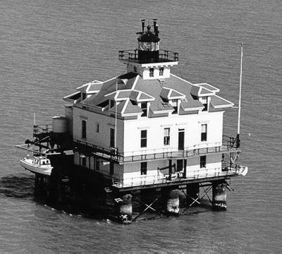
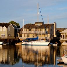
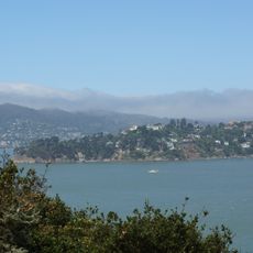
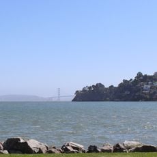
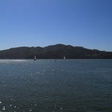
Southampton Shoal Light, Maritime navigation station in San Francisco Bay, US

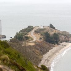
Southampton Shoal Light is a lighthouse standing on a platform at the southwest edge of Southampton Shoals in San Francisco Bay, northeast of Angel Island. The structure rests on eleven steel cylinder pilings and features a wooden building with multiple stories and balconies.

Construction began in 1905 as a floating residential structure supported by eleven steel cylinder pilings. The building was designed to serve dual purposes: providing shelter and aiding marine navigation in the bay.

The building earned its name 'House on the Bay' from local maritime communities due to its residential design with balconies and multi-story layout.

The building is privately owned and serves as accommodation for members of the St. Francis Yacht Club. The site is not open to the public, though it can be viewed from boats passing through the bay.

A heavy brass signal device weighing about 1,600 kilograms sat on the upper floor to alert ships during fog. This manual system gave way to automated electric horns that proved more dependable over time.

The community of curious travelers

AroundUs brings together thousands of curated places, local tips, and hidden gems, enriched daily by 60,000 contributors worldwide.

Start exploring
Inception
1905
Height
10 m
GPS coordinates
37.88167,-122.40000
Latest update
December 14, 2025 12:22
Around this place
Angel Island Immigration Station
United States of America

Angel Island Immigration Station

2.6 km
SS Red Oak Victory
United States of America

SS Red Oak Victory

4 km
Ford Motor Company Assembly Plant
United States of America

Ford Motor Company Assembly Plant

4.9 km
Model Industries Building
United States of America

Model Industries Building

6.4 km
Social Hall
United States of America

Social Hall

6.3 km
United States of America

Richmond Inner Harbor

5.6 km
Rosie the Riveter World War II Home Front National Historical Park
United States of America

Rosie the Riveter World War II Home Front National Historical Park

4.9 km
The Plunge
United States of America

The Plunge

5 km
Power House
United States of America

Power House

6.3 km
Wapama
United States of America

Wapama

4 km
Alcatraz Water Tower
United States of America

Alcatraz Water Tower

6.4 km
Kaiser Richmond Field Hospital
United States of America

Kaiser Richmond Field Hospital

6 km
Point Richmond Historic District
United States of America

Point Richmond Historic District

5.1 km
Golden State Model Railroad Museum
United States of America

Golden State Model Railroad Museum

4 km
Hotel Mac
United States of America

Hotel Mac

4.7 km
Point Blunt Light
United States of America

Point Blunt Light

3.6 km
Brickyard Cove
United States of America

Brickyard Cove

3.1 km
Belvedere-Tiburon Library
United States of America

Belvedere-Tiburon Library

5.4 km
Former Military Chapel
United States of America

Former Military Chapel

6.4 km
Tiburon Railroad & Ferry Depot Museum
United States of America

Tiburon Railroad & Ferry Depot Museum

4.6 km
Point Stuart Light
United States of America

Point Stuart Light

3.6 km
Point lone
United States of America

Point lone

3.8 km
Richmond Shipyard Number Three
United States of America

Richmond Shipyard Number Three

4.3 km
Perles Beach
United States of America

Perles Beach

4.5 km
Scenic viewpoint
United States of America

Scenic viewpoint

4.9 km
Angel Island State Park
United States of America

Angel Island State Park

3.4 km
Scenic viewpoint
United States of America

Scenic viewpoint

4.6 km
Scenic viewpoint
United States of America

Scenic viewpoint

3.9 km
Show the full map
« Southampton Shoal Light - Maritime navigation station in San Francisco Bay, US » is provided by Around Us (aroundus.com). Images and texts are derived from Wikimedia project under a Creative Commons license. You are allowed to copy, distribute, and modify copies of this page, under the conditions set by the license, as long as this note is clearly visible.

Discover hidden gems everywhere you go!

From secret cafés to breathtaking viewpoints, skip the crowded tourist spots and find places that match your style. Our app makes it easy with voice search, smart filtering, route optimization, and insider tips from travelers worldwide. Download now for the complete mobile experience.

Around Us App Screenshot

A unique approach to discovering new places

Le Figaro

All the places worth exploring

France Info

A tailor-made excursion in just a few clicks

20 Minutes

Around Us
Travel Guide & Maps
Download

Send to your phone

QR Code
1

Open the camera app on your mobile.

2

Point at the QR code with your camera. A notification will appear.

3

Tap the notification to open the link.