Enable Location

We need your location to show you interesting places around you

Discover nearby places

Find interesting locations and hidden gems around you

Precise directions

Get accurate directions and distances to places

Your location is never shared with other users. It's only used when you tap the location button.

Contra Costa County

Log in to your account

Start exploring — it's free

Trusted by travelers worldwide

Continue with Google
Continue with Apple
or

We will send you a code to connect

By continuing, you accept our Terms and Conditions and our Privacy Policy

Check your inbox

We've sent a pincode in your inbox. Please enter the code below.

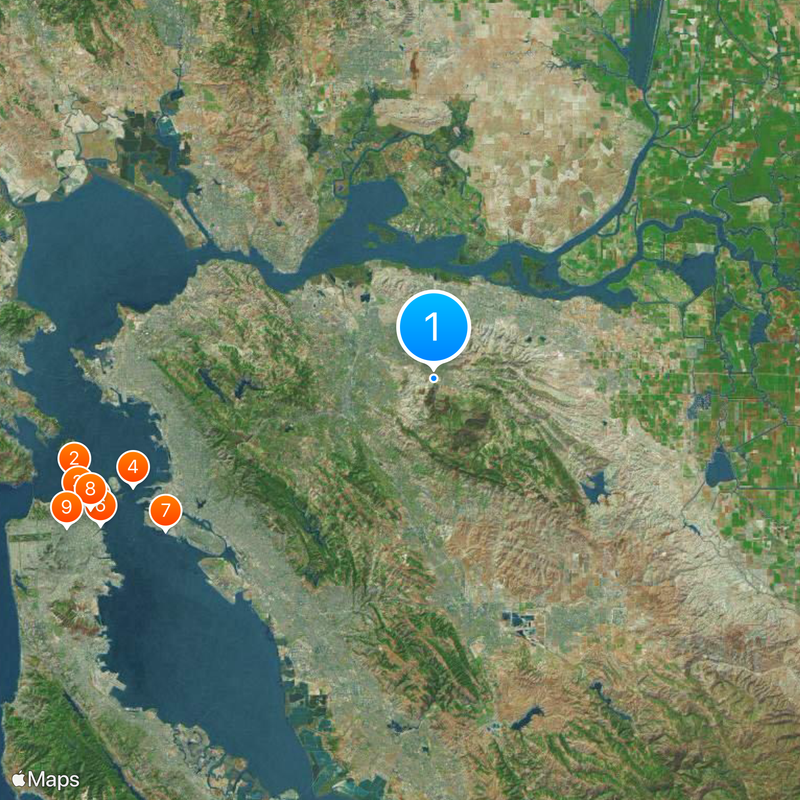
Contra Costa County, County in San Francisco Bay Area, California, United States

Description

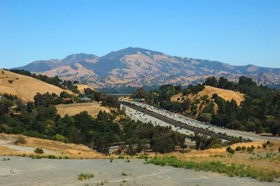
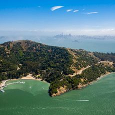
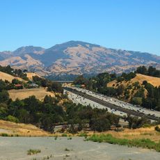
Contra Costa County is a county situated on the eastern edge of the San Francisco Bay, stretching toward the San Joaquin Valley. The landscape is dominated by Mount Diablo, a peak about 3,800 feet (1,160 meters) high, rising from the surrounding plain.

History

The region was founded in 1850 as one of the first 27 counties during California's statehood. It had previously been part of Spanish colonial land and passed to the United States after the Mexican-American War.

Culture

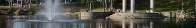
The area is known for its technology industry, and many people commute from here to major companies in Silicon Valley or San Francisco. In neighborhoods like Concord or Walnut Creek, residential areas mix with smaller commercial centers where shops and restaurants serve daily needs.

Practical

Access is often through the BART and regional transit systems, which also connect to other parts of the bay area. Hiking routes and viewpoints at Mount Diablo are popular, but the weather can become very hot and dry in summer.

Did you know?

The name was given by Spanish colonists who described the opposite coast from their main settlement area in San Francisco. Wild animals such as mountain lions live in the hills around Mount Diablo and are sometimes spotted by hikers.

Location
Inception
1850
Capital city
Martinez
Part of
Oakland–Fremont–Berkeley metropolitan division
Shares border with
Alameda County, Solano County, Sacramento County, San Joaquin County
Phone
GPS coordinates
37.93000,-121.95000
Latest update
December 18, 2025 15:40

AroundUs brings together thousands of curated places, local tips, and hidden gems, enriched daily by 60,000 contributors worldwide. Discover all places nearby (California).

Around this place
Alcatraz Island
United States of America

Alcatraz Island

43.1 km
Lombard Street
United States of America

Lombard Street

43.6 km
San Francisco–Oakland Bay Bridge
United States of America

San Francisco–Oakland Bay Bridge

37 km
Salesforce Tower
United States of America

Salesforce Tower

42.3 km
Oracle Park
United States of America

Oracle Park

42.2 km
USS Hornet
United States of America

USS Hornet

35.6 km
Transamerica Pyramid
United States of America

Transamerica Pyramid

42.5 km
Painted Ladies
United States of America

Painted Ladies

45.8 km
Millennium Tower
United States of America

Millennium Tower

42.2 km
San Francisco Armory
United States of America

San Francisco Armory

45.2 km
Coit Tower
United States of America

Coit Tower

42.5 km
Angel Island
United States of America

Angel Island

42.9 km
San Francisco cable car system
United States of America

San Francisco cable car system

42.9 km
Chinatown
United States of America

Chinatown

42.9 km
Pier 39 Sea Lions
United States of America

Pier 39 Sea Lions

42.7 km
Mount Diablo
United States of America

Mount Diablo

6.2 km
Oakland Coliseum
United States of America

Oakland Coliseum

29.7 km
Mission San Francisco de Asís
United States of America

Mission San Francisco de Asís

45.8 km
The Fillmore
United States of America

The Fillmore

45.5 km
San Francisco Museum of Modern Art
United States of America

San Francisco Museum of Modern Art

42.8 km
Union Square
United States of America

Union Square

43.2 km
Angel Island Immigration Station
United States of America

Angel Island Immigration Station

42.3 km
American Conservatory Theater
United States of America

American Conservatory Theater

43.5 km
California Aqueduct
United States of America

California Aqueduct

36.3 km
People's Park
United States of America

People's Park

27.9 km
National Defense Reserve Fleet
United States of America

National Defense Reserve Fleet

20.4 km
Eastern span replacement of the San Francisco–Oakland Bay Bridge
United States of America

Eastern span replacement of the San Francisco–Oakland Bay Bridge

37.5 km
Embarcadero
United States of America

Embarcadero

41.7 km
Show the full map
Administrative divisions
« Contra Costa County - County in San Francisco Bay Area, California, United States » is provided by Around Us (aroundus.com). Images and texts are derived from Wikimedia project under a Creative Commons license. You are allowed to copy, distribute, and modify copies of this page, under the conditions set by the license, as long as this note is clearly visible.

Discover hidden gems everywhere you go!

From secret cafés to breathtaking viewpoints, skip the crowded tourist spots and find places that match your style. Our app makes it easy with voice search, smart filtering, route optimization, and insider tips from travelers worldwide. Download now for the complete mobile experience.

Around Us App Screenshot

A unique approach to discovering new places

Le Figaro

All the places worth exploring

France Info

A tailor-made excursion in just a few clicks

20 Minutes

Around Us
Travel Guide & Maps
Download

Send to your phone

QR Code
1

Open the camera app on your mobile.

2

Point at the QR code with your camera. A notification will appear.

3

Tap the notification to open the link.