Chest opened
+${chestReward.xp} XP
Explorer
NOUVEAU ×${chestReward.collectible.quantity}
tapez pour fermer
Chest locked

Open chests in the app

Around Us is built for your phone — chests unlock when you walk, explore and capture nearby places.

Enable Location

We need your location to show you interesting places around you

Discover nearby places

Find interesting locations and hidden gems around you

Precise directions

Get accurate directions and distances to places

Your location is never shared with other users. It's only used when you tap the location button.

Log in to your account

Start exploring — it's free

Trusted by 72,891 travelers worldwide

Continue with Google
Continue with Apple
or

We will send you a code to connect

By continuing, you accept our Terms and Conditions and our Privacy Policy

Check your inbox

We've sent a pincode in your inbox. Please enter the code below.

Stege Marsh
Discussion Reviews Photo
2.6k Popularity

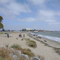
Stege Marsh, Wetland ecosystem in Richmond, California.

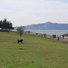
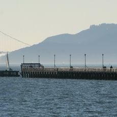
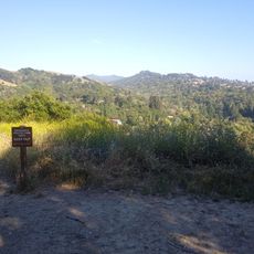
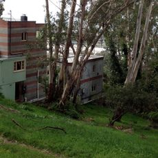
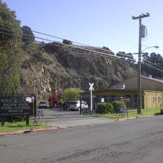
Stege Marsh is a wetland located near Richmond that spreads across the tidal channels and salt marshes of the Baxter Creek delta. The site contains patches of vegetation adapted to brackish water and regular tidal flooding common to the San Francisco Bay area.

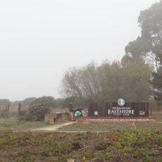
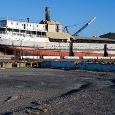
The site was originally a natural wetland but became industrialized during the 20th century when chemical manufacturing plants were built in the area. This industrial period left lasting impacts on the ecosystem that scientists continue to study today.

Environmental scientists and researchers regularly conduct studies in Stege Marsh to monitor water quality and document the effects of urban development on wetland habitats.

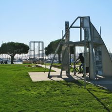
Access to the marsh is available through the UC Berkeley Richmond Field Station, where you can observe birds and other wildlife. Guided nature walks are the best way to explore the different habitat zones without disturbing the delicate ecosystem.

The site contains a rare mix of industrial pollutants that makes it a reference location for studying contamination in coastal areas. Scientists use this unusual combination to understand how wetlands respond to and recover from chemical exposure.

The community of curious travelers

AroundUs brings together thousands of curated places, local tips, and hidden gems, enriched daily by 60,000 contributors worldwide.

Start exploring
Location
GPS coordinates
37.90970,-122.33000
Latest update
December 12, 2025 17:46
Around this place
924 Gilman Street
United States of America

924 Gilman Street

4.3 km
SS Red Oak Victory
United States of America

SS Red Oak Victory

3.1 km
Point Isabel Regional Shoreline
United States of America

Point Isabel Regional Shoreline

1.3 km
Ford Motor Company Assembly Plant
United States of America

Ford Motor Company Assembly Plant

2.5 km
Berkeley Pier
United States of America

Berkeley Pier

5.3 km
United States of America

Richmond Inner Harbor

1.3 km
Rosie the Riveter World War II Home Front National Historical Park
United States of America

Rosie the Riveter World War II Home Front National Historical Park

2.4 km
Albany Hill
United States of America

Albany Hill

2.8 km
McLaughlin Eastshore State Park
United States of America

McLaughlin Eastshore State Park

5 km
Adventure Playground
United States of America

Adventure Playground

5.4 km
The Plunge
United States of America

The Plunge

5 km
Wildcat Canyon Regional Park
United States of America

Wildcat Canyon Regional Park

4.8 km
Sala House
United States of America

Sala House

2.9 km
Wapama
United States of America

Wapama

3.2 km
Blake Garden
United States of America

Blake Garden

4 km
Kaiser Richmond Field Hospital
United States of America

Kaiser Richmond Field Hospital

3 km
Point Richmond Historic District
United States of America

Point Richmond Historic District

5.2 km
Unitarian Universalist Church of Berkeley
United States of America

Unitarian Universalist Church of Berkeley

4.3 km
Golden State Model Railroad Museum
United States of America

Golden State Model Railroad Museum

4.7 km
Hotel Mac
United States of America

Hotel Mac

5.4 km
Ashkenaz
United States of America

Ashkenaz

4.4 km
Albany Beach
United States of America

Albany Beach

2.6 km
Donald and Helen Olsen House
United States of America

Donald and Helen Olsen House

5.3 km
Brickyard Cove
United States of America

Brickyard Cove

5 km
John Hinkel Park
United States of America

John Hinkel Park

5.2 km
Sunset Mausoleum and Columbarium
United States of America

Sunset Mausoleum and Columbarium

3.9 km
Kellers Beach
United States of America

Kellers Beach

5.1 km
Richmond Shipyard Number Three
United States of America

Richmond Shipyard Number Three

3.2 km
Show the full map
Reviews
Share your experience

No review yet

Discussions
Start a discussion...

No discussion yet

« Stege Marsh - Wetland ecosystem in Richmond, California » is provided by Around Us (aroundus.com). Images and texts are derived from Wikimedia project under a Creative Commons license. You are allowed to copy, distribute, and modify copies of this page, under the conditions set by the license, as long as this note is clearly visible.

Discover hidden gems everywhere you go!

From secret cafés to breathtaking viewpoints, skip the crowded tourist spots and find places that match your style. Our app makes it easy with voice search, smart filtering, route optimization, and insider tips from travelers worldwide. Download now for the complete mobile experience.

Around Us App Screenshot

A unique approach to discovering new places

Le Figaro

All the places worth exploring

France Info

A tailor-made excursion in just a few clicks

20 Minutes

Around Us
Travel Guide & Maps
Download

Send to your phone

QR Code
1

Open the camera app on your mobile.

2

Point at the QR code with your camera. A notification will appear.

3

Tap the notification to open the link.