Enable Location

We need your location to show you interesting places around you

Discover nearby places

Find interesting locations and hidden gems around you

Precise directions

Get accurate directions and distances to places

Your location is never shared with other users. It's only used when you tap the location button.

Wildcat Canyon Regional Park

Log in to your account

Start exploring — it's free

Trusted by 64,628 travelers worldwide

Continue with Google
Continue with Apple
or

We will send you a code to connect

By continuing, you accept our Terms and Conditions and our Privacy Policy

Check your inbox

We've sent a pincode in your inbox. Please enter the code below.

Wildcat Canyon Regional Park
Discussion Reviews 1 Photos
4.7k Popularity

Wildcat Canyon Regional Park, Regional park in Richmond, California.

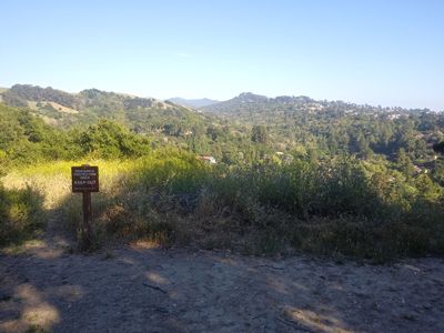
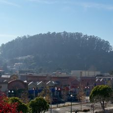
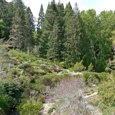
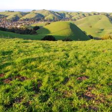
Wildcat Canyon Regional Park is a natural area in Richmond, California, that runs along Wildcat Creek and connects to Tilden and Alvarado Park. It includes a mix of dirt trails, wide fire roads, and the paved Nimitz Way path that crosses open grassland and wooded hillsides.

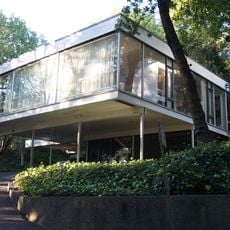
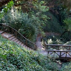
Spanish explorers first reached this area around 1772, and the Castro brothers later received land grants in the 1840s for mission and ranching purposes. The stone structures and developed paths that visitors see today were largely built through government work programs in the 1930s.

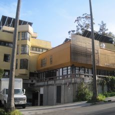
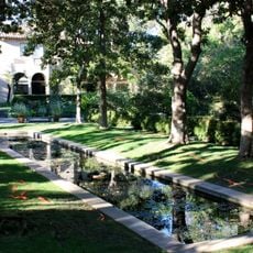
The stone buildings near Alvarado Park were built by workers hired through government programs in the 1930s, and they still stand today. Walking through that part of the park, you can see the carefully laid walls and terraces that were built as public gathering spaces.

The park can be entered from several different access points, so it helps to know in advance which trailhead leads to the route you want. Cooler months tend to be more comfortable for longer walks, especially when the creek is running well.

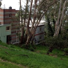
Hidden within the park are the ruins of the former Belgum Sanitarium, a medical facility that was abandoned decades ago and is rarely noticed by passing visitors. The overgrown remains appear unexpectedly beside one of the trails, offering a quiet reminder that this land once served very different purposes.

The community of curious travelers

AroundUs brings together thousands of curated places, local tips, and hidden gems, enriched daily by 60,000 contributors worldwide.

Start exploring
Location
GPS coordinates
37.93470,-122.28600
Latest update
March 3, 2026 10:07
Around this place
924 Gilman Street
United States of America

924 Gilman Street

6.3 km
Tilden Regional Park
United States of America

Tilden Regional Park

5.9 km
Gourmet Ghetto
United States of America

Gourmet Ghetto

6.2 km
Point Isabel Regional Shoreline
United States of America

Point Isabel Regional Shoreline

5.2 km
Ford Motor Company Assembly Plant
United States of America

Ford Motor Company Assembly Plant

6.9 km
Hillside Elementary School
United States of America

Hillside Elementary School

6.5 km
San Pablo Reservoir
United States of America

San Pablo Reservoir

2.3 km
Berkeley Rose Garden
United States of America

Berkeley Rose Garden

5.9 km
United States of America

Richmond Inner Harbor

6.1 km
Rosie the Riveter World War II Home Front National Historical Park
United States of America

Rosie the Riveter World War II Home Front National Historical Park

6.9 km
Albany Hill
United States of America

Albany Hill

4.7 km
San Pablo Lytton Casino
United States of America

San Pablo Lytton Casino

4.7 km
Sala House
United States of America

Sala House

5 km
Casa Zimbabwe
United States of America

Casa Zimbabwe

6.9 km
Blake Garden
United States of America

Blake Garden

2.4 km
Tilden Park Merry-Go-Round
United States of America

Tilden Park Merry-Go-Round

4.6 km
Sikh Center of San Francisco Bay Area El Sobrante
United States of America

Sikh Center of San Francisco Bay Area El Sobrante

3.9 km
Regional Parks Botanic Garden
United States of America

Regional Parks Botanic Garden

5.9 km
Unitarian Universalist Church of Berkeley
United States of America

Unitarian Universalist Church of Berkeley

1.9 km
Ashkenaz
United States of America

Ashkenaz

6.1 km
Albany Beach
United States of America

Albany Beach

5.7 km
Stebbins Hall
United States of America

Stebbins Hall

6.9 km
Donald and Helen Olsen House
United States of America

Donald and Helen Olsen House

4.5 km
John Hinkel Park
United States of America

John Hinkel Park

4.5 km
Sobrante Ridge Botanic Regional Preserve
United States of America

Sobrante Ridge Botanic Regional Preserve

3.8 km
Sunset Mausoleum and Columbarium
United States of America

Sunset Mausoleum and Columbarium

3 km
Kensington Library
United States of America

Kensington Library

2.4 km
Albany Library
United States of America

Albany Library

5.2 km
Show the full map
Reviews
Share your experience

No review yet

Discussions
Start a discussion...

No discussion yet

« Wildcat Canyon Regional Park - Regional park in Richmond, California » is provided by Around Us (aroundus.com). Images and texts are derived from Wikimedia project under a Creative Commons license. You are allowed to copy, distribute, and modify copies of this page, under the conditions set by the license, as long as this note is clearly visible.

Discover hidden gems everywhere you go!

From secret cafés to breathtaking viewpoints, skip the crowded tourist spots and find places that match your style. Our app makes it easy with voice search, smart filtering, route optimization, and insider tips from travelers worldwide. Download now for the complete mobile experience.

Around Us App Screenshot

A unique approach to discovering new places

Le Figaro

All the places worth exploring

France Info

A tailor-made excursion in just a few clicks

20 Minutes

Around Us
Travel Guide & Maps
Download

Send to your phone

QR Code
1

Open the camera app on your mobile.

2

Point at the QR code with your camera. A notification will appear.

3

Tap the notification to open the link.