Log in to your account

AroundUs is a community-driven map of interesting places, built by curious explorers like you. It grows with every review, story, and photo you share.
Connect to save your favorite spots, contribute locations, and create personalized routes.
Continue with Google
Continue with Apple
Continue with X
Continue with Facebook
Continue with email
By continuing, you accept our Terms and Conditions and our Privacy Policy
Create an account

Mount Zion State Forest

Add to collection
Map
Suggest a change
Share

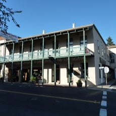
Mount Zion State Forest, State forest in Pine Grove, Amador County, US.

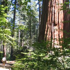
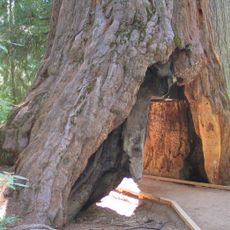
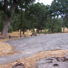
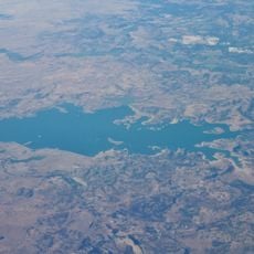
Mount Zion State Forest is a wooded area in California's Sierra Nevada with trails that wind through different ecosystems and elevation zones. The landscape includes open clearings, dense stands of mixed conifers, and viewpoints scattered throughout the terrain.

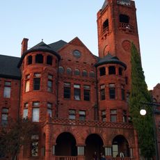
The forest area became important for fire management in the 20th century when the Mount Zion Fire Lookout Tower was built. This structure reflected California's efforts to protect mountain woodlands from the wildfires that regularly threaten the region.

The forest functions as a place where visitors learn about sustainable woodland management and mountain ecology through hands-on observation. You can see how foresters care for the land and maintain its health across the seasons.

You can reach the forest via Mount Zion Road from California State Route 88, with parking areas near the forest office. Conditions change with the seasons, so wear appropriate footwear and bring water, as shade can be limited on some trails.

Besides the historic fire tower, the summit also hosts a microwave communications tower that provides technical support to the region. This blend of old and new infrastructure shows how mountain areas balance preservation with modern needs.

Location: Amador County

GPS coordinates: 38.39250,-120.65333

Latest update: December 14, 2025 14:25

Photos
Around this place
Preston School of Industry
United States of America

Preston School of Industry

24.9 km
Calaveras Big Trees State Park
United States of America

Calaveras Big Trees State Park

34.3 km
Pioneer Cabin Tree
United States of America

Pioneer Cabin Tree

33 km
Camanche Reservoir
United States of America

Camanche Reservoir

35.6 km
Murphys Hotel
United States of America

Murphys Hotel

32.7 km
Indian Grinding Rock State Historic Park
United States of America

Indian Grinding Rock State Historic Park

3.7 km
New Hogan Lake
United States of America

New Hogan Lake

30.3 km
Mercer Caverns
United States of America

Mercer Caverns

30.9 km
California Caverns
United States of America

California Caverns

24.6 km
Angels Hotel
United States of America

Angels Hotel

37.2 km
Pardee Dam
United States of America

Pardee Dam

22.8 km
Camanche Dam
United States of America

Camanche Dam

37.3 km
Knight Foundry
United States of America

Knight Foundry

11.4 km
St. George Hotel
United States of America

St. George Hotel

5.9 km
Community Methodist Church of Ione
United States of America

Community Methodist Church of Ione

24.8 km
Altaville Grammar School
United States of America

Altaville Grammar School

35.4 km
Thorn House
United States of America

Thorn House

22.1 km
Sierra Nevada Logging Museum
United States of America

Sierra Nevada Logging Museum

30.5 km
Calaveras County Courthouse
United States of America

Calaveras County Courthouse

21.9 km
D. Stewart Company Store
United States of America

D. Stewart Company Store

24.8 km
John J. Snyder House
United States of America

John J. Snyder House

21.9 km
Douglas Flat School
United States of America

Douglas Flat School

35.3 km
Sam Choy Brick Store
United States of America

Sam Choy Brick Store

37.4 km
Utica Mansion
United States of America

Utica Mansion

37.1 km
Murphys Grammar School
United States of America

Murphys Grammar School

33.4 km
Scully Ranch
United States of America

Scully Ranch

27.1 km
William J. Paugh House
United States of America

William J. Paugh House

11.2 km
Jackson Downtown Historic District
United States of America

Jackson Downtown Historic District

11.5 km
Show the full map
Reviews

Visited this place? Tap the stars to rate it and share your experience / photos with the community! Try now! You can cancel it anytime.

« Mount Zion State Forest - State forest in Pine Grove, Amador County, US » is provided by Around Us (aroundus.com). Images and texts are derived from Wikimedia project under a Creative Commons license. You are allowed to copy, distribute, and modify copies of this page, under the conditions set by the license, as long as this note is clearly visible.

Discover hidden gems everywhere you go!

From secret cafés to breathtaking viewpoints, skip the crowded tourist spots and find places that match your style. Our app makes it easy with voice search, smart filtering, route optimization, and insider tips from travelers worldwide. Download now for the complete mobile experience.

Around Us App Screenshot

A unique approach to discovering new places

Le Figaro

All the places worth exploring

France Info

A tailor-made excursion in just a few clicks

20 Minutes