Chest opened
+${chestReward.xp} XP
Explorer
NOUVEAU ×${chestReward.collectible.quantity}
tapez pour fermer

See the monuments around you in AR Open chests in the app

Around Us is built for your phone — point your camera at the streets and discover the monuments and places around you in augmented reality. Around Us is built for your phone — chests unlock when you walk, explore and capture nearby places.

Enable Location

We need your location to show you interesting places around you

Discover nearby places

Find interesting locations and hidden gems around you

Precise directions

Get accurate directions and distances to places

Your location is never shared with other users. It's only used when you tap the location button.

Camanche Dam

Log in to your account

Start exploring — it's free

Trusted by 85,238 travelers worldwide

Continue with Google
Continue with Apple
or

We will send you a code to connect

By continuing, you accept our Terms and Conditions and our Privacy Policy

Check your inbox

We've sent a pincode in your inbox. Please enter the code below.

Camanche Dam
Discussion Reviews 1 Photos
3k Popularity

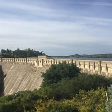
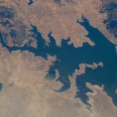
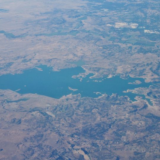
Camanche Dam, Embankment dam in San Joaquin County, United States.

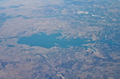
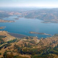
Camanche Dam is an embankment dam in San Joaquin County that spans the Mokelumne River and creates a large water reservoir. The structure serves multiple purposes including flood control, water supply for farming, and recreation like fishing, boating, and camping.

The dam was built between 1963 and 1964 by the East Bay Municipal Utility District, flooding a small town that had existed since California's Gold Rush era. This construction marked a major shift in how water was managed and supplied to the surrounding region.

The name comes from a misspelling of the Comanche Native American tribe during California's early settlement era. Walking around the reservoir, you can learn how this naming mistake became permanent in the region.

The reservoir is open year-round for recreation and offers access at various points along the shoreline. Water levels can change seasonally, so visitors should plan accordingly and check local rules for fishing and boating activities.

The dam features the world's largest artificial salmon spawning channel, specifically engineered to support local fish populations. This engineering feature shows how infrastructure projects can be designed to protect wildlife.

The community of curious travelers

AroundUs brings together thousands of curated places, local tips, and hidden gems, enriched daily by 60,000 contributors worldwide.
Start exploring
GPS coordinates
38.22420,-121.02300
Latest update
August 30, 2026 12:57
Around this place
Preston School of Industry
United States of America

Preston School of Industry

10.6 mi
Camanche Reservoir
United States of America

Camanche Reservoir

1.3 mi
New Hogan Lake
United States of America

New Hogan Lake

12.5 mi
Cosumnes River Preserve
United States of America

Cosumnes River Preserve

22.8 mi
Stagg Memorial Stadium
United States of America

Stagg Memorial Stadium

23.4 mi
Pardee Dam
United States of America

Pardee Dam

9.7 mi
Micke Grove Zoo
United States of America

Micke Grove Zoo

16.9 mi
Knight Foundry
United States of America

Knight Foundry

17.5 mi
Micke Grove Regional Park
United States of America

Micke Grove Regional Park

16.8 mi
Salt Spring Valley Reservoir
United States of America

Salt Spring Valley Reservoir

19.7 mi
Brewster Building
United States of America

Brewster Building

18.5 mi
Brewster House
United States of America

Brewster House

15.4 mi
Community Methodist Church of Ione
United States of America

Community Methodist Church of Ione

10 mi
Thorn House
United States of America

Thorn House

18.9 mi
Calaveras County Courthouse
United States of America

Calaveras County Courthouse

18.8 mi
Alta Mesa Farm Bureau Hall
United States of America

Alta Mesa Farm Bureau Hall

15.6 mi
Elks Building
United States of America

Elks Building

23 mi
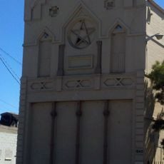
Woodbridge Masonic Lodge No. 131
United States of America

Woodbridge Masonic Lodge No. 131

15.9 mi
D. Stewart Company Store
United States of America

D. Stewart Company Store

10.1 mi
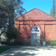
Harmony Grove Church
United States of America

Harmony Grove Church

9.9 mi
Benjamin Holt House
United States of America

Benjamin Holt House

23.1 mi
John J. Snyder House
United States of America

John J. Snyder House

18.5 mi
Scully Ranch
United States of America

Scully Ranch

9.6 mi
I.O.O.F. Hall
United States of America

I.O.O.F. Hall

15.8 mi
William J. Paugh House
United States of America

William J. Paugh House

16.3 mi
Locke's Meat Market
United States of America

Locke's Meat Market

8 mi
Jackson Downtown Historic District
United States of America

Jackson Downtown Historic District

16.1 mi
Chaparral Gardens
United States of America

Chaparral Gardens

23.3 mi
Show the full map
Reviews
Share your experience

No review yet

Discussions
Start a discussion...

No discussion yet

« Camanche Dam - Embankment dam in San Joaquin County, United States » is provided by Around Us (aroundus.com). Images and texts are derived from Wikimedia project under a Creative Commons license. You are allowed to copy, distribute, and modify copies of this page, under the conditions set by the license, as long as this note is clearly visible.

Discover hidden gems everywhere you go!

From secret cafés to breathtaking viewpoints, skip the crowded tourist spots and find places that match your style. Our app makes it easy with voice search, smart filtering, route optimization, and insider tips from travelers worldwide. Download now for the complete mobile experience.
Around Us App Screenshot

A unique approach to discovering new places

Le Figaro

All the places worth exploring

France Info

A tailor-made excursion in just a few clicks

20 Minutes

Around Us
Travel Guide & Maps
Download

Send to your phone

QR Code
1

Open the camera app on your mobile.

2

Point at the QR code with your camera. A notification will appear.

3

Tap the notification to open the link.