Enable Location

We need your location to show you interesting places around you

Discover nearby places

Find interesting locations and hidden gems around you

Precise directions

Get accurate directions and distances to places

Your location is never shared with other users. It's only used when you tap the location button.

San Joaquin County

Log in to your account

Start exploring — it's free

Trusted by 61,364 travelers worldwide

Continue with Google
Continue with Apple
or

We will send you a code to connect

By continuing, you accept our Terms and Conditions and our Privacy Policy

Check your inbox

We've sent a pincode in your inbox. Please enter the code below.

San Joaquin County, County seat in Central Valley, California, US

Description

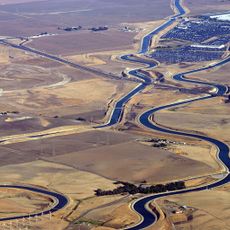
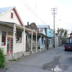
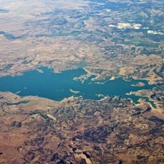
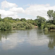
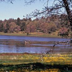
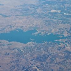
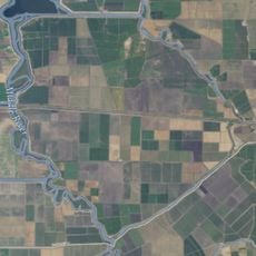
San Joaquin County is an administrative division in the Central Valley of California, positioned between the Sierra Nevada and the coastal ranges. The landscape alternates between flat agricultural land with wide fields and gentle hills to the east, crossed by irrigation channels and smaller waterways.

History

The division was formed in 1850 when California became a state and takes its name from the river flowing through the area. Earlier, Yokuts and Miwok peoples lived here before European settlers moved into the Central Valley.

Culture

The region maintains connections to Yokuts and Miwok indigenous communities who established settlements before European colonization arrived in the area.

Practical

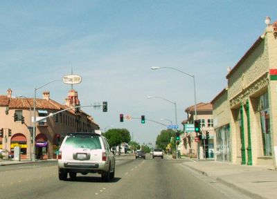
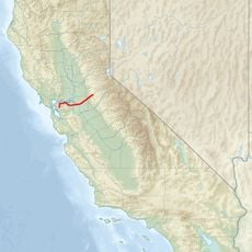
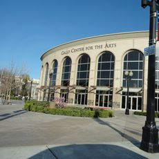
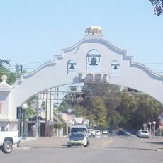
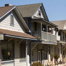
The main towns sit along the highway corridors that cross the area from north to south and provide access to shops and services. Visitors exploring the rural parts should plan to use a car, as public transport outside the cities is limited.

Did you know?

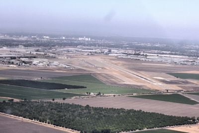
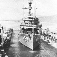
The port in Stockton lies about 75 miles (120 kilometers) inland and allows ocean vessels to reach it from the Pacific through an artificially deepened channel. This system connects the interior directly to international trade routes without transferring cargo to smaller vessels.

Location
Inception
1850
Capital city
Stockton
Shares border with
Sacramento County, Amador County, Calaveras County, Stanislaus County, Santa Clara County, Alameda County, Contra Costa County
GPS coordinates
37.93000,-121.27000
Latest update
December 15, 2025 08:17

AroundUs brings together thousands of curated places, local tips, and hidden gems, enriched daily by 60,000 contributors worldwide. Discover all places nearby (California).

Around this place
California Aqueduct
United States of America

California Aqueduct

27.6 km
Locke
United States of America

Locke

41.4 km
Altamont Raceway Park
United States of America

Altamont Raceway Park

33.5 km
Camanche Reservoir
United States of America

Camanche Reservoir

40.3 km
United States of America

Clifton Court Forebay

27.6 km
USS Lucid
United States of America

USS Lucid

6.9 km
Caswell Memorial State Park
United States of America

Caswell Memorial State Park

26.9 km
McHenry Mansion
United States of America

McHenry Mansion

40.1 km
Cosumnes River Preserve
United States of America

Cosumnes River Preserve

40.2 km
Stagg Memorial Stadium
United States of America

Stagg Memorial Stadium

6.7 km
Haggin Museum
United States of America

Haggin Museum

5.1 km
United States of America

San Joaquin River National Wildlife Refuge

33.8 km
United States of America

Carnegie State Vehicular Recreation Area

39.3 km
Micke Grove Zoo
United States of America

Micke Grove Zoo

16.6 km
Modesto Arch
United States of America

Modesto Arch

40.2 km
Delta Meadows Park Property
United States of America

Delta Meadows Park Property

41.8 km
Mokelumne Aqueduct
United States of America

Mokelumne Aqueduct

17.4 km
Wiley’s Waterpark
United States of America

Wiley’s Waterpark

16.1 km
Hotel Stockton
United States of America

Hotel Stockton

3.1 km
Gallo Center for the Arts
United States of America

Gallo Center for the Arts

40.2 km
Camanche Dam
United States of America

Camanche Dam

39.3 km
Stockton Memorial Civic Auditorium
United States of America

Stockton Memorial Civic Auditorium

3.7 km
United States of America

Hearst-Argyle Tower

41.9 km
Hawke Castle
United States of America

Hawke Castle

39.7 km
Lodi Arch
United States of America

Lodi Arch

22.7 km
Micke Grove Regional Park
United States of America

Micke Grove Regional Park

16.6 km
Jones Tract
United States of America

Jones Tract

19 km
Walnut Grove Japanese-American Historic District
United States of America

Walnut Grove Japanese-American Historic District

40.8 km
Show the full map
Administrative divisions
« San Joaquin County - County seat in Central Valley, California, US » is provided by Around Us (aroundus.com). Images and texts are derived from Wikimedia project under a Creative Commons license. You are allowed to copy, distribute, and modify copies of this page, under the conditions set by the license, as long as this note is clearly visible.

Discover hidden gems everywhere you go!

From secret cafés to breathtaking viewpoints, skip the crowded tourist spots and find places that match your style. Our app makes it easy with voice search, smart filtering, route optimization, and insider tips from travelers worldwide. Download now for the complete mobile experience.

Around Us App Screenshot

A unique approach to discovering new places

Le Figaro

All the places worth exploring

France Info

A tailor-made excursion in just a few clicks

20 Minutes

Around Us
Travel Guide & Maps
Download

Send to your phone

QR Code
1

Open the camera app on your mobile.

2

Point at the QR code with your camera. A notification will appear.

3

Tap the notification to open the link.