Auburn State Recreation Area

Log in to your account

AroundUs is a community-driven map of interesting places, built by curious explorers like you. It grows with every review, story, and photo you share.
Connect to save your favorite spots, contribute locations, and create personalized routes.
Continue with Google
Continue with Apple
Continue with X
Continue with Facebook
Continue with email
By continuing, you accept our Terms and Conditions and our Privacy Policy
Create an account

Auburn State Recreation Area

Add to collection
Map
Suggest a change
Share

Auburn State Recreation Area, Natural reserve in Auburn, California, US

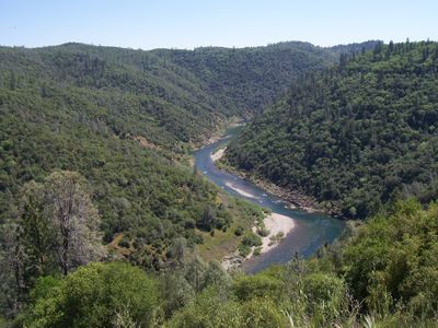
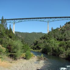
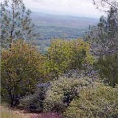
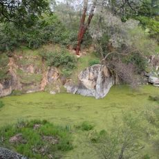
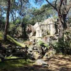
Auburn State Recreation Area is a nature reserve spanning the North and Middle Forks of the American River for about 40 miles. The land contains river valleys, hills, forests, and open areas with trails of varying difficulty.

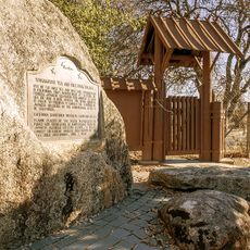
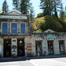
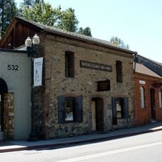
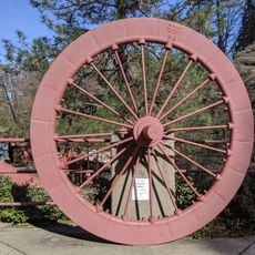
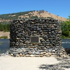
The area saw major gold mining activity along the American River during the 1800s, when fortune seekers worked the riverbed and banks. Old mining sites, dams, and related structures from that era remain visible throughout the land today.

The name Auburn comes from a town in New England, reflecting early American settlement patterns in the region. Today, the landscape shows how local communities value outdoor recreation and river-based activities.

The reserve is accessible from Auburn via Highway 49 and Auburn-Foresthill Road, with multiple entry points along both routes. Plan your visit to end before sunset, as the area closes at that time.

Lake Clementine within the reserve has designated zones for water skiing and boating activities that many visitors seek out. Mammoth Bar serves as a separate location for off-road vehicle use, drawing a different crowd of outdoor enthusiasts.

Location: Auburn

Website: https://parks.ca.gov/?page_id=502

GPS coordinates: 38.98065,-120.84513

Latest update: December 8, 2025 19:58

Photos
Around this place
Foresthill Bridge
United States of America

Foresthill Bridge

18 km
Empire Mine State Historic Park
United States of America

Empire Mine State Historic Park

30.1 km
Auburn Dam
United States of America

Auburn Dam

21.8 km
Lake Clementine
United States of America

Lake Clementine

15.1 km
Wakamatsu Tea and Silk Farm Colony
United States of America

Wakamatsu Tea and Silk Farm Colony

23.6 km
Sugar Pine Reservoir
United States of America

Sugar Pine Reservoir

17.7 km
Pine Hill Ecological Reserve
United States of America

Pine Hill Ecological Reserve

31.7 km
Home of Lola Montez
United States of America

Home of Lola Montez

32.4 km
North Star House
United States of America

North Star House

31.1 km
John Pearson Soda Works
United States of America

John Pearson Soda Works

28.4 km
Griffith Quarry
United States of America

Griffith Quarry

31.2 km
Mount Saint Mary's Convent and Academy
United States of America

Mount Saint Mary's Convent and Academy

32.3 km
Fountain-Tallman Soda Works
United States of America

Fountain-Tallman Soda Works

28.3 km
Grass Valley Public Library
United States of America

Grass Valley Public Library

32.3 km
Mountain Quarries Bridge
United States of America

Mountain Quarries Bridge

18.5 km
Bernhard Museum Complex
United States of America

Bernhard Museum Complex

22.3 km
Combellack-Blair House
United States of America

Combellack-Blair House

28.5 km
Church of Our Saviour
United States of America

Church of Our Saviour

28.1 km
Confidence Hall
United States of America

Confidence Hall

28.2 km
Auburn Public Library
United States of America

Auburn Public Library

21.6 km
Eddy Arboretum
United States of America

Eddy Arboretum

28.2 km
Auburn Masonic Temple
United States of America

Auburn Masonic Temple

21.6 km
Oddfellows Hall
United States of America

Oddfellows Hall

21.9 km
Northstar Mining Museum
United States of America

Northstar Mining Museum

31.9 km
Griffith Quarry Park & Museum
United States of America

Griffith Quarry Park & Museum

31.2 km
Sutter's Mill Site
United States of America

Sutter's Mill Site

20.1 km
Grass Valley Library-Royce Branch
United States of America

Grass Valley Library-Royce Branch

32.4 km
Placer County Courthouse
United States of America

Placer County Courthouse

22.1 km
Show the full map
Reviews

Visited this place? Tap the stars to rate it and share your experience / photos with the community! Try now! You can cancel it anytime.

« Auburn State Recreation Area - Natural reserve in Auburn, California, US » is provided by Around Us (aroundus.com). Images and texts are derived from Wikimedia project under a Creative Commons license. You are allowed to copy, distribute, and modify copies of this page, under the conditions set by the license, as long as this note is clearly visible.

Discover hidden gems everywhere you go!

From secret cafés to breathtaking viewpoints, skip the crowded tourist spots and find places that match your style. Our app makes it easy with voice search, smart filtering, route optimization, and insider tips from travelers worldwide. Download now for the complete mobile experience.

Around Us App Screenshot

A unique approach to discovering new places

Le Figaro

All the places worth exploring

France Info

A tailor-made excursion in just a few clicks

20 Minutes