Enable Location

We need your location to show you interesting places around you

Discover nearby places

Find interesting locations and hidden gems around you

Precise directions

Get accurate directions and distances to places

Your location is never shared with other users. It's only used when you tap the location button.

Lake Clementine

Log in to your account

Start exploring — it's free

Trusted by 62,386 travelers worldwide

Continue with Google
Continue with Apple
or

We will send you a code to connect

By continuing, you accept our Terms and Conditions and our Privacy Policy

Check your inbox

We've sent a pincode in your inbox. Please enter the code below.

Lake Clementine

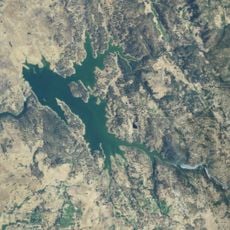
Lake Clementine, body of water

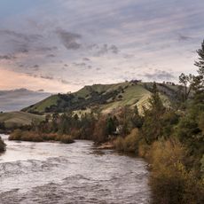
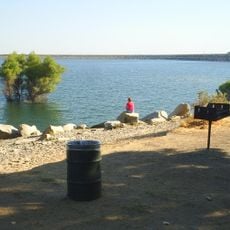
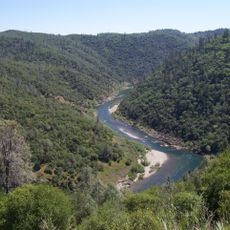
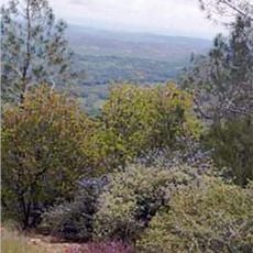
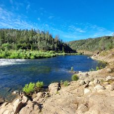
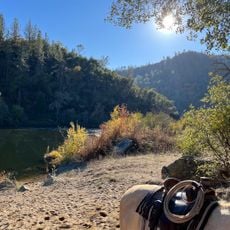
Lake Clementine is a reservoir in California located on the North Fork of the American River within the Auburn State Recreation Area. The water is clear and cold, fed by snowmelt from the mountains above, and the lake consists of two sections: the upper lake with calm water for paddlers and swimmers, and the lower lake where motorboats are permitted.

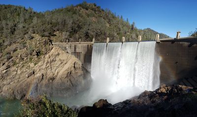
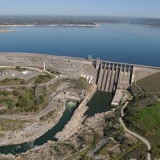
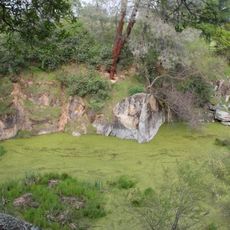
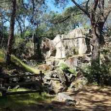
The lake was created by a dam that holds back the North Fork of the American River for water storage and regional management. The lower area bears traces of the Gold Rush period, including a distinctive rock outcrop called Robbers' Roost, which carries stories from that era.

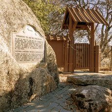
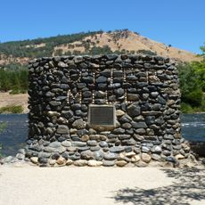
The name reflects early settlement history when miners and settlers passed through this region. Today visitors use the lake for paddling, fishing, and picnicking, showing how this place has become a meeting point for people seeking a break from daily routines.

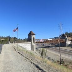
The lake is reached via narrow and sometimes rough dirt roads, so visitors should drive carefully and arrive early to secure parking. The park closes in the evening, and swimming is only permitted in a designated area near the Access Trail, so visitors should know these boundaries.

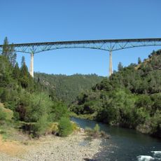
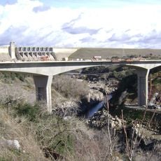
The North Fork Dam above the lake creates rainbows in the spray on sunny days as water cascades over the concrete structure. A popular trail leads to the dam where visitors can watch the force of the water and see the Foresthill Bridge, one of California's tallest bridges, spanning the deep canyon nearby.

The community of curious travelers

AroundUs brings together thousands of curated places, local tips, and hidden gems, enriched daily by 60,000 contributors worldwide.

Start exploring
Location
GPS coordinates
38.94222,-121.01278
Latest update
February 7, 2026 11:01
Around this place
Show the full map
« Lake Clementine - body of water » is provided by Around Us (aroundus.com). Images and texts are derived from Wikimedia project under a Creative Commons license. You are allowed to copy, distribute, and modify copies of this page, under the conditions set by the license, as long as this note is clearly visible.

Discover hidden gems everywhere you go!

From secret cafés to breathtaking viewpoints, skip the crowded tourist spots and find places that match your style. Our app makes it easy with voice search, smart filtering, route optimization, and insider tips from travelers worldwide. Download now for the complete mobile experience.

Around Us App Screenshot

A unique approach to discovering new places

Le Figaro

All the places worth exploring

France Info

A tailor-made excursion in just a few clicks

20 Minutes

Around Us
Travel Guide & Maps
Download

Send to your phone

QR Code
1

Open the camera app on your mobile.

2

Point at the QR code with your camera. A notification will appear.

3

Tap the notification to open the link.