Folsom Lake

Log in to your account

AroundUs is a community-driven map of interesting places, built by curious explorers like you. It grows with every review, story, and photo you share.
Connect to save your favorite spots, contribute locations, and create personalized routes.
Continue with Google
Continue with Apple
Continue with X
Continue with Facebook
Continue with email
By continuing, you accept our Terms and Conditions and our Privacy Policy
Create an account
Add to collection
Map
Suggest a change
Share

Folsom Lake, Reservoir in Sierra Nevada foothills, California

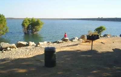
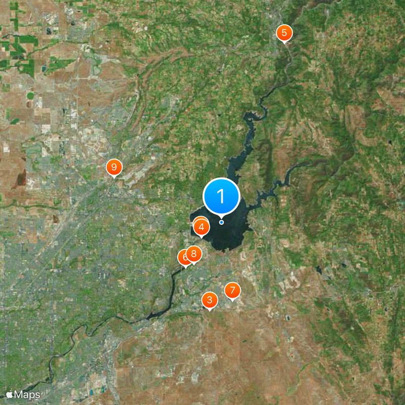
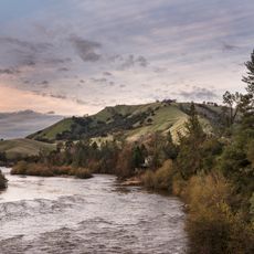
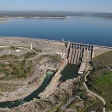
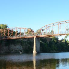
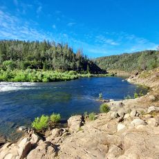
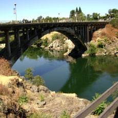
Folsom Lake is a reservoir in the foothills of the Sierra Nevada in California, stretching across three counties and fed by the American River. The water reaches a surface area of around 4,600 hectares (11,400 acres) at normal pool level with over 120 kilometers (75 miles) of shoreline shaped by grassy slopes, rocky cliffs, and small coves.

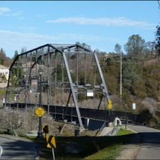
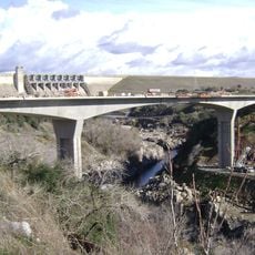
The dam was built by the United States Army Corps of Engineers between 1948 and 1956 to prevent flooding and generate electricity for the growing Sacramento region. When the valley was flooded, several old settlements disappeared beneath the water, including the former Gold Rush town of Mormon Island.

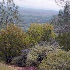
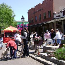
Locals refer to the reservoir simply as "Folsom" and use it year-round for boating, fishing, and picnics along the shore. On weekends, families from across the region come here to relax by the water and explore the trails along the shore.

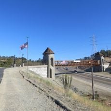
Visitor zones are open from sunrise to sunset and offer parking, restrooms, and water access at several points around the lake. During low water levels, some boat ramps and swimming areas may be closed, so it is worth checking current conditions beforehand.

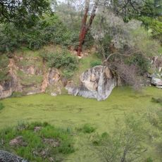
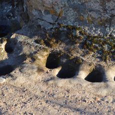
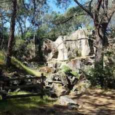
During extreme drought, the ruins of Mormon Island emerge from the water, including foundations and old roads from the Gold Rush settlement. Divers report submerged bridges and tree stumps deep below the surface, reminders of the earlier landscape before the dam was built.

Location: California

Elevation above the sea: 142 m

GPS coordinates: 38.72061,-121.13393

Latest update: December 20, 2025 14:38

Photos
Around this place
American River
United States of America

American River

2.4 km
U.S. Route 50 in California
United States of America

U.S. Route 50 in California

8.8 km
Folsom Dam
United States of America

Folsom Dam

2.5 km
Auburn Dam
United States of America

Auburn Dam

19 km
Folsom Powerhouse State Historic Park
United States of America

Folsom Powerhouse State Historic Park

5.7 km
SeaQuest Folsom
United States of America

SeaQuest Folsom

7.8 km
United States of America

Folsom City Zoo Sanctuary

5 km
Roseville Golfland Sunsplash
United States of America

Roseville Golfland Sunsplash

11.6 km
Fair Oaks Bridge
United States of America

Fair Oaks Bridge

14.8 km
Pine Hill Ecological Reserve
United States of America

Pine Hill Ecological Reserve

12.4 km
All-American Speedway
United States of America

All-American Speedway

14.2 km
Griffith Quarry
United States of America

Griffith Quarry

14.8 km
United States of America

Carpenter Hill

8.5 km
Maidu Museum & Historic Site
United States of America

Maidu Museum & Historic Site

9.9 km
Bernhard Museum Complex
United States of America

Bernhard Museum Complex

19.7 km
Jensen Botanical Gardens
United States of America

Jensen Botanical Gardens

18.6 km
American River Grange Hall No. 172
United States of America

American River Grange Hall No. 172

18.1 km
Cohn House
United States of America

Cohn House

5.9 km
Faith Episcopal Church
United States of America

Faith Episcopal Church

12.9 km
Rusch Botanical Gardens
United States of America

Rusch Botanical Gardens

14.4 km
Sacramento Children's Museum
United States of America

Sacramento Children's Museum

19.6 km
Alden Memorial Bridge
United States of America

Alden Memorial Bridge

5.6 km
Griffith Quarry Park & Museum
United States of America

Griffith Quarry Park & Museum

14.6 km
Historic Opera House
United States of America

Historic Opera House

6.1 km
Oregon Bar
United States of America

Oregon Bar

17.3 km
Rainbow Bridge
United States of America

Rainbow Bridge

5.6 km
Johnny Cash Trail Bridge
United States of America

Johnny Cash Trail Bridge

2.9 km
Folsom Lake Crossing
United States of America

Folsom Lake Crossing

3.2 km
Show the full map
Reviews

Visited this place? Tap the stars to rate it and share your experience / photos with the community! Try now! You can cancel it anytime.

« Folsom Lake - Reservoir in Sierra Nevada foothills, California » is provided by Around Us (aroundus.com). Images and texts are derived from Wikimedia project under a Creative Commons license. You are allowed to copy, distribute, and modify copies of this page, under the conditions set by the license, as long as this note is clearly visible.

Discover hidden gems everywhere you go!

From secret cafés to breathtaking viewpoints, skip the crowded tourist spots and find places that match your style. Our app makes it easy with voice search, smart filtering, route optimization, and insider tips from travelers worldwide. Download now for the complete mobile experience.

Around Us App Screenshot

A unique approach to discovering new places

Le Figaro

All the places worth exploring

France Info

A tailor-made excursion in just a few clicks

20 Minutes