Chest opened
+${chestReward.xp} XP
Explorer
NOUVEAU ×${chestReward.collectible.quantity}
tapez pour fermer
Chest locked

Open chests in the app

Around Us is built for your phone — chests unlock when you walk, explore and capture nearby places.

Enable Location

We need your location to show you interesting places around you

Discover nearby places

Find interesting locations and hidden gems around you

Precise directions

Get accurate directions and distances to places

Your location is never shared with other users. It's only used when you tap the location button.

Log in to your account

Start exploring — it's free

Trusted by 72,874 travelers worldwide

Continue with Google
Continue with Apple
or

We will send you a code to connect

By continuing, you accept our Terms and Conditions and our Privacy Policy

Check your inbox

We've sent a pincode in your inbox. Please enter the code below.

Discussion Reviews Photo
19.7k Popularity

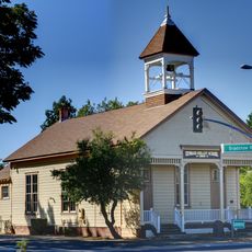
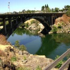
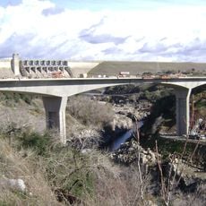
Antelope, Census-designated place in Sacramento County, California

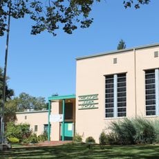
Antelope is a residential community located in Sacramento County, northeast of Sacramento and southwest of Roseville. The area contains neighborhoods and is served by several school districts that shape the local character.

The area began as a rural settlement in the late 1800s and transformed into its present-day residential community through planned development beginning in the 1980s. This shift shaped the modern structure visible today.

The community reflects population diversity with 63.8% White, 8.8% African American, and 13.3% Asian residents reported in the 2010 Census data.

Visitors will find a residential area with good school services and local infrastructure. The location is accessible from both Sacramento and Roseville depending on your starting point.

An explosion of aircraft bombs from a rail car in 1973 destroyed the local general store and caused extensive damage to nearby homes.

The community of curious travelers

AroundUs brings together thousands of curated places, local tips, and hidden gems, enriched daily by 60,000 contributors worldwide.

Start exploring
Shares border with
Roseville
GPS coordinates
38.71528,-121.36083
Latest update
December 7, 2025 10:07
Around this place
American River
United States of America

American River

17.6 km
Heart Health Park
United States of America

Heart Health Park

15.4 km
Aerospace Museum of California
United States of America

Aerospace Museum of California

5.2 km
Folsom Powerhouse State Historic Park
United States of America

Folsom Powerhouse State Historic Park

16.6 km
United States of America

Folsom City Zoo Sanctuary

17.3 km
Roseville Golfland Sunsplash
United States of America

Roseville Golfland Sunsplash

10.3 km
Fair Oaks Bridge
United States of America

Fair Oaks Bridge

12.1 km
All-American Speedway
United States of America

All-American Speedway

7.7 km
Scandia Fun Center
United States of America

Scandia Fun Center

6.3 km
Discovery Park
United States of America

Discovery Park

17.4 km
Brighton School
United States of America

Brighton School

17.2 km
Maidu Museum & Historic Site
United States of America

Maidu Museum & Historic Site

10.3 km
Jensen Botanical Gardens
United States of America

Jensen Botanical Gardens

9.1 km
American River Grange Hall No. 172
United States of America

American River Grange Hall No. 172

14.8 km
Cohn House
United States of America

Cohn House

16.7 km
Rusch Botanical Gardens
United States of America

Rusch Botanical Gardens

5.4 km
Theodore Judah School
United States of America

Theodore Judah School

17.3 km
Sacramento Children's Museum
United States of America

Sacramento Children's Museum

15.6 km
Wake Island Water Park
United States of America

Wake Island Water Park

10.4 km
Raging Waters Sacramento
United States of America

Raging Waters Sacramento

15.3 km
Alden Memorial Bridge
United States of America

Alden Memorial Bridge

16.5 km
Scandia Family Fun Center
United States of America

Scandia Family Fun Center

6.3 km
Deterding Park
United States of America

Deterding Park

14 km
Historic Opera House
United States of America

Historic Opera House

16.5 km
H Street Bridge
United States of America

H Street Bridge

17.2 km
Rainbow Bridge
United States of America

Rainbow Bridge

16.5 km
Folsom Lake Crossing
United States of America

Folsom Lake Crossing

17.1 km
Isador Cohen
United States of America

Isador Cohen

17.2 km
Show the full map
Reviews
Share your experience

No review yet

Discussions
Start a discussion...

No discussion yet

« Antelope - Census-designated place in Sacramento County, California » is provided by Around Us (aroundus.com). Images and texts are derived from Wikimedia project under a Creative Commons license. You are allowed to copy, distribute, and modify copies of this page, under the conditions set by the license, as long as this note is clearly visible.

Discover hidden gems everywhere you go!

From secret cafés to breathtaking viewpoints, skip the crowded tourist spots and find places that match your style. Our app makes it easy with voice search, smart filtering, route optimization, and insider tips from travelers worldwide. Download now for the complete mobile experience.

Around Us App Screenshot

A unique approach to discovering new places

Le Figaro

All the places worth exploring

France Info

A tailor-made excursion in just a few clicks

20 Minutes

Around Us
Travel Guide & Maps
Download

Send to your phone

QR Code
1

Open the camera app on your mobile.

2

Point at the QR code with your camera. A notification will appear.

3

Tap the notification to open the link.