Enable Location

We need your location to show you interesting places around you

Discover nearby places

Find interesting locations and hidden gems around you

Precise directions

Get accurate directions and distances to places

Your location is never shared with other users. It's only used when you tap the location button.

Eagle Point

Log in to your account

Start exploring — it's free

Trusted by 62,415 travelers worldwide

Continue with Google
Continue with Apple
or

We will send you a code to connect

By continuing, you accept our Terms and Conditions and our Privacy Policy

Check your inbox

We've sent a pincode in your inbox. Please enter the code below.

Eagle Point, Municipal center in Jackson County, Oregon, United States.

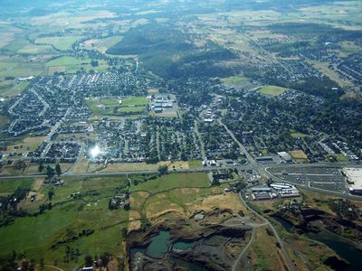
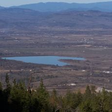
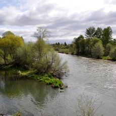
Eagle Point is a city located in the Rogue River Valley north of Medford along Oregon Route 62 in Jackson County. The town sits in a valley setting with small creeks flowing through the area, surrounded by rolling terrain and forested land.

The city took its name in the mid-1800s from a rocky cliff that eagles used for nesting. The post office opened in 1872, marking the beginning of organized settlement and growth in the area.

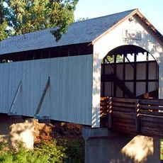
The Butte Creek Mill represents a gathering place where locals connect with their community's industrial past. Visitors can observe the working mill along the creek and see how grain processing shaped daily life here.

The town is easily reached via Oregon Route 62 from Medford, making it straightforward to visit. Visitors can explore the town on foot and access walking paths through the surrounding valley and creek areas.

The historic Butte Creek Mill was destroyed by fire on Christmas Day 2015 but was fully rebuilt and resumed grain processing in 2020. This restoration makes it a remarkable example of community dedication to preserving local heritage.

The community of curious travelers

AroundUs brings together thousands of curated places, local tips, and hidden gems, enriched daily by 60,000 contributors worldwide.

Start exploring
Location
Inception
1911
Elevation above the sea
399 m
GPS coordinates
42.46778,-122.80167
Latest update
December 20, 2025 12:08
Around this place
United States of America

Denman Wildlife Area

3.5 km
Medford Oregon Temple
United States of America

Medford Oregon Temple

15.1 km
Agate Lake
United States of America

Agate Lake

6.9 km
United States of America

Agate Desert

8.9 km
TouVelle State Recreation Site
United States of America

TouVelle State Recreation Site

7.8 km
Jackson County Fairground
United States of America

Jackson County Fairground

12.8 km
Antelope Creek Bridge
United States of America

Antelope Creek Bridge

500 m
United States of America

Southern Oregon Speedway

5.6 km
Rogue Valley Family Fun Center
United States of America

Rogue Valley Family Fun Center

12.9 km
Conro Fiero House
United States of America

Conro Fiero House

12 km
Fort Lane
United States of America

Fort Lane

15.1 km
Frank Chamberlain Clark House
United States of America

Frank Chamberlain Clark House

15.9 km
Elks Lodge
United States of America

Elks Lodge

16.6 km
United States of America

H. Chandler and Alice B. Egan House

12.9 km
Camp White Station Hospital Administration Building
United States of America

Camp White Station Hospital Administration Building

4.4 km
United States of America

Dodge Bridge County Park

7.3 km
United States of America

Bradshaw Drop

7.5 km
Sparta Building
United States of America

Sparta Building

16.6 km
United States of America

Agate Lake County Park

7.1 km
United States of America

Osborne Reservoir

13.4 km
United States of America

Gold Ray Reservoir

14.4 km
Southern Oregon Live Steamers
United States of America

Southern Oregon Live Steamers

14.7 km
United States of America

Rogue Valley Country Club

15.9 km
United States of America

Jackson Travel Agency

13.5 km
United States of America

Rogue Valley Model Railroad Club

14.7 km
United States of America

Splash Pad

13.9 km
United States of America

Amphitheater

12.8 km
United States of America

Scenic viewpoint

12.3 km
Show the full map
« Eagle Point - Municipal center in Jackson County, Oregon, United States » is provided by Around Us (aroundus.com). Images and texts are derived from Wikimedia project under a Creative Commons license. You are allowed to copy, distribute, and modify copies of this page, under the conditions set by the license, as long as this note is clearly visible.

Discover hidden gems everywhere you go!

From secret cafés to breathtaking viewpoints, skip the crowded tourist spots and find places that match your style. Our app makes it easy with voice search, smart filtering, route optimization, and insider tips from travelers worldwide. Download now for the complete mobile experience.

Around Us App Screenshot

A unique approach to discovering new places

Le Figaro

All the places worth exploring

France Info

A tailor-made excursion in just a few clicks

20 Minutes

Around Us
Travel Guide & Maps
Download

Send to your phone

QR Code
1

Open the camera app on your mobile.

2

Point at the QR code with your camera. A notification will appear.

3

Tap the notification to open the link.