Powell Butte, Extinct cinder cone butte in Multnomah County, Oregon, United States
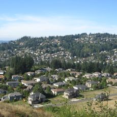
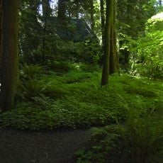
Powell Butte is an extinct cinder cone butte in Multnomah County, Oregon, part of the Boring Lava Field. Its top holds volcanic rock of the Troutdale Formation beneath scoria and ash from a local eruption. The Powell Butte Nature Park covers about 612 acres of meadow and mixed forest, with 9 miles of trails and views of Mount Adams, Mount Hood, Mount Jefferson and Mount St. Helens.
Portland acquired the land in 1925 from George Wilson for water storage purposes. Farming continued on the property until 1948, after which it became open to the public.
A stone circle at the summit marks the names and elevations of visible peaks, helping visitors identify distant mountains. This marker shows how people use the location to connect with the surrounding landscape.
The location is accessible daily with parking at the base and trails for different skill levels. Visitors should prepare for variable weather and wear sturdy footwear.
Powell Butte is one of the smaller cones of the Boring Lava Field, a group of over 80 volcanic edifices in the Portland area. Its top holds Troutdale Formation rock beneath scoria and ash from a local eruption. The butte also hides two underground reservoirs, each holding 50 million US gallons of Portland's water.
The community of curious travelers
AroundUs brings together thousands of curated places, local tips, and hidden gems, enriched daily by 93,779 contributors worldwide.