Chest opened
+${chestReward.xp} XP
Explorer
NOUVEAU ×${chestReward.collectible.quantity}
tapez pour fermer
Chest locked

Open chests in the app

Around Us is built for your phone — chests unlock when you walk, explore and capture nearby places.

Enable Location

We need your location to show you interesting places around you

Discover nearby places

Find interesting locations and hidden gems around you

Precise directions

Get accurate directions and distances to places

Your location is never shared with other users. It's only used when you tap the location button.

Columbia River Estuary

Log in to your account

Start exploring — it's free

Trusted by 72,878 travelers worldwide

Continue with Google
Continue with Apple
or

We will send you a code to connect

By continuing, you accept our Terms and Conditions and our Privacy Policy

Check your inbox

We've sent a pincode in your inbox. Please enter the code below.

Columbia River Estuary
Discussion Reviews 1 Photos
11.5k Popularity

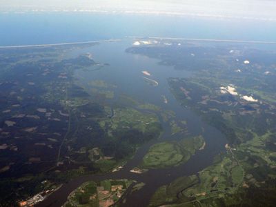
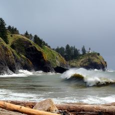
Columbia River Estuary, Coastal estuary at Pacific Ocean border, Washington and Oregon, US.

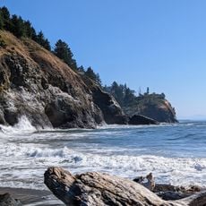
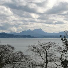
The Columbia River Estuary is a coastal area where the Columbia River flows into the Pacific Ocean, mixing fresh and salt water. The landscape includes mud flats, tidal channels, and wetland zones that support diverse plant and animal life.

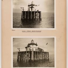
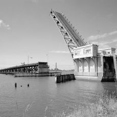
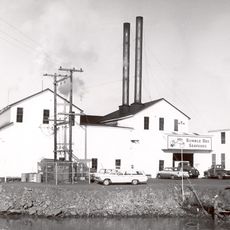
Indigenous peoples lived in this region for thousands of years before European explorers arrived in the early 1800s. Commercial fishing and trade later became major forces that shaped the area's development.

The Chinook people maintained extensive trading networks along the estuary, establishing a complex society centered around seasonal salmon harvests.

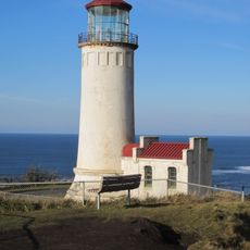
You can visit several viewing areas around the estuary to watch birds and marine animals. The best time is during spring and fall when many species are migrating through the region.

The estuary serves as a natural research site where scientists study how fresh river water and ocean salt water interact. This mixing zone creates conditions found nowhere else in quite the same way.

The community of curious travelers

AroundUs brings together thousands of curated places, local tips, and hidden gems, enriched daily by 60,000 contributors worldwide.

Start exploring
Location
Location
Part of
Columbia River
GPS coordinates
46.24420,-124.05800
Latest update
December 8, 2025 13:40
Around this place
Astoria–Megler Bridge
United States of America

Astoria–Megler Bridge

15.3 km
Fort Stevens
United States of America

Fort Stevens

8.7 km
Fort Clatsop
United States of America

Fort Clatsop

18.4 km
Cape Disappointment State Park
United States of America

Cape Disappointment State Park

5.3 km
Captain George Flavel House Museum
United States of America

Captain George Flavel House Museum

18.3 km
Oregon Film Museum
United States of America

Oregon Film Museum

18.2 km
Cape Disappointment Light
United States of America

Cape Disappointment Light

3.5 km
Fort Columbia State Park
United States of America

Fort Columbia State Park

10.9 km
North Head Light
United States of America

North Head Light

6.3 km
Waikiki Beach
United States of America

Waikiki Beach

4.2 km
Columbia River Quarantine Station
United States of America

Columbia River Quarantine Station

18 km
New Youngs Bay Bridge
United States of America

New Youngs Bay Bridge

16.5 km
Desdemona Sands Light
United States of America

Desdemona Sands Light

8.3 km
Chinook Point
United States of America

Chinook Point

10.5 km
Lewis and Clark River Bridge
United States of America

Lewis and Clark River Bridge

18.4 km
George C. and Winona Flavel House
United States of America

George C. and Winona Flavel House

18.3 km
Samuel Elmore Cannery
United States of America

Samuel Elmore Cannery

17.4 km
Astoria Victory Monument
United States of America

Astoria Victory Monument

17.3 km
Clatsop County Courthouse
United States of America

Clatsop County Courthouse

18.3 km
Daniel Knight Warren House
United States of America

Daniel Knight Warren House

13.5 km
Fort Stevens State Park
United States of America

Fort Stevens State Park

9.4 km
John Hobson House
United States of America

John Hobson House

18.1 km
Colbert House
United States of America

Colbert House

7.4 km
Astoria Wharf and Warehouse Company
United States of America

Astoria Wharf and Warehouse Company

17.9 km
Battery Russell
United States of America

Battery Russell

8.5 km
World Kite Museum
United States of America

World Kite Museum

11.3 km
Columbia Pacific Heritage Museum
United States of America

Columbia Pacific Heritage Museum

7.2 km
Old Clatsop County Jail
United States of America

Old Clatsop County Jail

18.2 km
Show the full map
Reviews
Share your experience

No review yet

Discussions
Start a discussion...

No discussion yet

« Columbia River Estuary - Coastal estuary at Pacific Ocean border, Washington and Oregon, US » is provided by Around Us (aroundus.com). Images and texts are derived from Wikimedia project under a Creative Commons license. You are allowed to copy, distribute, and modify copies of this page, under the conditions set by the license, as long as this note is clearly visible.

Discover hidden gems everywhere you go!

From secret cafés to breathtaking viewpoints, skip the crowded tourist spots and find places that match your style. Our app makes it easy with voice search, smart filtering, route optimization, and insider tips from travelers worldwide. Download now for the complete mobile experience.

Around Us App Screenshot

A unique approach to discovering new places

Le Figaro

All the places worth exploring

France Info

A tailor-made excursion in just a few clicks

20 Minutes

Around Us
Travel Guide & Maps
Download

Send to your phone

QR Code
1

Open the camera app on your mobile.

2

Point at the QR code with your camera. A notification will appear.

3

Tap the notification to open the link.