Chest opened
+${chestReward.xp} XP
Explorer
NOUVEAU ×${chestReward.collectible.quantity}
tapez pour fermer
Chest locked

Open chests in the app

Around Us is built for your phone — chests unlock when you walk, explore and capture nearby places.

Enable Location

We need your location to show you interesting places around you

Discover nearby places

Find interesting locations and hidden gems around you

Precise directions

Get accurate directions and distances to places

Your location is never shared with other users. It's only used when you tap the location button.

Eatonville

Log in to your account

Start exploring — it's free

Trusted by 72,914 travelers worldwide

Continue with Google
Continue with Apple
or

We will send you a code to connect

By continuing, you accept our Terms and Conditions and our Privacy Policy

Check your inbox

We've sent a pincode in your inbox. Please enter the code below.

Discussion Reviews 1 Photos
18.2k Popularity

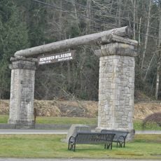
Eatonville, town in Pierce County, Washington, United States

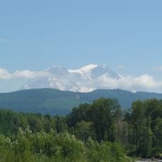
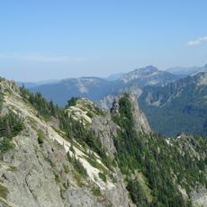
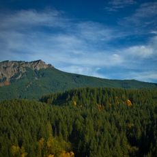
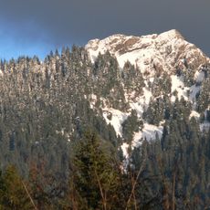
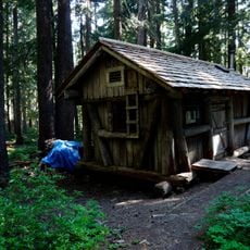
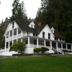
Eatonville is a small town in Pierce County surrounded by farmland, forests, and views of Mount Rainier. The streets are quiet and simple, with local shops, cafes, and parks like Millpond and Smallwood where visitors can walk and sit by the water.

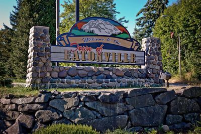
Thomas C. VanEaton established the town in the late 1880s as a trading post for early settlers, naming it after himself. In 1889, a Native American guide named Indian Henry led VanEaton to Mount Rainier, creating the area's lasting connection to the mountain.

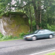
The town's name comes from its founder Thomas C. VanEaton, and this connection to early settlement shapes how locals see their home. People here value their farming roots and remember Native American visitors who traveled through the area long ago.

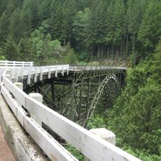
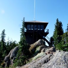
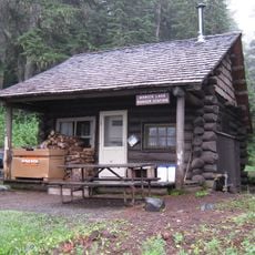
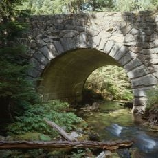
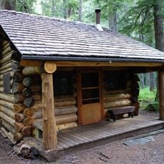
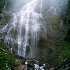
The town is easy to walk around, and visitors can explore several parks and trails, including hikes to Mashel Falls and the nearby Northwest Trek Wildlife Park. Many restaurants and cafes have outdoor seating with mountain views, especially during warmer months.

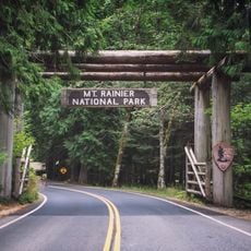
Visitors often overlook that the town serves as a gateway to Mount Rainier and a convenient stop before heading into mountain wilderness. Local spots like Mill Haus Cider Co with live music and Stringtown Cellars set in lavender fields show how the community blends agriculture with gathering spaces.

The community of curious travelers

AroundUs brings together thousands of curated places, local tips, and hidden gems, enriched daily by 60,000 contributors worldwide.

Start exploring
Location
Elevation above the sea
244 m
GPS coordinates
46.86830,-122.27000
Latest update
February 17, 2026 00:01
Around this place
Skystone
United States of America

Skystone

32.3 km
Western Air Defense Sector
United States of America

Western Air Defense Sector

33.3 km
Northwest Trek Wildlife Park
United States of America

Northwest Trek Wildlife Park

5.3 km
Mount Rainier Scenic Railroad
United States of America

Mount Rainier Scenic Railroad

12.8 km
Tolmie Peak
United States of America

Tolmie Peak

31.5 km
Fairfax Bridge
United States of America

Fairfax Bridge

26 km
Tolmie Peak Fire Lookout
United States of America

Tolmie Peak Fire Lookout

31.2 km
Glacier View Wilderness
United States of America

Glacier View Wilderness

27 km
Mount Wow
United States of America

Mount Wow

29.8 km
Gobbler's Knob Fire Lookout
United States of America

Gobbler's Knob Fire Lookout

28.2 km
McMillin Bridge
United States of America

McMillin Bridge

29.2 km
Nisqually Entrance Historic District
United States of America

Nisqually Entrance Historic District

30.3 km
Lake George Patrol Cabin
United States of America

Lake George Patrol Cabin

29.2 km
Ashford Mansion
United States of America

Ashford Mansion

22.1 km
Mowich Lake Patrol Cabin
United States of America

Mowich Lake Patrol Cabin

31.9 km
Holy Trinity Orthodox Church
United States of America

Holy Trinity Orthodox Church

31.6 km
St. Andrews Creek Bridge
United States of America

St. Andrews Creek Bridge

28 km
South Puyallup River Bridge
United States of America

South Puyallup River Bridge

29.6 km
United States of America

Fay Peak

32.9 km
Wilkeson Arch
United States of America

Wilkeson Arch

31.5 km
St. Andrews Patrol Cabin
United States of America

St. Andrews Patrol Cabin

28.2 km
Lake Lawrence erratic
United States of America

Lake Lawrence erratic

23.5 km
Wilkeson School
United States of America

Wilkeson School

31.2 km
LeMay Collections at Marymount
United States of America

LeMay Collections at Marymount

30.6 km
Recycled Spirits of Iron
United States of America

Recycled Spirits of Iron

16.1 km
Sunset Park Patrol Cabin
United States of America

Sunset Park Patrol Cabin

28.2 km
Carbon River Ranger Station
United States of America

Carbon River Ranger Station

30.5 km
Spray Falls
United States of America

Spray Falls

33 km
Show the full map
Reviews
Share your experience

No review yet

Discussions
Start a discussion...

No discussion yet

« Eatonville - town in Pierce County, Washington, United States » is provided by Around Us (aroundus.com). Images and texts are derived from Wikimedia project under a Creative Commons license. You are allowed to copy, distribute, and modify copies of this page, under the conditions set by the license, as long as this note is clearly visible.

Discover hidden gems everywhere you go!

From secret cafés to breathtaking viewpoints, skip the crowded tourist spots and find places that match your style. Our app makes it easy with voice search, smart filtering, route optimization, and insider tips from travelers worldwide. Download now for the complete mobile experience.

Around Us App Screenshot

A unique approach to discovering new places

Le Figaro

All the places worth exploring

France Info

A tailor-made excursion in just a few clicks

20 Minutes

Around Us
Travel Guide & Maps
Download

Send to your phone

QR Code
1

Open the camera app on your mobile.

2

Point at the QR code with your camera. A notification will appear.

3

Tap the notification to open the link.