Chest opened
+${chestReward.xp} XP
Explorer
NOUVEAU ×${chestReward.collectible.quantity}
tapez pour fermer
Chest locked

Open chests in the app

Around Us is built for your phone — chests unlock when you walk, explore and capture nearby places.

Enable Location

We need your location to show you interesting places around you

Discover nearby places

Find interesting locations and hidden gems around you

Precise directions

Get accurate directions and distances to places

Your location is never shared with other users. It's only used when you tap the location button.

Log in to your account

Start exploring — it's free

Trusted by 72,887 travelers worldwide

Continue with Google
Continue with Apple
or

We will send you a code to connect

By continuing, you accept our Terms and Conditions and our Privacy Policy

Check your inbox

We've sent a pincode in your inbox. Please enter the code below.

Shaw Island
Discussion Reviews Photo
14.6k Popularity

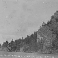
Shaw Island, San Juan Islands archipelago in Washington State, US

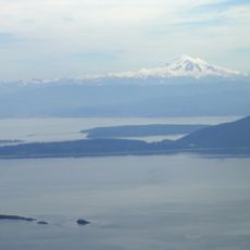
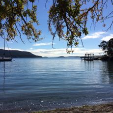
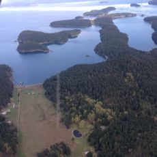
Shaw Island is a rural island in the San Juan Islands archipelago with forests, rocky shores, and open grasslands throughout. A network of roads connects the scattered settlements to the ferry terminal, which serves as the island's main hub.

The island was named in 1841 after a United States Naval officer when the Wilkes Expedition surveyed the region. The Lummi people, who traditionally inhabited the area, have known the island by their own name for centuries.

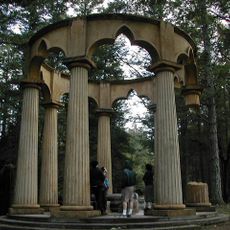
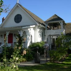
Several Catholic religious communities established monasteries on the island over the past century, shaping the spiritual life of residents and visitors. These sisters continue to maintain their presence and influence the island's character today.

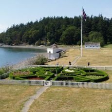
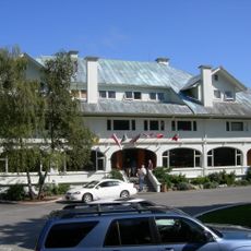
Washington State Ferries operates regular service to and from the island, making it accessible to visitors throughout the year. A general store and post office near the ferry dock provide basic services and supplies when you arrive.

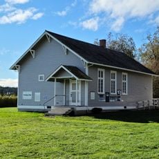
A one-room schoolhouse built in 1891 still operates on the island today, serving students with a teaching approach from a different era. This school remains one of the oldest continuously functioning educational buildings in Washington State.

The community of curious travelers

AroundUs brings together thousands of curated places, local tips, and hidden gems, enriched daily by 60,000 contributors worldwide.

Start exploring
GPS coordinates
48.57101,-122.94887
Latest update
December 7, 2025 20:21
Around this place
Afterglow Vista
United States of America

Afterglow Vista

15.6 km
Mount Constitution
United States of America

Mount Constitution

14.7 km
San Juan Island National Historical Park
United States of America

San Juan Island National Historical Park

12.9 km
Moran State Park
United States of America

Moran State Park

13.7 km
Lime Kiln Point State Park
United States of America

Lime Kiln Point State Park

16.1 km
San Juan Islands National Wildlife Refuge
United States of America

San Juan Islands National Wildlife Refuge

13 km
Spencer Spit State Park
United States of America

Spencer Spit State Park

7.7 km
Posey Island State Park
United States of America

Posey Island State Park

17 km
Lime Kiln Light
United States of America

Lime Kiln Light

16.2 km
Obstruction Pass State Park
United States of America

Obstruction Pass State Park

9.7 km
Rosario
United States of America

Rosario

10 km
Stuart Island State Park
United States of America

Stuart Island State Park

21.9 km
Burrows Island Light
United States of America

Burrows Island Light

20.2 km
Cattle Point Light
United States of America

Cattle Point Light

13.4 km
Patos Island Lighthouse
United States of America

Patos Island Lighthouse

24.3 km
Blind Island Marine State Park
United States of America

Blind Island Marine State Park

1.8 km
Discovery Island Light
Canada

Discovery Island Light

26.2 km
Turn Point Light
United States of America

Turn Point Light

24.9 km
Port Stanley School
United States of America

Port Stanley School

7.4 km
Emmanuel Episcopal Church
United States of America

Emmanuel Episcopal Church

14.1 km
East Point Lighthouse (Saturna Island)
Canada

East Point Lighthouse (Saturna Island)

24.7 km
Mount Constitution Lookout Tower
United States of America

Mount Constitution Lookout Tower

14.7 km
San Juan Island Museum of Art
United States of America

San Juan Island Museum of Art

6.9 km
English Camp
United States of America

English Camp

14.2 km
American Camp
United States of America

American Camp

12.9 km
Anacortes Cinemas
United States of America

Anacortes Cinemas

25.4 km
Eagle Cliff
United States of America

Eagle Cliff

17.1 km
Empire Theater
United States of America

Empire Theater

25.5 km
Show the full map
Reviews
Share your experience

No review yet

Discussions
Start a discussion...

No discussion yet

« Shaw Island - San Juan Islands archipelago in Washington State, US » is provided by Around Us (aroundus.com). Images and texts are derived from Wikimedia project under a Creative Commons license. You are allowed to copy, distribute, and modify copies of this page, under the conditions set by the license, as long as this note is clearly visible.

Discover hidden gems everywhere you go!

From secret cafés to breathtaking viewpoints, skip the crowded tourist spots and find places that match your style. Our app makes it easy with voice search, smart filtering, route optimization, and insider tips from travelers worldwide. Download now for the complete mobile experience.

Around Us App Screenshot

A unique approach to discovering new places

Le Figaro

All the places worth exploring

France Info

A tailor-made excursion in just a few clicks

20 Minutes

Around Us
Travel Guide & Maps
Download

Send to your phone

QR Code
1

Open the camera app on your mobile.

2

Point at the QR code with your camera. A notification will appear.

3

Tap the notification to open the link.