Chest opened
+${chestReward.xp} XP
Explorer
NOUVEAU ×${chestReward.collectible.quantity}
tapez pour fermer
Chest locked

Open chests in the app

Around Us is built for your phone — chests unlock when you walk, explore and capture nearby places.

Enable Location

We need your location to show you interesting places around you

Discover nearby places

Find interesting locations and hidden gems around you

Precise directions

Get accurate directions and distances to places

Your location is never shared with other users. It's only used when you tap the location button.

Log in to your account

Start exploring — it's free

Trusted by 72,888 travelers worldwide

Continue with Google
Continue with Apple
or

We will send you a code to connect

By continuing, you accept our Terms and Conditions and our Privacy Policy

Check your inbox

We've sent a pincode in your inbox. Please enter the code below.

Discussion Reviews Photo
14.3k Popularity

Oso, Census-designated place in Snohomish County, United States.

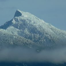
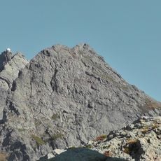
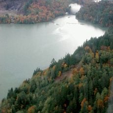
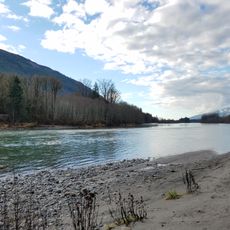
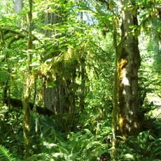
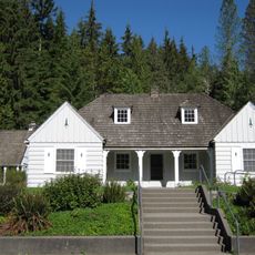
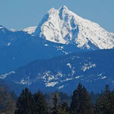
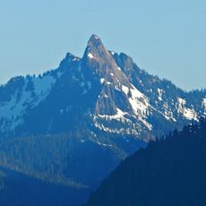
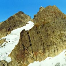
Oso is a small community in Snohomish County, Washington, located along a river valley in the Cascade Range foothills. The area consists of scattered homes and forested land with rolling terrain characteristic of this mountain region.

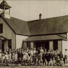
The settlement adopted its name from a ghost town in Texas to avoid confusion with another place that had a similar name in the state. This rename reflects how early settlers drew inspiration from places they had known elsewhere.

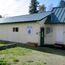
The settlement consists mostly of houses spread across the landscape in a rural pattern, reflecting how people live in this mountain valley. Visitors notice the community's residential character and the way families have established themselves throughout the area.

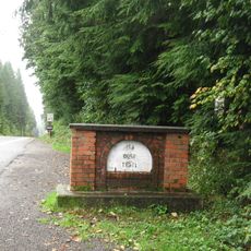
The main road, State Route 530, connects the community to larger towns and provides access through the valley toward the mountains. Visitors should know this is a rural area where services are limited and a car is necessary for getting around.

The area is linked to a tragic natural disaster that many visitors don't know about and that deeply affected the region. This event is important for understanding why the landscape and community are shaped the way they are today.

The community of curious travelers

AroundUs brings together thousands of curated places, local tips, and hidden gems, enriched daily by 60,000 contributors worldwide.

Start exploring
Location
Elevation above the sea
63 m
GPS coordinates
48.27220,-121.91900
Latest update
December 7, 2025 20:22
Around this place
Tsubaki Grand Shrine of America
United States of America

Tsubaki Grand Shrine of America

22.2 km
Mount Pilchuck
United States of America

Mount Pilchuck

25.5 km
Three Fingers Lookout
United States of America

Three Fingers Lookout

20.6 km
Lake Shannon
United States of America

Lake Shannon

33.3 km
Rasar State Park
United States of America

Rasar State Park

27.4 km
Whitehorse Mountain
United States of America

Whitehorse Mountain

19.1 km
Mount Pilchuck State Park
United States of America

Mount Pilchuck State Park

26.3 km
Big Bear Mountain
United States of America

Big Bear Mountain

22.3 km
Boulder River Wilderness
United States of America

Boulder River Wilderness

9.8 km
Giant Cedar Stump
United States of America

Giant Cedar Stump

23.1 km
Mark Clark Bridge
United States of America

Mark Clark Bridge

34.6 km
Rockport State Park
United States of America

Rockport State Park

32.9 km
Robe Canyon Historic Trail Park
United States of America

Robe Canyon Historic Trail Park

19.2 km
Marysville Opera House
United States of America

Marysville Opera House

31.4 km
Verlot Ranger Station-Public Service Center
United States of America

Verlot Ranger Station-Public Service Center

22.5 km
Indian Shaker Church
United States of America

Indian Shaker Church

34.5 km
Liberty Mountain
United States of America

Liberty Mountain

24.3 km
Concrete Heritage Museum
United States of America

Concrete Heritage Museum

32.3 km
Devils Thumb
United States of America

Devils Thumb

31.7 km
Stanwood IOOF Public Hall
United States of America

Stanwood IOOF Public Hall

33.7 km
Queest-alb Glacier
United States of America

Queest-alb Glacier

19.9 km
Feature Show Falls
United States of America

Feature Show Falls

8 km
So-Bahli-Alhi Glacier
United States of America

So-Bahli-Alhi Glacier

18.8 km
Olympic Theatre
United States of America

Olympic Theatre

17.7 km
Concrete Theatre
United States of America

Concrete Theatre

32.3 km
Mount Pilchuck Lookout
United States of America

Mount Pilchuck Lookout

25.5 km
Skagit City School
United States of America

Skagit City School

35 km
Hibulb Cultural Center
United States of America

Hibulb Cultural Center

32 km
Show the full map
Reviews
Share your experience

No review yet

Discussions
Start a discussion...

No discussion yet

« Oso - Census-designated place in Snohomish County, United States » is provided by Around Us (aroundus.com). Images and texts are derived from Wikimedia project under a Creative Commons license. You are allowed to copy, distribute, and modify copies of this page, under the conditions set by the license, as long as this note is clearly visible.

Discover hidden gems everywhere you go!

From secret cafés to breathtaking viewpoints, skip the crowded tourist spots and find places that match your style. Our app makes it easy with voice search, smart filtering, route optimization, and insider tips from travelers worldwide. Download now for the complete mobile experience.

Around Us App Screenshot

A unique approach to discovering new places

Le Figaro

All the places worth exploring

France Info

A tailor-made excursion in just a few clicks

20 Minutes

Around Us
Travel Guide & Maps
Download

Send to your phone

QR Code
1

Open the camera app on your mobile.

2

Point at the QR code with your camera. A notification will appear.

3

Tap the notification to open the link.