Southern California Logistics Airport, Cargo airport in Victorville, California, United States.
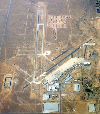
Southern California Logistics Airport is a cargo airport in Victorville, California, operating two runways across a large parcel of desert land. The facility handles heavy international freight aircraft and serves as a major distribution hub for cargo operations throughout the region.
The airport began as George Air Force Base in 1941, serving as a flight training center for the United States Air Force during World War II. It transitioned to civilian cargo operations after the military closed the base in 1992.
The airport grounds have served as a filming location for several Hollywood productions, offering filmmakers a remote desert setting that works well for aviation-themed scenes.
The airport maintains 24-hour United States Customs services and connects to major highways for efficient cargo distribution. Keep in mind that this is an active cargo terminal with restricted access for authorized personnel only.
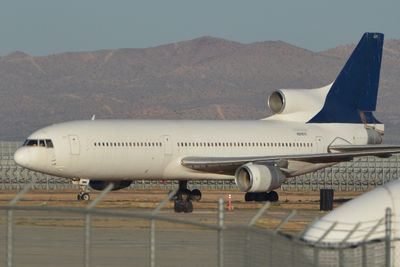
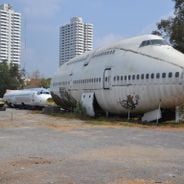
The airport serves as a storage facility for hundreds of retired commercial aircraft parked in the desert. This collection of large planes, including old Boeing 747s, demonstrates how the location operates as a long-term holding ground for idle aircraft.
Location: California
Official opening: 1941
Elevation above the sea: 879 m
Operator: Southern California Logistics Airport Authority
Address: Phantom West
Website: https://victorvilleca.gov/government/city-departments/airport
GPS coordinates: 34.59750,-117.38306
Latest update: December 12, 2025 18:18
United States Penitentiary, Victorville
3.6 km
California Route 66 Museum
10.5 km
Horsethief Canyon
31.3 km
Mormon Trail Monument
30.4 km
Silver Mountain
12.2 km
Bell Mountain
15.3 km
Highway 18 Park
18.1 km
Rockview Park
6.6 km
Hesperia Lake Park
26.5 km
Apple Valley Golf Course
16.2 km
Mom
22.2 km
Green Tree Golf Course
12 km
Spring Valley Lake Country Club
16.4 km
Ashwood Golf Course
21.3 km
West Winds Golf Course
3.6 km
Silver Lakes Golf Course
17.9 km
Elmer’s Bottle Tree Ranch
11.1 km
Civic Center Park Amphitheatre
17.6 km
Hesperia Golf & Country Club
23.7 km
Old Town Arch
10.7 km
Mojave River Forks Dam overlook
31.9 km
Route 66 sign on the Street
4.2 km
Scenic viewpoint
28.1 km
Uncanny Expeditions
29 km
Scenic viewpoint
29.5 km
Scenic viewpoint
29.4 km
Scenic viewpoint
29.3 km
Scenic viewpoint
27.7 kmVisited this place? Tap the stars to rate it and share your experience / photos with the community! Try now! You can cancel it anytime.
Discover hidden gems everywhere you go!
From secret cafés to breathtaking viewpoints, skip the crowded tourist spots and find places that match your style. Our app makes it easy with voice search, smart filtering, route optimization, and insider tips from travelers worldwide. Download now for the complete mobile experience.
A unique approach to discovering new places❞
— Le Figaro
All the places worth exploring❞
— France Info
A tailor-made excursion in just a few clicks❞
— 20 Minutes