Seligman Commercial Historic District

Log in to your account

AroundUs is a community-driven map of interesting places, built by curious explorers like you. It grows with every review, story, and photo you share.
Connect to save your favorite spots, contribute locations, and create personalized routes.
By continuing, you accept our Terms and Conditions and our Privacy Policy
Add to collection
Map
Suggest a change
Share

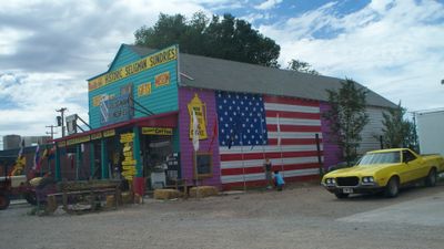
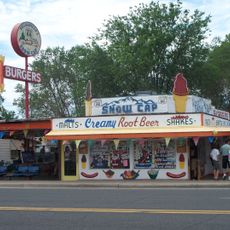
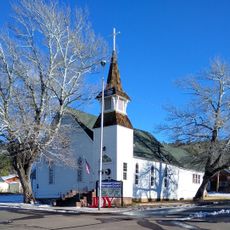
Seligman Commercial Historic District, Historic district in Seligman, Arizona, US.

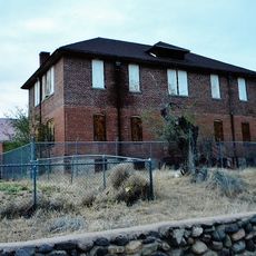
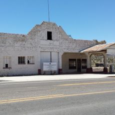
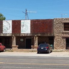
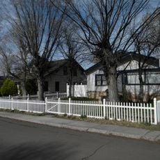
Seligman Commercial Historic District is a commercial area with railroad, automobile, and business structures from the early 20th century set along the original Route 66. The buildings date mostly from 1900 to 1960 and reflect the transportation infrastructure of that era.

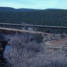
The area was founded in 1886 as Prescott Junction and later renamed after banker Jesse Seligman, who financed the Atchison, Topeka and Santa Fe Railway. The town's growth followed the railroad and then the arrival of Route 66.

The district reflects different eras of transportation, from rail to automobile travel, and you can see how these shifts shaped how people lived and worked here.

A walk through the district takes about 20 minutes and you can explore the historic buildings at your own pace. The area is flat and easy to navigate, making it accessible for most visitors.

The area gained recognition on the National Register of Historic Places in 2005 following detailed documentation work by local resident Mirna Delgadillo. This grassroots effort helped preserve the area's importance in Route 66 history.

Location: Seligman

GPS coordinates: 35.32639,-112.87417

Latest update: December 14, 2025 11:41

Photos
Around this place
Grand Canyon Railway
United States of America

Grand Canyon Railway

70.9 km
Grand Canyon Caverns
United States of America

Grand Canyon Caverns

39.5 km
Delgadillo's Snow Cap Drive-In
United States of America

Delgadillo's Snow Cap Drive-In

111 m
Granite Mountain
United States of America

Granite Mountain

81 km
Kendrick Peak
United States of America

Kendrick Peak

93.3 km
Granite Basin Lake
United States of America

Granite Basin Lake

84.3 km
Sycamore Canyon Wilderness
United States of America

Sycamore Canyon Wilderness

89 km
Red Butte
United States of America

Red Butte

89.8 km
Woodchute Wilderness
United States of America

Woodchute Wilderness

90 km
Barney Flat Historic Railroad Logging Landscape
United States of America

Barney Flat Historic Railroad Logging Landscape

68.7 km
Perkinsville Bridge
United States of America

Perkinsville Bridge

77.6 km
Schoolhouse at Truxton Canyon Training School
United States of America

Schoolhouse at Truxton Canyon Training School

71.7 km
John Osterman Gas Station
United States of America

John Osterman Gas Station

54.9 km
Peach Springs Trading Post
United States of America

Peach Springs Trading Post

55 km
Camp Clover Ranger Station
United States of America

Camp Clover Ranger Station

60.4 km
Gold King Mine Ghost Town
United States of America

Gold King Mine Ghost Town

92.8 km
First Methodist Episcopal Church and Parsonage
United States of America

First Methodist Episcopal Church and Parsonage

62.3 km
Williams Residential Historic District
United States of America

Williams Residential Historic District

63.1 km
Route 66 Museum And Gift Shop
United States of America

Route 66 Museum And Gift Shop

62.3 km
Volunteer Lookout Cabin
United States of America

Volunteer Lookout Cabin

89.8 km
Historic Angel's Barber Shop Museum
United States of America

Historic Angel's Barber Shop Museum

53 m
Thornton Lookout Tower
United States of America

Thornton Lookout Tower

60.2 km
Bill Williams Lookout Tower
United States of America

Bill Williams Lookout Tower

62.4 km
Red Butte Lookout Tower
United States of America

Red Butte Lookout Tower

89.9 km
Volunteer Lookout Tower
United States of America

Volunteer Lookout Tower

89.7 km
Big Hell Canyon Railroad Bridge
United States of America

Big Hell Canyon Railroad Bridge

59.3 km
Little Hell Canyon Bridge
United States of America

Little Hell Canyon Bridge

50.6 km
Little Hell Canyon Railroad Bridge
United States of America

Little Hell Canyon Railroad Bridge

50.6 km
Show the full map
Reviews

Visited this place? Tap the stars to rate it and share your experience / photos with the community! Try now! You can cancel it anytime.

« Seligman Commercial Historic District - Historic district in Seligman, Arizona, US » is provided by Around Us (aroundus.com). Images and texts are derived from Wikimedia project under a Creative Commons license. You are allowed to copy, distribute, and modify copies of this page, under the conditions set by the license, as long as this note is clearly visible.

Discover hidden gems everywhere you go!

From secret cafés to breathtaking viewpoints, skip the crowded tourist spots and find places that match your style. Our app makes it easy with voice search, smart filtering, route optimization, and insider tips from travelers worldwide. Download now for the complete mobile experience.

Around Us App Screenshot

A unique approach to discovering new places

Le Figaro

All the places worth exploring

France Info

A tailor-made excursion in just a few clicks

20 Minutes