Chest opened
+${chestReward.xp} XP
Explorer
NOUVEAU ×${chestReward.collectible.quantity}
tapez pour fermer

See the monuments around you in AR Open chests in the app

Around Us is built for your phone — point your camera at the streets and discover the monuments and places around you in augmented reality. Around Us is built for your phone — chests unlock when you walk, explore and capture nearby places.

Enable Location

We need your location to show you interesting places around you

Discover nearby places

Find interesting locations and hidden gems around you

Precise directions

Get accurate directions and distances to places

Your location is never shared with other users. It's only used when you tap the location button.

Log in to your account

Start exploring — it's free

Trusted by 82,878 travelers worldwide

Continue with Google
Continue with Apple
or

We will send you a code to connect

By continuing, you accept our Terms and Conditions and our Privacy Policy

Check your inbox

We've sent a pincode in your inbox. Please enter the code below.

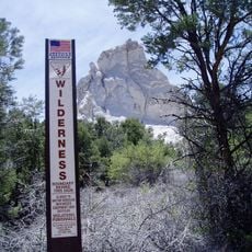
Parsnip Peak Wilderness
Discussion Reviews Photo
1.4k Popularity

Parsnip Peak Wilderness, Protected wilderness area in Lincoln County, Nevada, US

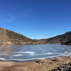
Parsnip Peak Wilderness is a protected natural area spanning approximately 44,000 acres across the Wilson Creek Mountain Range. The landscape ranges from 6,160 to 8,916 feet in elevation and features varied forest cover with open areas throughout.

Congress designated this area as protected wilderness in 2004 through federal legislation. This action safeguarded the natural landscape and its archaeological heritage for future generations.

People can find traces of ancient habitation throughout the wilderness, including rock shelters, stone rings, and old camping areas that show where indigenous people once lived. These sites remain scattered across the landscape for visitors to discover.

Bring maps and navigation tools when visiting, as this is a remote area accessible only by unpaved roads. Check conditions beforehand, as weather and road access can change seasonally.

Within the wilderness sits a geological formation called Indian Playground featuring intricate rock patterns. This formation becomes visible from higher elevations and offers visitors an unusual view of natural rock structures.

The community of curious travelers

AroundUs brings together thousands of curated places, local tips, and hidden gems, enriched daily by 60,000 contributors worldwide.

Start exploring
Location
GPS coordinates
38.14610,-114.32500
Latest update
August 12, 2026 11:38
Around this place
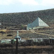
Righteous Branch of the Church of Jesus Christ of Latter-day Saints
United States of America

Righteous Branch of the Church of Jesus Christ of Latter-day Saints

66.1 km
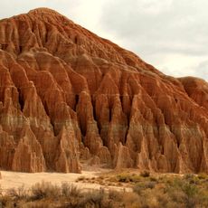
Cathedral Gorge State Park
United States of America

Cathedral Gorge State Park

37.2 km
Echo Canyon State Park
United States of America

Echo Canyon State Park

26.9 km
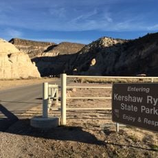
Kershaw–Ryan State Park
United States of America

Kershaw–Ryan State Park

64.4 km
Spring Valley State Park
United States of America

Spring Valley State Park

17 km
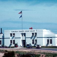
Lincoln County Courthouse
United States of America

Lincoln County Courthouse

26.3 km
Bristol Wells Town Site
United States of America

Bristol Wells Town Site

32.7 km
Fortification Range Wilderness
United States of America

Fortification Range Wilderness

47.5 km
1938 Lincoln County Courthouse
United States of America

1938 Lincoln County Courthouse

25.8 km
United States of America

Shingle Peak

66.3 km
United States of America

Comet Peak

35.8 km
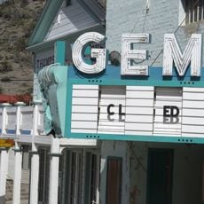
Gem Theatre
United States of America

Gem Theatre

26.5 km
United States of America

Smith Hotel-Cornelius Hotel

61.1 km
United States of America

Pioche Firehouse

26.5 km
United States of America

The Bluffs

47.4 km
United States of America

Rattlesnake Point

41.8 km
United States of America

Craw Knoll

18.5 km
United States of America

White Cliff

52.8 km
United States of America

Indian Peak State Game Management Area

44.4 km
United States of America

Government Peak

29.8 km
United States of America

Warm Point

66.8 km
United States of America

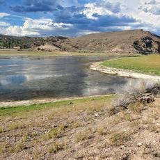
Eccles Reservoir

64.7 km
United States of America

Statue, Work of art

61.9 km
United States of America

Statue

40 km
United States of America

Millers Point

36.1 km
United States of America

Cathedral Cave

36.7 km
United States of America

Moon Caves

37.1 km
United States of America

Scenic viewpoint

37.1 km
Show the full map
Reviews
Share your experience

No review yet

Discussions
Start a discussion...

No discussion yet

« Parsnip Peak Wilderness - Protected wilderness area in Lincoln County, Nevada, US » is provided by Around Us (aroundus.com). Images and texts are derived from Wikimedia project under a Creative Commons license. You are allowed to copy, distribute, and modify copies of this page, under the conditions set by the license, as long as this note is clearly visible.

Discover hidden gems everywhere you go!

From secret cafés to breathtaking viewpoints, skip the crowded tourist spots and find places that match your style. Our app makes it easy with voice search, smart filtering, route optimization, and insider tips from travelers worldwide. Download now for the complete mobile experience.

Around Us App Screenshot

A unique approach to discovering new places

Le Figaro

All the places worth exploring

France Info

A tailor-made excursion in just a few clicks

20 Minutes

Around Us
Travel Guide & Maps
Download

Send to your phone

QR Code
1

Open the camera app on your mobile.

2

Point at the QR code with your camera. A notification will appear.

3

Tap the notification to open the link.