Bristol Wells Town Site

Log in to your account

AroundUs is a community-driven map of interesting places, built by curious explorers like you. It grows with every review, story, and photo you share.
Connect to save your favorite spots, contribute locations, and create personalized routes.
By continuing, you accept our Terms and Conditions and our Privacy Policy
Add to collection
Map
Suggest a change
Share

Bristol Wells Town Site, Mining ghost town in Lincoln County, Nevada.

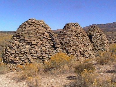
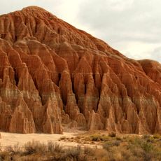
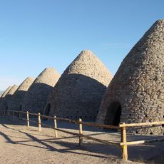
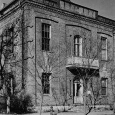
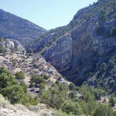
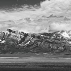
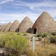
Bristol Wells Town Site is an abandoned mining settlement on the west side of Bristol Mountain, featuring stone buildings and two standing charcoal kilns from the mining era. The site also includes a cemetery and the foundations of several other structures from that period.

The settlement started in 1870 with mining claims and went through several name changes as silver and lead ore were extracted from the region. The town grew during the height of mining activity and left behind structures reflecting this era of expansion.

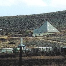
The stone buildings and cemetery show how miners lived and worked in Nevada's harsh desert, with structures that reflect their daily routines and survival strategies. These ruins reveal the close connection between industrial work and family life in remote mining settlements.

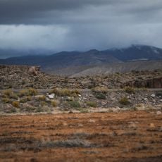
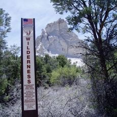
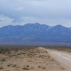
The site sits roughly 35 kilometers northwest of Pioche and requires a vehicle with good clearance for rough dirt roads, especially during winter weather. Plan extra travel time for unpaved roads and bring water and supplies for the desert environment.

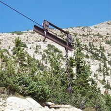
An aerial tramway built in 1908 carried ore from this settlement to a nearby processing point and then to a railroad connection. This transportation system reveals how isolated mining camps connected to broader commercial networks.

Location: Nevada

GPS coordinates: 38.10610,-114.69500

Latest update: December 13, 2025 17:06

Photos
Around this place
Wheeler Peak
United States of America

Wheeler Peak

103.4 km
Tikaboo Peak
United States of America

Tikaboo Peak

103 km
Righteous Branch of the Church of Jesus Christ of Latter-day Saints
United States of America

Righteous Branch of the Church of Jesus Christ of Latter-day Saints

88.9 km
Cathedral Gorge State Park
United States of America

Cathedral Gorge State Park

40.3 km
Basin and Range National Monument
United States of America

Basin and Range National Monument

63.3 km
Ward Charcoal Ovens State Historic Park
United States of America

Ward Charcoal Ovens State Historic Park

104.5 km
Wheeler Peak Glacier
United States of America

Wheeler Peak Glacier

103.4 km
Echo Canyon State Park
United States of America

Echo Canyon State Park

43.9 km
Pahranagat National Wildlife Refuge
United States of America

Pahranagat National Wildlife Refuge

101.1 km
Kershaw–Ryan State Park
United States of America

Kershaw–Ryan State Park

59.6 km
Spring Valley State Park
United States of America

Spring Valley State Park

46.3 km
Lincoln County Courthouse
United States of America

Lincoln County Courthouse

28.8 km
Red Mountain Wilderness
United States of America

Red Mountain Wilderness

105.5 km
Quinn Canyon Wilderness
United States of America

Quinn Canyon Wilderness

86.7 km
Clover Mountains Wilderness
United States of America

Clover Mountains Wilderness

84.5 km
Weepah Spring Wilderness
United States of America

Weepah Spring Wilderness

36.2 km
Elgin Schoolhouse State Historic Site
United States of America

Elgin Schoolhouse State Historic Site

85.1 km
South Egan Range Wilderness
United States of America

South Egan Range Wilderness

67.7 km
Fortification Range Wilderness
United States of America

Fortification Range Wilderness

54.7 km
Johnson Lake Mine Historic District
United States of America

Johnson Lake Mine Historic District

99.4 km
1938 Lincoln County Courthouse
United States of America

1938 Lincoln County Courthouse

28.5 km
Troy Peak
United States of America

Troy Peak

74.3 km
Gem Theatre
United States of America

Gem Theatre

29 km
Lund Grade School
United States of America

Lund Grade School

88.1 km
Lexington Arch
United States of America

Lexington Arch

92.5 km
Pyramid Peak
United States of America

Pyramid Peak

100.1 km
Baker Peak
United States of America

Baker Peak

101.7 km
Ward Charcoal Ovens
United States of America

Ward Charcoal Ovens

104.5 km
Show the full map
Reviews

Visited this place? Tap the stars to rate it and share your experience / photos with the community! Try now! You can cancel it anytime.

« Bristol Wells Town Site - Mining ghost town in Lincoln County, Nevada » is provided by Around Us (aroundus.com). Images and texts are derived from Wikimedia project under a Creative Commons license. You are allowed to copy, distribute, and modify copies of this page, under the conditions set by the license, as long as this note is clearly visible.

Discover hidden gems everywhere you go!

From secret cafés to breathtaking viewpoints, skip the crowded tourist spots and find places that match your style. Our app makes it easy with voice search, smart filtering, route optimization, and insider tips from travelers worldwide. Download now for the complete mobile experience.

Around Us App Screenshot

A unique approach to discovering new places

Le Figaro

All the places worth exploring

France Info

A tailor-made excursion in just a few clicks

20 Minutes