Enable Location

We need your location to show you interesting places around you

Discover nearby places

Find interesting locations and hidden gems around you

Precise directions

Get accurate directions and distances to places

Your location is never shared with other users. It's only used when you tap the location button.

Troy Peak

Log in to your account

Start exploring — it's free

Trusted by 62,832 travelers worldwide

Continue with Google
Continue with Apple
or

We will send you a code to connect

By continuing, you accept our Terms and Conditions and our Privacy Policy

Check your inbox

We've sent a pincode in your inbox. Please enter the code below.

Troy Peak

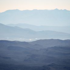
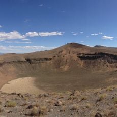
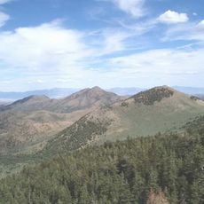
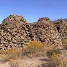
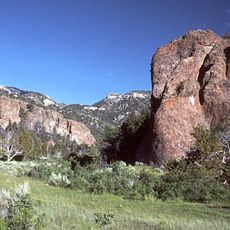
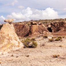
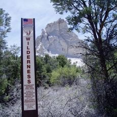
Troy Peak, Mountain summit in Grant Range, Nevada, US

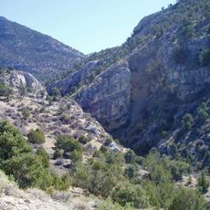
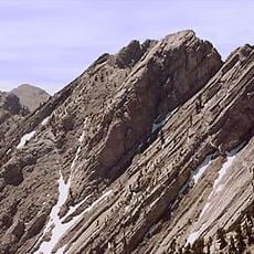
Troy Peak is a mountain in the Grant Range that rises above 11,000 feet and features prominent white limestone cliffs. The steep slopes and rocky terrain define this summit in Nevada's wilderness area.

The mountain was climbed and named in the late 1800s following a naturalist's expedition through the region. This ascent and subsequent documentation helped establish the peak's geographic recognition.

The mountain serves as a destination for climbers participating in Nevada's mountain challenges, particularly during summer expeditions from June through July.

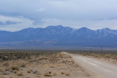
The drive to reach the mountain involves traveling on paved and gravel roads from the south, ending at a trailhead parking area. Visitors should prepare for remote conditions and limited facilities along the way.

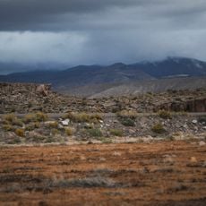
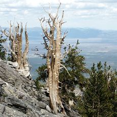
Ancient bristlecone pine trees grow directly on the western limestone face at high altitude in one of North America's harshest environments. These trees are among the oldest living organisms on the continent.

The community of curious travelers

AroundUs brings together thousands of curated places, local tips, and hidden gems, enriched daily by 60,000 contributors worldwide.

Start exploring
Location
GPS coordinates
38.31883,-115.50003
Latest update
December 14, 2025 18:41
Around this place
Nevada State Route 375
United States of America

Nevada State Route 375

76.5 km
Tikaboo Peak
United States of America

Tikaboo Peak

109.2 km
Cathedral Gorge State Park
United States of America

Cathedral Gorge State Park

110.2 km
Basin and Range National Monument
United States of America

Basin and Range National Monument

39.5 km
Ward Charcoal Ovens State Historic Park
United States of America

Ward Charcoal Ovens State Historic Park

98 km
Nevada Northern Railway Museum
United States of America

Nevada Northern Railway Museum

118.2 km
Hotel Nevada and Gambling Hall
United States of America

Hotel Nevada and Gambling Hall

116.1 km
Cave Lake State Park
United States of America

Cave Lake State Park

118.1 km
Fallon Range Training Complex
United States of America

Fallon Range Training Complex

107.4 km
Lunar Crater National Natural Landmark
United States of America

Lunar Crater National Natural Landmark

50.2 km
Echo Canyon State Park
United States of America

Echo Canyon State Park

117.7 km
Lincoln County Courthouse
United States of America

Lincoln County Courthouse

101.4 km
Red Mountain Wilderness
United States of America

Red Mountain Wilderness

67.5 km
Bristol Wells Town Site
United States of America

Bristol Wells Town Site

74.3 km
Quinn Canyon Wilderness
United States of America

Quinn Canyon Wilderness

24.7 km
Weepah Spring Wilderness
United States of America

Weepah Spring Wilderness

50.6 km
Currant Mountain Wilderness
United States of America

Currant Mountain Wilderness

66.4 km
South Egan Range Wilderness
United States of America

South Egan Range Wilderness

63.4 km
Central Theatre
United States of America

Central Theatre

116.8 km
Fortification Range Wilderness
United States of America

Fortification Range Wilderness

94.9 km
Currant Mountain
United States of America

Currant Mountain

66.1 km
Ely L.D.S. Stake Tabernacle
United States of America

Ely L.D.S. Stake Tabernacle

116.4 km
Capital Theatre
United States of America

Capital Theatre

116 km
1938 Lincoln County Courthouse
United States of America

1938 Lincoln County Courthouse

101.3 km
White Pine County Courthouse
United States of America

White Pine County Courthouse

116.2 km
Gem Theatre
United States of America

Gem Theatre

101.6 km
Lund Grade School
United States of America

Lund Grade School

73.7 km
Ward Charcoal Ovens
United States of America

Ward Charcoal Ovens

98 km
Show the full map
« Troy Peak - Mountain summit in Grant Range, Nevada, US » is provided by Around Us (aroundus.com). Images and texts are derived from Wikimedia project under a Creative Commons license. You are allowed to copy, distribute, and modify copies of this page, under the conditions set by the license, as long as this note is clearly visible.

Discover hidden gems everywhere you go!

From secret cafés to breathtaking viewpoints, skip the crowded tourist spots and find places that match your style. Our app makes it easy with voice search, smart filtering, route optimization, and insider tips from travelers worldwide. Download now for the complete mobile experience.

Around Us App Screenshot

A unique approach to discovering new places

Le Figaro

All the places worth exploring

France Info

A tailor-made excursion in just a few clicks

20 Minutes

Around Us
Travel Guide & Maps
Download

Send to your phone

QR Code
1

Open the camera app on your mobile.

2

Point at the QR code with your camera. A notification will appear.

3

Tap the notification to open the link.