Enable Location

We need your location to show you interesting places around you

Discover nearby places

Find interesting locations and hidden gems around you

Precise directions

Get accurate directions and distances to places

Your location is never shared with other users. It's only used when you tap the location button.

Pahranagat National Wildlife Refuge

Log in to your account

Start exploring — it's free

Trusted by 66,773 travelers worldwide

Continue with Google
Continue with Apple
or

We will send you a code to connect

By continuing, you accept our Terms and Conditions and our Privacy Policy

Check your inbox

We've sent a pincode in your inbox. Please enter the code below.

Pahranagat National Wildlife Refuge
Discussion Reviews 1 Photos
3.3k Popularity

Pahranagat National Wildlife Refuge, National wildlife refuge in Lincoln County, Nevada.

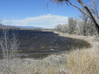
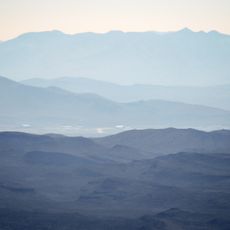
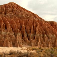
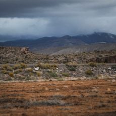
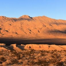
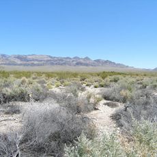
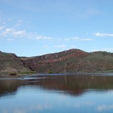
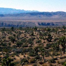
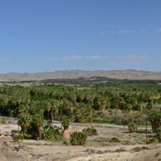
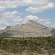
Pahranagat National Wildlife Refuge is a federally protected area in southern Nevada made up of spring-fed ponds, wetlands, and open desert flats. It sits in a valley between rocky ridges, giving it a sheltered feel surrounded by dry open land on all sides.

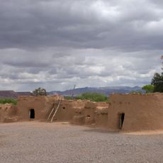
The refuge was established in 1963 to protect wetland habitats in a region where water is rare and where human activity had already changed the land significantly. Before that, ranchers and farmers had tapped the springs for irrigation, shrinking the natural ponds over time.

The name "Pahranagat" comes from a Southern Paiute word meaning "place of many waters," which still holds true today. Visitors walking around the ponds can see how the water draws birds, deer, and other animals into an otherwise dry desert setting.

Spring and fall bring the most bird activity, making those seasons a good time to visit if watching wildlife is the goal. The site has little shade and can get very hot in summer, so bringing plenty of water and sun protection is a good idea any time of year.

The springs here are home to the Pahranagat roundtail chub, a small fish found nowhere else on Earth outside of this system of springs. This makes the water itself, not just the birds, a reason why protecting the source of the springs matters so much.

The community of curious travelers

AroundUs brings together thousands of curated places, local tips, and hidden gems, enriched daily by 60,000 contributors worldwide.

Start exploring
Location
Inception
1963
GPS coordinates
37.25000,-115.07900
Latest update
March 3, 2026 13:56
Around this place
Valley of Fire State Park
United States of America

Valley of Fire State Park

102.6 km
Sedan Crater
United States of America

Sedan Crater

86.1 km
High Desert State Prison
United States of America

High Desert State Prison

93.5 km
Double Negative
United States of America

Double Negative

96.2 km
Tikaboo Peak
United States of America

Tikaboo Peak

26.9 km
Cathedral Gorge State Park
United States of America

Cathedral Gorge State Park

86.4 km
Basin and Range National Monument
United States of America

Basin and Range National Monument

85.3 km
Tule Springs Fossil Beds National Monument
United States of America

Tule Springs Fossil Beds National Monument

97.4 km
Lost City Museum
United States of America

Lost City Museum

98.2 km
Desert National Wildlife Range
United States of America

Desert National Wildlife Range

62.3 km
Warm Springs Natural Area
United States of America

Warm Springs Natural Area

68.4 km
Fallon Range Training Complex
United States of America

Fallon Range Training Complex

103.7 km
Echo Canyon State Park
United States of America

Echo Canyon State Park

103 km
Beaver Dam Wash National Conservation Area
United States of America

Beaver Dam Wash National Conservation Area

103.2 km
Kershaw–Ryan State Park
United States of America

Kershaw–Ryan State Park

62.1 km
Tule Springs Ranch
United States of America

Tule Springs Ranch

104.9 km
Moapa Valley National Wildlife Refuge
United States of America

Moapa Valley National Wildlife Refuge

68 km
Lincoln County Courthouse
United States of America

Lincoln County Courthouse

93.9 km
Bristol Wells Town Site
United States of America

Bristol Wells Town Site

101.1 km
United States of America

Las Vegas Indian Colony

102.8 km
Clover Mountains Wilderness
United States of America

Clover Mountains Wilderness

68.8 km
Weepah Spring Wilderness
United States of America

Weepah Spring Wilderness

83.7 km
Elgin Schoolhouse State Historic Site
United States of America

Elgin Schoolhouse State Historic Site

49.4 km
Thomas Leavitt House
United States of America

Thomas Leavitt House

100 km
Parley Hunt House
United States of America

Parley Hunt House

100.6 km
1938 Lincoln County Courthouse
United States of America

1938 Lincoln County Courthouse

94.4 km
Gem Theatre
United States of America

Gem Theatre

93.8 km
Davidson Peak
United States of America

Davidson Peak

77.7 km
Show the full map
Reviews
Share your experience

No review yet

Discussions
Start a discussion...

No discussion yet

« Pahranagat National Wildlife Refuge - National wildlife refuge in Lincoln County, Nevada » is provided by Around Us (aroundus.com). Images and texts are derived from Wikimedia project under a Creative Commons license. You are allowed to copy, distribute, and modify copies of this page, under the conditions set by the license, as long as this note is clearly visible.

Discover hidden gems everywhere you go!

From secret cafés to breathtaking viewpoints, skip the crowded tourist spots and find places that match your style. Our app makes it easy with voice search, smart filtering, route optimization, and insider tips from travelers worldwide. Download now for the complete mobile experience.

Around Us App Screenshot

A unique approach to discovering new places

Le Figaro

All the places worth exploring

France Info

A tailor-made excursion in just a few clicks

20 Minutes

Around Us
Travel Guide & Maps
Download

Send to your phone

QR Code
1

Open the camera app on your mobile.

2

Point at the QR code with your camera. A notification will appear.

3

Tap the notification to open the link.