Desert National Wildlife Range

Log in to your account

AroundUs is a community-driven map of interesting places, built by curious explorers like you. It grows with every review, story, and photo you share.
Connect to save your favorite spots, contribute locations, and create personalized routes.
By continuing, you accept our Terms and Conditions and our Privacy Policy

Desert National Wildlife Range

Add to collection
Map
Suggest a change
Share

Desert National Wildlife Range, National Wildlife Refuge in Clark County, Nevada

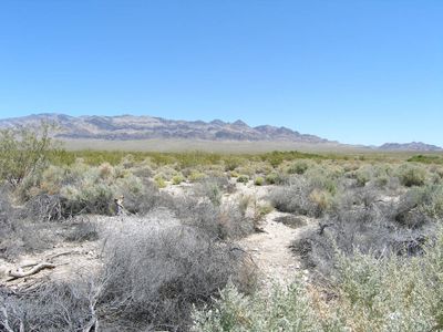
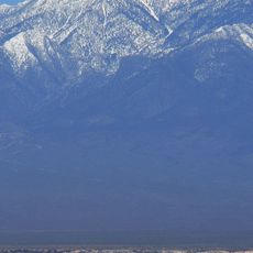
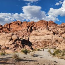
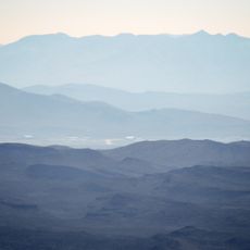
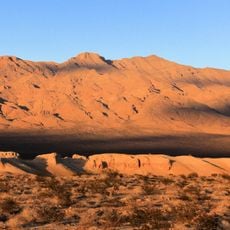
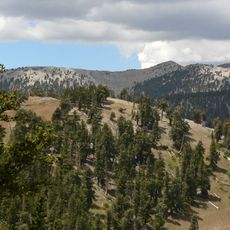
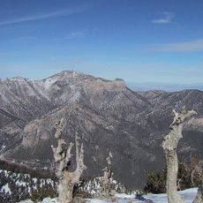
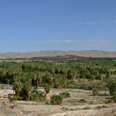
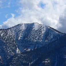
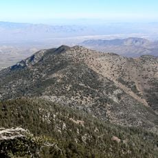
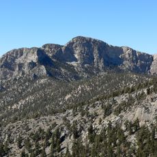
The Desert National Wildlife Range spans a large area in the Mojave Desert region and features mountain ridges, valleys, and open plains with sparse vegetation. The refuge is crisscrossed by access roads and open to visitors during designated periods.

The refuge was established in the 1930s to protect bighorn sheep and other desert wildlife from declining numbers. This action made it one of the largest wildlife protection areas in the nation.

Several Native American tribes used and moved through this land over centuries, and visitors can still encounter signs of their presence in certain areas. This deep connection to the desert landscape remains woven into the region's identity.

The site is best explored by car since distances are large and shade is scarce throughout the terrain. Bring plenty of water and plan your visit for early morning hours when temperatures are cooler.

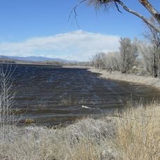
The refuge supports hundreds of different animal and plant species living together in this desert landscape. This variety of life makes it an important habitat despite the harsh conditions.

Location: Clark County

Location: Nye County

Location: Lincoln County

Inception: 1936

Elevation above the sea: 1,354 m

Operator: United States Fish and Wildlife Service

Website: https://fws.gov/refuge/desert

GPS coordinates: 36.76670,-115.43300

Latest update: December 6, 2025 17:41

Alternative entertainment in Nevada

Nevada offers far more than the casinos of Las Vegas and Reno. The Clown Motel in Tonopah houses an unusual collection, while the Neon Boneyard in Las Vegas preserves historic electric signs. The Pinball Hall of Fame displays machines spanning several decades, and the International Car Forest near Goldfield presents painted vehicles as outdoor art. History seekers can explore the ghost town of Rhyolite near Beatty with its abandoned mining era buildings and the Pioneer Saloon in Goodsprings, a working tavern since 1913.

Around this place
Show the full map
Las Vegas Motor Speedway
United States of America

Las Vegas Motor Speedway

66.8 km
Charleston Peak
United States of America

Charleston Peak

59.9 km
Sedan Crater
United States of America

Sedan Crater

71.1 km
Shadow Creek Golf Course
United States of America

Shadow Creek Golf Course

63.8 km
High Desert State Prison
United States of America

High Desert State Prison

31.3 km
Red Rock Canyon National Conservation Area
United States of America

Red Rock Canyon National Conservation Area

63.7 km
Aliante Casino and Hotel
United States of America

Aliante Casino and Hotel

57.5 km
Texas Station
United States of America

Texas Station

66.9 km
Santa Fe Station
United States of America

Santa Fe Station

59.9 km
Tikaboo Peak
United States of America

Tikaboo Peak

64.6 km
Fiesta Rancho
United States of America

Fiesta Rancho

66.2 km
Tule Springs Fossil Beds National Monument
United States of America

Tule Springs Fossil Beds National Monument

40.9 km
TPC at Summerlin
United States of America

TPC at Summerlin

65.6 km
Las Vegas Motor Speedway
United States of America

Las Vegas Motor Speedway

66.9 km
Warm Springs Natural Area
United States of America

Warm Springs Natural Area

64.5 km
Mount Charleston Wilderness
United States of America

Mount Charleston Wilderness

60.2 km
Mummy Mountain
United States of America

Mummy Mountain

55.5 km
Pahranagat National Wildlife Refuge
United States of America

Pahranagat National Wildlife Refuge

62.3 km
Kyle Ranch
United States of America

Kyle Ranch

67.7 km
Tule Springs Ranch
United States of America

Tule Springs Ranch

51.9 km
Moapa Valley National Wildlife Refuge
United States of America

Moapa Valley National Wildlife Refuge

64.1 km
Craig Ranch Regional Park
United States of America

Craig Ranch Regional Park

63.5 km
Griffith Peak
United States of America

Griffith Peak

62.5 km
Las Vegas Indian Colony
United States of America

Las Vegas Indian Colony

47.1 km
Eureka
United States of America

Eureka

63.3 km
Harris Mountain
United States of America

Harris Mountain

60.6 km
McFarland Peak
United States of America

McFarland Peak

54.1 km
West Wind Drive-In
United States of America

West Wind Drive-In

66.3 km
Show the full map

Reviews

Visited this place? Tap the stars to rate it and share your experience / photos with the community! Try now! You can cancel it anytime.

« Desert National Wildlife Range - National Wildlife Refuge in Clark County, Nevada » is provided by Around Us (aroundus.com). Images and texts are derived from Wikimedia project under a Creative Commons license. You are allowed to copy, distribute, and modify copies of this page, under the conditions set by the license, as long as this note is clearly visible.

Discover hidden gems everywhere you go!

From secret cafés to breathtaking viewpoints, skip the crowded tourist spots and find places that match your style. Our app makes it easy with voice search, smart filtering, route optimization, and insider tips from travelers worldwide. Download now for the complete mobile experience.

Around Us App Screenshot

A unique approach to discovering new places

Le Figaro

All the places worth exploring

France Info

A tailor-made excursion in just a few clicks

20 Minutes