Enable Location

We need your location to show you interesting places around you

Discover nearby places

Find interesting locations and hidden gems around you

Precise directions

Get accurate directions and distances to places

Your location is never shared with other users. It's only used when you tap the location button.

Harris Mountain

Log in to your account

Start exploring — it's free

Trusted by 62,061 travelers worldwide

Continue with Google
Continue with Apple
or

We will send you a code to connect

By continuing, you accept our Terms and Conditions and our Privacy Policy

Check your inbox

We've sent a pincode in your inbox. Please enter the code below.

Harris Mountain

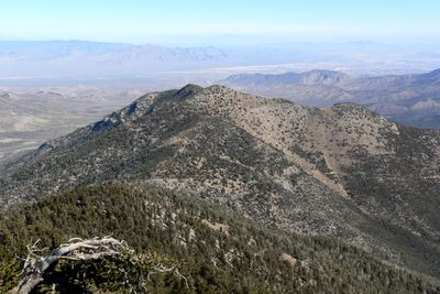
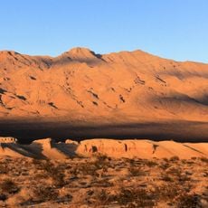
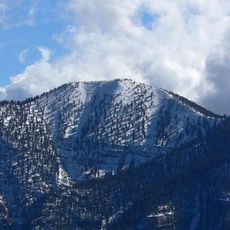
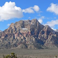
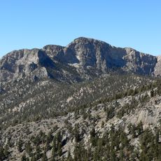
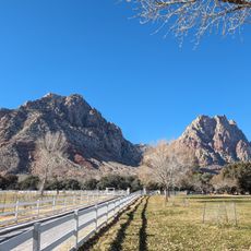
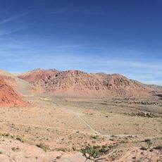
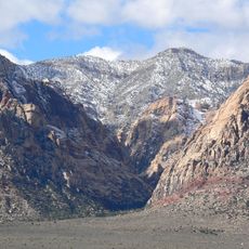
Harris Mountain, Mountain summit in Spring Mountains, Nevada, USA.

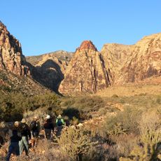
Harris Mountain is a summit in the Spring Mountains Wilderness with an elevation of about 10,000 feet and a prominence of about 900 feet. The peak can be reached via multiple routes, with Harris Springs serving as an established climbing path.

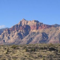
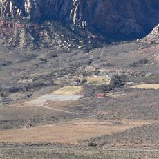
A road started in the early 1930s near this peak was abandoned in 1935 when its final purpose became unclear. Traces of this incomplete project remain visible in the landscape today.

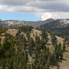
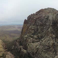
The peak draws climbers who share their experiences and preferred routes with one another. Harris Springs stands out as the most popular way to reach the summit among those who visit regularly.

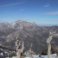
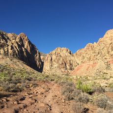
Access to the mountain requires a 4-wheel-drive vehicle to reach the trailhead from Kyle Canyon Road, then a hiking portion to proceed. Plan your visit during warmer months when snow has melted and trails are more passable.

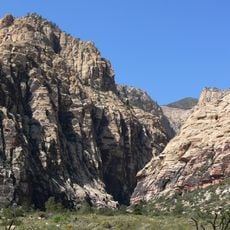
An alternative climbing route runs through Rainbow Canyon, offering a different experience than the main paths and demanding more vertical elevation gain. Many visitors miss this option when choosing their approach to the summit.

The community of curious travelers

AroundUs brings together thousands of curated places, local tips, and hidden gems, enriched daily by 60,000 contributors worldwide.

Start exploring
Location
GPS coordinates
36.24135,-115.61140
Latest update
December 14, 2025 18:41
Around this place
Red Rock Canyon National Conservation Area
United States of America

Red Rock Canyon National Conservation Area

20.3 km
Charleston Peak
United States of America

Charleston Peak

8.3 km
Red Rock Canyon National Conservation Area
United States of America

Red Rock Canyon National Conservation Area

16.4 km
Bonnie Springs Ranch
United States of America

Bonnie Springs Ranch

24.7 km
Downtown Summerlin
United States of America

Downtown Summerlin

26.9 km
Spring Mountain Ranch State Park
United States of America

Spring Mountain Ranch State Park

23.7 km
Tule Springs Fossil Beds National Monument
United States of America

Tule Springs Fossil Beds National Monument

29.1 km
TPC at Summerlin
United States of America

TPC at Summerlin

29.1 km
Spring Mountain Motorsports Ranch
United States of America

Spring Mountain Motorsports Ranch

28.1 km
One Queensridge Place
United States of America

One Queensridge Place

29.7 km
Mount Charleston Wilderness
United States of America

Mount Charleston Wilderness

10 km
Mummy Mountain
United States of America

Mummy Mountain

7.3 km
United States of America

Carpenter Canyon

17.5 km
Bridge Mountain
United States of America

Bridge Mountain

16 km
Griffith Peak
United States of America

Griffith Peak

3.3 km
Mount Wilson
United States of America

Mount Wilson

20 km
Sandstone Ranch
United States of America

Sandstone Ranch

23.7 km
United States of America

Las Vegas Indian Colony

27.1 km
McFarland Peak
United States of America

McFarland Peak

15.1 km
Main Ranch House
United States of America

Main Ranch House

23.6 km
Faith Community Lutheran Church (Las Vegas)
United States of America

Faith Community Lutheran Church (Las Vegas)

28.7 km
Calico Basin
United States of America

Calico Basin

20.2 km
Juniper Canyon
United States of America

Juniper Canyon

18.1 km
Oak Creek Canyon
United States of America

Oak Creek Canyon

19 km
Pine Creek Canyon
United States of America

Pine Creek Canyon

17.4 km
Icebox Canyon
United States of America

Icebox Canyon

15.1 km
Black Velvet Canyon
United States of America

Black Velvet Canyon

27.2 km
First Creek Canyon
United States of America

First Creek Canyon

23.1 km
Show the full map
« Harris Mountain - Mountain summit in Spring Mountains, Nevada, USA » is provided by Around Us (aroundus.com). Images and texts are derived from Wikimedia project under a Creative Commons license. You are allowed to copy, distribute, and modify copies of this page, under the conditions set by the license, as long as this note is clearly visible.

Discover hidden gems everywhere you go!

From secret cafés to breathtaking viewpoints, skip the crowded tourist spots and find places that match your style. Our app makes it easy with voice search, smart filtering, route optimization, and insider tips from travelers worldwide. Download now for the complete mobile experience.

Around Us App Screenshot

A unique approach to discovering new places

Le Figaro

All the places worth exploring

France Info

A tailor-made excursion in just a few clicks

20 Minutes

Around Us
Travel Guide & Maps
Download

Send to your phone

QR Code
1

Open the camera app on your mobile.

2

Point at the QR code with your camera. A notification will appear.

3

Tap the notification to open the link.