Enable Location

We need your location to show you interesting places around you

Discover nearby places

Find interesting locations and hidden gems around you

Precise directions

Get accurate directions and distances to places

Your location is never shared with other users. It's only used when you tap the location button.

McFarland Peak

Log in to your account

Join the adventure

Create your free account and start exploring (like 60k+ others)

We will send you a code to connect

or
Continue with Google
Continue with Apple
By continuing, you accept our Terms and Conditions and our Privacy Policy

Check your inbox

We've sent a pincode in your inbox. Please enter the code below.

McFarland Peak

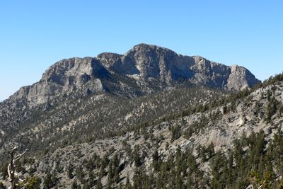
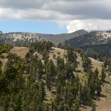
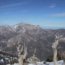
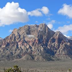
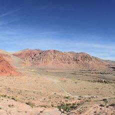
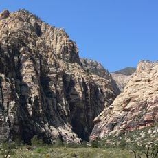
McFarland Peak, Limestone summit in Spring Mountains, Nevada.

Description

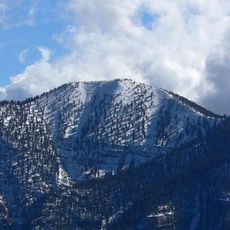
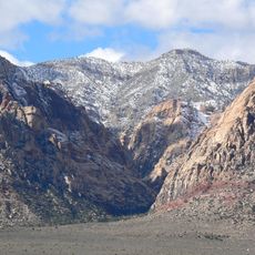
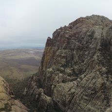
McFarland Peak is a limestone summit in the northern Spring Mountains with steep cliffs and rocky terrain throughout. The elevation provides views across the surrounding mountain landscape and wilderness area.

History

The summit was named after John McFarland, a settler during territorial expansion in southern Nevada. The name reflects early settlement in the region during the 1800s.

Culture

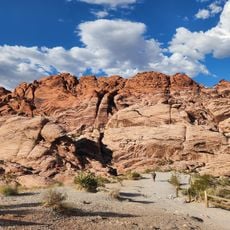
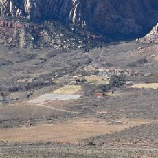
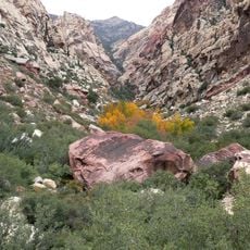
The peak stands within Mount Charleston Wilderness, part of Toiyabe National Forest, where native flora and fauna maintain ecological balance in the mountain ecosystem.

Practical

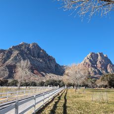
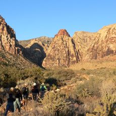
The Bonanza Trail provides access to the summit through a challenging route with varying difficulty. Bring plenty of water and be prepared for steep sections and exposed terrain near the top.

Did you know?

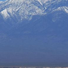
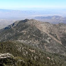
From the summit on clear days, the Las Vegas valley becomes visible despite being over 30 kilometers away. This view demonstrates the dramatic elevation change across the landscape.

Location
GPS coordinates
36.34135,-115.72558
Latest update
December 14, 2025 20:04

AroundUs brings together thousands of curated places, local tips, and hidden gems, enriched daily by 60,000 contributors worldwide. Discover all places nearby (Nevada).

Around this place
Chicken Ranch
United States of America

Chicken Ranch

36.3 km
Red Rock Canyon National Conservation Area
United States of America

Red Rock Canyon National Conservation Area

35.3 km
Charleston Peak
United States of America

Charleston Peak

8.2 km
High Desert State Prison
United States of America

High Desert State Prison

23 km
Red Rock Canyon National Conservation Area
United States of America

Red Rock Canyon National Conservation Area

30.5 km
Bonnie Springs Ranch
United States of America

Bonnie Springs Ranch

39.8 km
Downtown Summerlin
United States of America

Downtown Summerlin

41 km
Spring Mountain Ranch State Park
United States of America

Spring Mountain Ranch State Park

38.8 km
Tule Springs Fossil Beds National Monument
United States of America

Tule Springs Fossil Beds National Monument

33.7 km
Spring Mountain Motorsports Ranch
United States of America

Spring Mountain Motorsports Ranch

25.2 km
Mount Charleston Wilderness
United States of America

Mount Charleston Wilderness

7.4 km
Mummy Mountain
United States of America

Mummy Mountain

8.3 km
United States of America

Carpenter Canyon

18.8 km
Tule Springs Ranch
United States of America

Tule Springs Ranch

41.1 km
Bridge Mountain
United States of America

Bridge Mountain

31.1 km
Griffith Peak
United States of America

Griffith Peak

14.1 km
Mount Wilson
United States of America

Mount Wilson

35.1 km
Sandstone Ranch
United States of America

Sandstone Ranch

38.8 km
United States of America

Las Vegas Indian Colony

34.5 km
Harris Mountain
United States of America

Harris Mountain

15.1 km
Main Ranch House
United States of America

Main Ranch House

38.7 km
Gold Town Casino
United States of America

Gold Town Casino

27.4 km
Calico Basin
United States of America

Calico Basin

35 km
Oak Creek Canyon
United States of America

Oak Creek Canyon

34.1 km
Juniper Canyon
United States of America

Juniper Canyon

33.2 km
Pine Creek Canyon
United States of America

Pine Creek Canyon

32.5 km
Icebox Canyon
United States of America

Icebox Canyon

30.2 km
First Creek Canyon
United States of America

First Creek Canyon

38.2 km
Show the full map
« McFarland Peak - Limestone summit in Spring Mountains, Nevada » is provided by Around Us (aroundus.com). Images and texts are derived from Wikimedia project under a Creative Commons license. You are allowed to copy, distribute, and modify copies of this page, under the conditions set by the license, as long as this note is clearly visible.

Discover hidden gems everywhere you go!

From secret cafés to breathtaking viewpoints, skip the crowded tourist spots and find places that match your style. Our app makes it easy with voice search, smart filtering, route optimization, and insider tips from travelers worldwide. Download now for the complete mobile experience.

Around Us App Screenshot

A unique approach to discovering new places

Le Figaro

All the places worth exploring

France Info

A tailor-made excursion in just a few clicks

20 Minutes

Around Us
Travel Guide & Maps
Download

Send to your phone

QR Code
1

Open the camera app on your mobile.

2

Point at the QR code with your camera. A notification will appear.

3

Tap the notification to open the link.