Charleston Peak

Log in to your account

AroundUs is a community-driven map of interesting places, built by curious explorers like you. It grows with every review, story, and photo you share.
Connect to save your favorite spots, contribute locations, and create personalized routes.
Continue with Google
Continue with Apple
Continue with X
Continue with Facebook
Continue with email
By continuing, you accept our Terms and Conditions and our Privacy Policy
Create an account
Add to collection
Map
Suggest a change
Share

Charleston Peak, Mountain summit in Clark County, United States

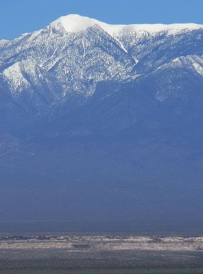
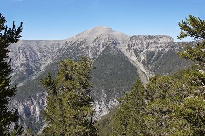
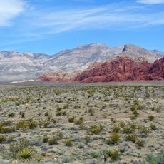
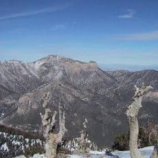
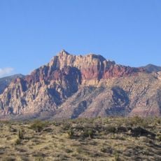
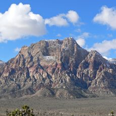
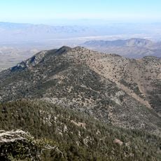
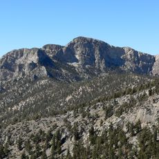
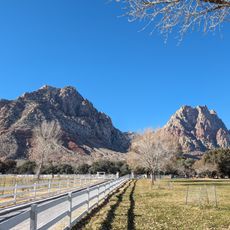
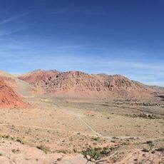
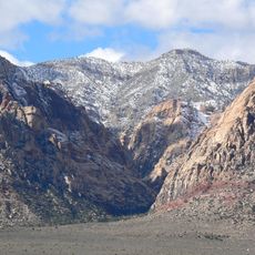
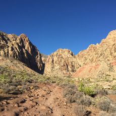
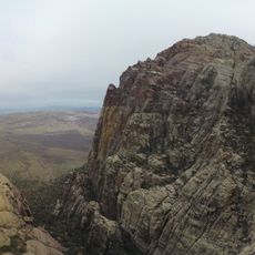
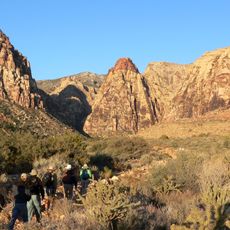
Charleston Peak is a mountain summit in the Spring Mountains of Clark County, Nevada, rising to 3,631 meters (11,916 feet) above sea level. The climb typically follows the South Loop Trail, a hiking path covering 28 kilometers (17.5 miles) with an elevation gain of nearly 1,490 meters (4,890 feet).

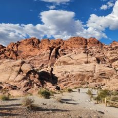
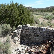
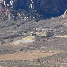
Recognition of this mountain as the highest point in the region came in the early 20th century when surveyors systematically mapped Nevada's topography. An aircraft crash occurred near the summit in 1955, and parts of the wreckage remain on site to this day.

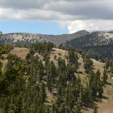
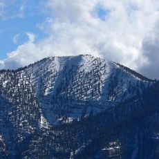
Local tribes use the word Nuvagantu from the Southern Paiute language for this summit, referring to the snow that covers it for much of the year. Hikers encounter a zone of bristlecone pines here, trees that have survived for centuries at this altitude and form part of the high alpine landscape.

Hikers should watch for rapid weather changes, as afternoon thunderstorms are common in summer and temperatures can vary sharply. The trail demands good fitness and proper gear for high-altitude hiking, especially during morning and evening hours.

Wreckage from a 1955 aircraft crash lies scattered near the summit area and remains visible to visitors who reach the upper part of the route. This site was later honored with a memorial dedicated to intelligence personnel during the Cold War.

Location: Clark County

Address: Charleston Peak, Mt Charleston, NV 89124, USA

GPS coordinates: 36.27172,-115.69560

Latest update: December 13, 2025 19:31

Photos
Around this place
Chicken Ranch
United States of America

Chicken Ranch

32.2 km
Red Rock Canyon National Conservation Area
United States of America

Red Rock Canyon National Conservation Area

28.5 km
Red Rock Canyon National Conservation Area
United States of America

Red Rock Canyon National Conservation Area

24.7 km
Bonnie Springs Ranch
United States of America

Bonnie Springs Ranch

32.1 km
Spring Mountain Ranch State Park
United States of America

Spring Mountain Ranch State Park

31.2 km
Tule Springs Fossil Beds National Monument
United States of America

Tule Springs Fossil Beds National Monument

33.7 km
TPC at Summerlin
United States of America

TPC at Summerlin

37.2 km
Spring Mountain Motorsports Ranch
United States of America

Spring Mountain Motorsports Ranch

22.4 km
One Queensridge Place
United States of America

One Queensridge Place

37.9 km
Mount Charleston Wilderness
United States of America

Mount Charleston Wilderness

1.7 km
Mummy Mountain
United States of America

Mummy Mountain

5.2 km
United States of America

Carpenter Canyon

13.3 km
Potosi Mining District
United States of America

Potosi Mining District

36.3 km
Bridge Mountain
United States of America

Bridge Mountain

23.9 km
Griffith Peak
United States of America

Griffith Peak

6.2 km
Mount Wilson
United States of America

Mount Wilson

27.5 km
Sandstone Ranch
United States of America

Sandstone Ranch

31.1 km
United States of America

Las Vegas Indian Colony

33 km
Harris Mountain
United States of America

Harris Mountain

8.3 km
McFarland Peak
United States of America

McFarland Peak

8.2 km
Main Ranch House
United States of America

Main Ranch House

31.1 km
Faith Community Lutheran Church (Las Vegas)
United States of America

Faith Community Lutheran Church (Las Vegas)

36.9 km
Calico Basin
United States of America

Calico Basin

28.5 km
Oak Creek Canyon
United States of America

Oak Creek Canyon

26.5 km
Black Velvet Canyon
United States of America

Black Velvet Canyon

34.4 km
Juniper Canyon
United States of America

Juniper Canyon

25.7 km
Pine Creek Canyon
United States of America

Pine Creek Canyon

25.1 km
Icebox Canyon
United States of America

Icebox Canyon

23 km
Show the full map
Reviews

Visited this place? Tap the stars to rate it and share your experience / photos with the community! Try now! You can cancel it anytime.

« Charleston Peak - Mountain summit in Clark County, United States » is provided by Around Us (aroundus.com). Images and texts are derived from Wikimedia project under a Creative Commons license. You are allowed to copy, distribute, and modify copies of this page, under the conditions set by the license, as long as this note is clearly visible.

Discover hidden gems everywhere you go!

From secret cafés to breathtaking viewpoints, skip the crowded tourist spots and find places that match your style. Our app makes it easy with voice search, smart filtering, route optimization, and insider tips from travelers worldwide. Download now for the complete mobile experience.

Around Us App Screenshot

A unique approach to discovering new places

Le Figaro

All the places worth exploring

France Info

A tailor-made excursion in just a few clicks

20 Minutes