Enable Location

We need your location to show you interesting places around you

Discover nearby places

Find interesting locations and hidden gems around you

Precise directions

Get accurate directions and distances to places

Your location is never shared with other users. It's only used when you tap the location button.

Nye County

Log in to your account

Start exploring — it's free

Trusted by 61,771 travelers worldwide

Continue with Google
Continue with Apple
or

We will send you a code to connect

By continuing, you accept our Terms and Conditions and our Privacy Policy

Check your inbox

We've sent a pincode in your inbox. Please enter the code below.

Nye County, County in Nevada, United States.

Description

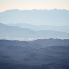
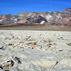
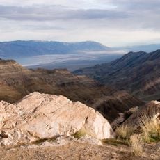
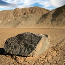
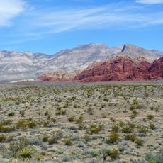
Nye County is a county in central and southern Nevada, spanning from Death Valley National Park to the Lincoln County border. The area includes desert basins, isolated mountain ranges, and broad valleys linked by a few paved highways.

History

The county formed during the Civil War and took the name of the first governor of Nevada Territory. Mining settlements in the early twentieth century shaped development and left abandoned towns scattered across the desert.

Culture

The region contains numerous ghost towns from the early 1900s mining era, including Rhyolite, which reached a population of 10,000 during its peak.

Practical

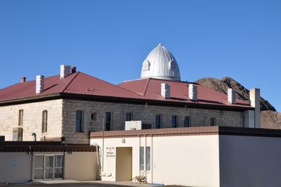
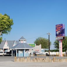
Tonopah in the north offers government offices, while Pahrump in the south is the largest town with road connections to Las Vegas. Fuel up before longer drives and plan extra time for distances between settlements.

Did you know?

A former nuclear weapons testing site sits within the county boundaries, and some sections remain closed to the public. Visitors can explore abandoned mining settlements from around nineteen hundred, where partly preserved buildings and ruins still stand.

Location
Inception
1864
Capital city
Tonopah
Shares border with
Lander County, Churchill County, Lincoln County, Eureka County, White Pine County, Clark County, Esmeralda County, Mineral County, Inyo County
GPS coordinates
38.05000,-116.45000
Latest update
December 12, 2025 23:35

AroundUs brings together thousands of curated places, local tips, and hidden gems, enriched daily by 60,000 contributors worldwide. Discover all places nearby (Nevada).

Around this place
Area 51
United States of America

Area 51

107.1 km
Sphere
United States of America

Sphere

243.3 km
Allegiant Stadium
United States of America

Allegiant Stadium

245.4 km
Death Valley
United States of America

Death Valley

181.1 km
Las Vegas Strip
United States of America

Las Vegas Strip

243.8 km
Caesars Palace
United States of America

Caesars Palace

243.2 km
MGM Grand Las Vegas
United States of America

MGM Grand Las Vegas

244.8 km
Methuselah
United States of America

Methuselah

169.1 km
Luxor Resort & Casino
United States of America

Luxor Resort & Casino

245.2 km
Flamingo Las Vegas
United States of America

Flamingo Las Vegas

243.4 km
Bellagio Hotel & Casino
United States of America

Bellagio Hotel & Casino

243.6 km
Mandalay Bay
United States of America

Mandalay Bay

245.7 km
Death Valley National Park
United States of America

Death Valley National Park

204 km
The Venetian
United States of America

The Venetian

243 km
Wynn Las Vegas
United States of America

Wynn Las Vegas

242.3 km
MGM Grand Garden Arena
United States of America

MGM Grand Garden Arena

244.6 km
Sailing stones
United States of America

Sailing stones

181.4 km
Stardust Resort and Casino
United States of America

Stardust Resort and Casino

241.9 km
Fremont Street Experience
United States of America

Fremont Street Experience

239.2 km
High Roller
United States of America

High Roller

243.4 km
Riviera Hotel and Casino
United States of America

Riviera Hotel and Casino

241.9 km
Fontainebleau Las Vegas
United States of America

Fontainebleau Las Vegas

241.8 km
The Palazzo
United States of America

The Palazzo

242.7 km
Golden Nugget Las Vegas Hotel & Casino
United States of America

Golden Nugget Las Vegas Hotel & Casino

239.1 km
Aria Resort and Casino
United States of America

Aria Resort and Casino

244 km
Chicken Ranch
United States of America

Chicken Ranch

224.3 km
Westgate Las Vegas Resort & Casino
United States of America

Westgate Las Vegas Resort & Casino

242.2 km
Red Rock Canyon National Conservation Area
United States of America

Red Rock Canyon National Conservation Area

231.7 km
Show the full map
« Nye County - County in Nevada, United States » is provided by Around Us (aroundus.com). Images and texts are derived from Wikimedia project under a Creative Commons license. You are allowed to copy, distribute, and modify copies of this page, under the conditions set by the license, as long as this note is clearly visible.

Discover hidden gems everywhere you go!

From secret cafés to breathtaking viewpoints, skip the crowded tourist spots and find places that match your style. Our app makes it easy with voice search, smart filtering, route optimization, and insider tips from travelers worldwide. Download now for the complete mobile experience.

Around Us App Screenshot

A unique approach to discovering new places

Le Figaro

All the places worth exploring

France Info

A tailor-made excursion in just a few clicks

20 Minutes

Around Us
Travel Guide & Maps
Download

Send to your phone

QR Code
1

Open the camera app on your mobile.

2

Point at the QR code with your camera. A notification will appear.

3

Tap the notification to open the link.