Enable Location

We need your location to show you interesting places around you

Discover nearby places

Find interesting locations and hidden gems around you

Precise directions

Get accurate directions and distances to places

Your location is never shared with other users. It's only used when you tap the location button.

Bright Angel Point Trail

Log in to your account

Start exploring — it's free

Trusted by 65,663 travelers worldwide

Continue with Google
Continue with Apple
or

We will send you a code to connect

By continuing, you accept our Terms and Conditions and our Privacy Policy

Check your inbox

We've sent a pincode in your inbox. Please enter the code below.

Bright Angel Point Trail
Discussion Reviews 1 Photos
4.5k Popularity

Bright Angel Point Trail, Hiking trail at Grand Canyon North Rim, Arizona.

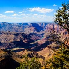
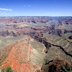
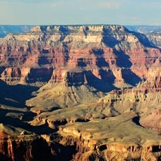
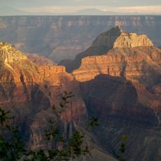
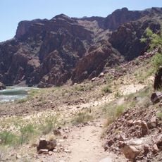
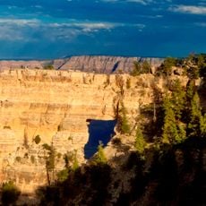
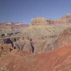
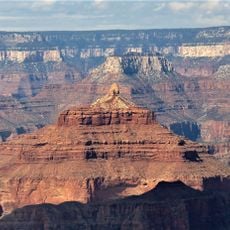
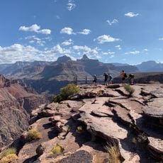
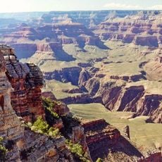
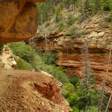
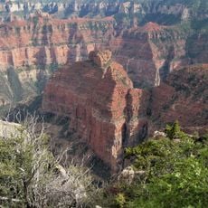
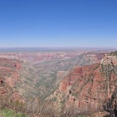
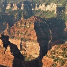
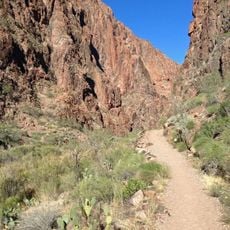
Bright Angel Point Trail is a short hiking trail on the North Rim of Grand Canyon in Arizona, running along a narrow limestone ridge to a lookout point at the tip. The path cuts through layered rock formations and ends at a spot where the canyon opens up on both sides, offering a wide view of the gorge below.

The trail was developed in the early years after Grand Canyon became a national park in 1919, as a way to give visitors on the North Rim a defined path to a viewpoint. Over the following decades, guardrails and paved sections were added to make the route safer and more accessible.

Several Native American tribes used this part of the canyon's North Rim over many generations, moving through and living within this landscape as part of their daily lives. Walking the trail today, visitors pass through the same rocky terrain those communities once knew well.

The trail is short and well-marked, with paved sections and guardrails at exposed spots, so most visitors can walk it without difficulty. Sturdy shoes are still a good idea, as some parts of the path are uneven and rocky underfoot.

The North Rim sits roughly 1,000 feet (300 meters) higher than the South Rim, which means the view from the end of this trail looks down into the canyon at a steeper angle than from most other viewpoints. That extra height changes how the rock layers appear, making the depth of the gorge feel more immediate.

The community of curious travelers

AroundUs brings together thousands of curated places, local tips, and hidden gems, enriched daily by 60,000 contributors worldwide.

Start exploring
Location
GPS coordinates
36.19700,-112.05200
Latest update
March 3, 2026 10:05
Reviews
Share your experience

No review yet

Discussions
Start a discussion...

No discussion yet

« Bright Angel Point Trail - Hiking trail at Grand Canyon North Rim, Arizona » is provided by Around Us (aroundus.com). Images and texts are derived from Wikimedia project under a Creative Commons license. You are allowed to copy, distribute, and modify copies of this page, under the conditions set by the license, as long as this note is clearly visible.

Discover hidden gems everywhere you go!

From secret cafés to breathtaking viewpoints, skip the crowded tourist spots and find places that match your style. Our app makes it easy with voice search, smart filtering, route optimization, and insider tips from travelers worldwide. Download now for the complete mobile experience.

Around Us App Screenshot

A unique approach to discovering new places

Le Figaro

All the places worth exploring

France Info

A tailor-made excursion in just a few clicks

20 Minutes

Around Us
Travel Guide & Maps
Download

Send to your phone

QR Code
1

Open the camera app on your mobile.

2

Point at the QR code with your camera. A notification will appear.

3

Tap the notification to open the link.