Enable Location

We need your location to show you interesting places around you

Discover nearby places

Find interesting locations and hidden gems around you

Precise directions

Get accurate directions and distances to places

Your location is never shared with other users. It's only used when you tap the location button.

Navajo Lake

Log in to your account

Start exploring — it's free

Trusted by 62,224 travelers worldwide

Continue with Google
Continue with Apple
or

We will send you a code to connect

By continuing, you accept our Terms and Conditions and our Privacy Policy

Check your inbox

We've sent a pincode in your inbox. Please enter the code below.

Navajo Lake

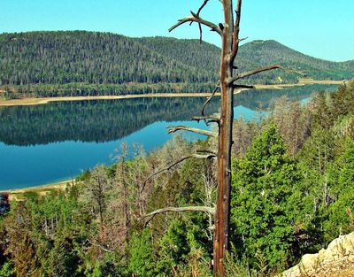
Navajo Lake, endorheic reservoir in Kane County, Utah, United States

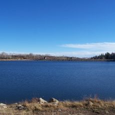
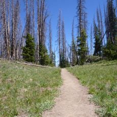
Navajo Lake is a small body of water in Kane County, Utah, surrounded by dense forests of pine, spruce, and fir trees within the Dixie National Forest. The water is clear and fed entirely through underground channels, as it has no surface outlet to carry water away.

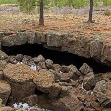
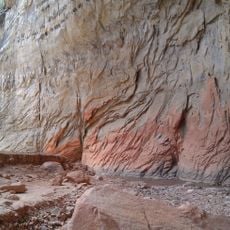
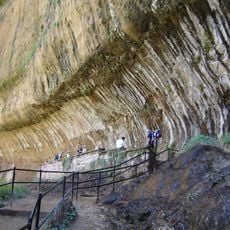
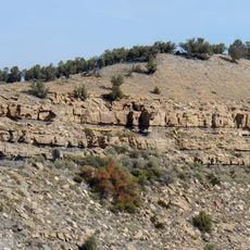
Navajo Lake formed when a lava flow blocked a valley and cut off the surface drainage of Duck Creek, causing water to accumulate behind the natural lava dam. Evidence of this ancient volcanic activity remains visible today in the rock formations visible along the shoreline.

Navajo Lake carries a name rooted in local history, originally called 'Pa-Cu-Ay' or 'Cloud Lake' by the Paiute people whose language reflects deep ties to this mountain region. The current name reflects past interactions between settlers and Navajo tribes that shaped the area's identity.

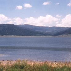
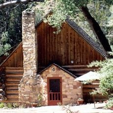
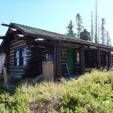
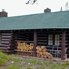
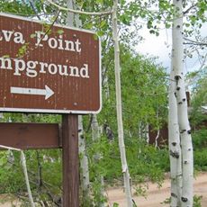
The lake sits roughly 25 miles east of Cedar City along Highway U-14 and is easily accessible by car. A nearby campground provides over 120 campsites with picnic tables and fire rings for overnight stays at this mountain elevation.

Water from the lake never leaves the area by flowing downhill but instead seeps entirely into underground aquifers that feed distant springs elsewhere. This hidden underground flow makes the lake a hydrological wonder that most visitors overlook while gazing at the visible surface.

The community of curious travelers

AroundUs brings together thousands of curated places, local tips, and hidden gems, enriched daily by 60,000 contributors worldwide.

Start exploring
Location
GPS coordinates
37.52500,-112.76800
Latest update
February 7, 2026 11:40
Around this place
The Narrows
United States of America

The Narrows

29 km
Panguitch Lake
United States of America

Panguitch Lake

23.9 km
Eccles Coliseum
United States of America

Eccles Coliseum

32 km
Mammoth Cave
United States of America

Mammoth Cave

16.6 km
Kolob Reservoir
United States of America

Kolob Reservoir

26.8 km
Brian Head
United States of America

Brian Head

18.3 km
Ashdown Gorge Wilderness
United States of America

Ashdown Gorge Wilderness

17 km
Weeping Rock
United States of America

Weeping Rock

31.8 km
Maynard and Edith Hamlin Dixon House and Studio
United States of America

Maynard and Edith Hamlin Dixon House and Studio

31.7 km
Naturita Formation
United States of America

Naturita Formation

14.3 km
Cedar Breaks National Monument Visitor Center
United States of America

Cedar Breaks National Monument Visitor Center

11.6 km
Cedar Breaks National Monument Caretaker's Cabin
United States of America

Cedar Breaks National Monument Caretaker's Cabin

11.2 km
Frontier Homestead State Park Museum
United States of America

Frontier Homestead State Park Museum

31.7 km
Cable Creek Bridge
United States of America

Cable Creek Bridge

32.2 km
East Rim Trail
United States of America

East Rim Trail

31 km
Riverside Walk
United States of America

Riverside Walk

30.4 km
Cable Mountain Draw Works
United States of America

Cable Mountain Draw Works

32.1 km
Southern Utah Museum of Art
United States of America

Southern Utah Museum of Art

31.3 km
Adams Memorial Shakespearean Theatre
United States of America

Adams Memorial Shakespearean Theatre

31.4 km
Alpine Pond Trail
United States of America

Alpine Pond Trail

13.3 km
Lava Point Campground
United States of America

Lava Point Campground

28.2 km
Cedar Canyon
United States of America

Cedar Canyon

29.8 km
Walter's Wiggles
United States of America

Walter's Wiggles

32.1 km
Arch Canyon
United States of America

Arch Canyon

13.2 km
Echo Canyon
United States of America

Echo Canyon

32.1 km
Temple of Sinawava
United States of America

Temple of Sinawava

31.1 km
Observation Point
United States of America

Observation Point

31.4 km
Square Arch
United States of America

Square Arch

12.1 km
Show the full map
« Navajo Lake - endorheic reservoir in Kane County, Utah, United States » is provided by Around Us (aroundus.com). Images and texts are derived from Wikimedia project under a Creative Commons license. You are allowed to copy, distribute, and modify copies of this page, under the conditions set by the license, as long as this note is clearly visible.

Discover hidden gems everywhere you go!

From secret cafés to breathtaking viewpoints, skip the crowded tourist spots and find places that match your style. Our app makes it easy with voice search, smart filtering, route optimization, and insider tips from travelers worldwide. Download now for the complete mobile experience.

Around Us App Screenshot

A unique approach to discovering new places

Le Figaro

All the places worth exploring

France Info

A tailor-made excursion in just a few clicks

20 Minutes

Around Us
Travel Guide & Maps
Download

Send to your phone

QR Code
1

Open the camera app on your mobile.

2

Point at the QR code with your camera. A notification will appear.

3

Tap the notification to open the link.