Enable Location

We need your location to show you interesting places around you

Discover nearby places

Find interesting locations and hidden gems around you

Precise directions

Get accurate directions and distances to places

Your location is never shared with other users. It's only used when you tap the location button.

Ashdown Gorge Wilderness

Log in to your account

Start exploring — it's free

Trusted by 66,670 travelers worldwide

Continue with Google
Continue with Apple
or

We will send you a code to connect

By continuing, you accept our Terms and Conditions and our Privacy Policy

Check your inbox

We've sent a pincode in your inbox. Please enter the code below.

Ashdown Gorge Wilderness
Discussion Reviews 1 Photos
3.1k Popularity

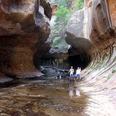
Ashdown Gorge Wilderness, Protected wilderness area in Iron County, United States.

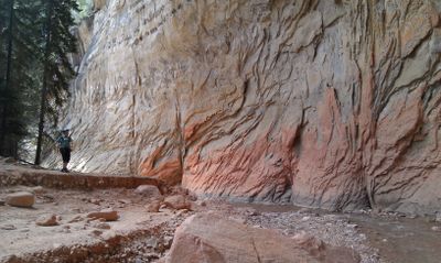
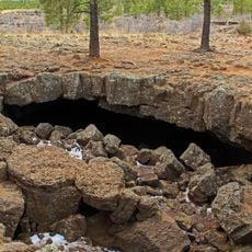
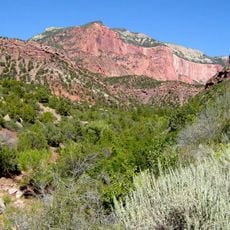
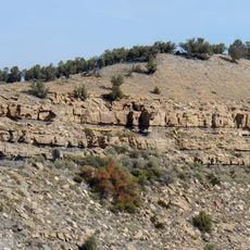
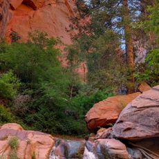
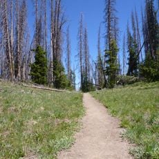
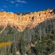
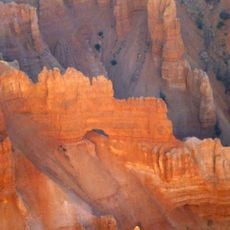
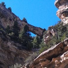
Ashdown Gorge Wilderness is a federally protected wilderness area on the western edge of the Markagunt Plateau in Iron County, Utah, known for its deep, steep-sided canyons carved into the rock. The land covers a range of terrain types, from forested plateau areas at the top to exposed canyon walls and narrow valley floors below.

The area was officially designated as a protected wilderness in 1984 under the National Wilderness Preservation System. Before that, the land had been used for logging, which is reflected in the name it carries today.

The name Ashdown comes from a sawmill operator who worked in this valley in the late 1800s, and that history quietly shapes how locals think about the land. Hikers today walk through the same canyon floors that were once used for timber work, though the forest has long since grown back.

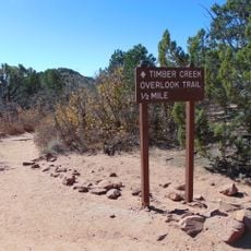
There are no facilities of any kind inside the wilderness, so visitors should carry enough water, food, and gear for the full day or overnight stay. Trails can be steep and unmarked in parts, so a map and some route-finding experience are helpful before heading in.

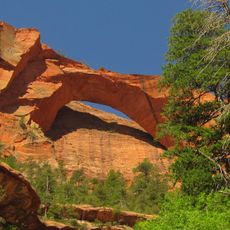
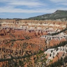
Bristlecone pines grow on the upper plateau, and some of these trees are around 1,000 years old, though they look small and gnarled compared to much younger trees nearby. The wilderness shares a boundary with Cedar Breaks National Monument, so from certain spots along the rim you can look directly into the red and orange rock formations next door.

The community of curious travelers

AroundUs brings together thousands of curated places, local tips, and hidden gems, enriched daily by 60,000 contributors worldwide.

Start exploring
Location
Elevation above the sea
2,509 m
Shares border with
Cedar Breaks National Monument
GPS coordinates
37.64390,-112.88900
Latest update
March 3, 2026 13:55
Around this place
Kolob Arch
United States of America

Kolob Arch

34.2 km
Panguitch Lake
United States of America

Panguitch Lake

23.1 km
Eccles Coliseum
United States of America

Eccles Coliseum

16.9 km
Mammoth Cave
United States of America

Mammoth Cave

27.9 km
Kolob Reservoir
United States of America

Kolob Reservoir

27.5 km
Brian Head
United States of America

Brian Head

6.6 km
Horse Ranch Mountain
United States of America

Horse Ranch Mountain

30.2 km
Zion Wilderness
United States of America

Zion Wilderness

37.4 km
Parowan Meetinghouse
United States of America

Parowan Meetinghouse

22.5 km
Naturita Formation
United States of America

Naturita Formation

5 km
Parowan Gap Petroglyphs

Parowan Gap Petroglyphs

30.7 km
Cedar Breaks National Monument Visitor Center
United States of America

Cedar Breaks National Monument Visitor Center

5.7 km
Fort Harmony
United States of America

Fort Harmony

35.6 km
Cedar Breaks National Monument Caretaker's Cabin
United States of America

Cedar Breaks National Monument Caretaker's Cabin

5.9 km
Jesse N. Smith House
United States of America

Jesse N. Smith House

22.5 km
Frontier Homestead State Park Museum
United States of America

Frontier Homestead State Park Museum

16.1 km
William and Julia Lyman House
United States of America

William and Julia Lyman House

22.5 km
Southern Utah Museum of Art
United States of America

Southern Utah Museum of Art

16 km
Kanarra Creek Canyon
United States of America

Kanarra Creek Canyon

26.1 km
Timber Creek Overlook Trail
United States of America

Timber Creek Overlook Trail

36.1 km
Adams Memorial Shakespearean Theatre
United States of America

Adams Memorial Shakespearean Theatre

16.2 km
Alpine Pond Trail
United States of America

Alpine Pond Trail

5.8 km
Lava Point Campground
United States of America

Lava Point Campground

31.6 km
Arch Canyon
United States of America

Arch Canyon

4.1 km
Cedar Canyon
United States of America

Cedar Canyon

14.5 km
Kolob Canyons Visitor Center
United States of America

Kolob Canyons Visitor Center

36.5 km
Square Arch
United States of America

Square Arch

5.4 km
Flanigan Arch
United States of America

Flanigan Arch

3.5 km
Show the full map
Reviews
Share your experience

No review yet

Discussions
Start a discussion...

No discussion yet

« Ashdown Gorge Wilderness - Protected wilderness area in Iron County, United States » is provided by Around Us (aroundus.com). Images and texts are derived from Wikimedia project under a Creative Commons license. You are allowed to copy, distribute, and modify copies of this page, under the conditions set by the license, as long as this note is clearly visible.

Discover hidden gems everywhere you go!

From secret cafés to breathtaking viewpoints, skip the crowded tourist spots and find places that match your style. Our app makes it easy with voice search, smart filtering, route optimization, and insider tips from travelers worldwide. Download now for the complete mobile experience.

Around Us App Screenshot

A unique approach to discovering new places

Le Figaro

All the places worth exploring

France Info

A tailor-made excursion in just a few clicks

20 Minutes

Around Us
Travel Guide & Maps
Download

Send to your phone

QR Code
1

Open the camera app on your mobile.

2

Point at the QR code with your camera. A notification will appear.

3

Tap the notification to open the link.