Chest opened
+${chestReward.xp} XP
Explorer
NOUVEAU ×${chestReward.collectible.quantity}
tapez pour fermer

See the monuments around you in AR Open chests in the app

Around Us is built for your phone — point your camera at the streets and discover the monuments and places around you in augmented reality. Around Us is built for your phone — chests unlock when you walk, explore and capture nearby places.

•

Enable Location

We need your location to show you interesting places around you

Discover nearby places

Find interesting locations and hidden gems around you

Precise directions

Get accurate directions and distances to places

Your location is never shared with other users. It's only used when you tap the location button.

Kolob Arch

Log in to your account

Start exploring — it's free

Trusted by 93,467 travelers worldwide

Continue with Google
Continue with Apple
or

We will send you a code to connect

By continuing, you accept our Terms and Conditions and our Privacy Policy

Check your inbox

We've sent a pincode in your inbox. Please enter the code below.

Kolob Arch, Natural arch in Washington County, Utah, US.

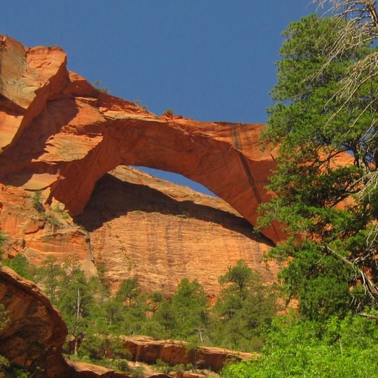
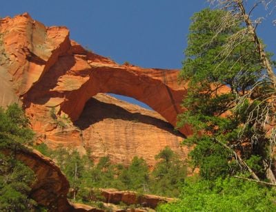
Kolob Arch is a natural arch of reddish-orange sandstone in Zion National Park, Utah. Its span opens as a wide, flattened curve, with a thick left leg rising from a rounded base and the right leg descending behind trees. The underside of the span is smooth and pale orange, and the rock above the opening forms a jagged, stepped edge.

Kolob Arch is a sandstone natural arch in Zion National Park, in Washington County, Utah. The Natural Arch and Bridge Society measured its span at 287.4 ± 2 feet (87.6 m) in 2006, making it the sixth-longest natural arch in the world by that measurement, slightly shorter than Landscape Arch in Arches National Park. The society notes that different measuring techniques or definitions can change the ranking.

The name Kolob comes from the Book of Abraham in the Mormon scripture Pearl of Great Price, where Kolob is described as the star nearest to the throne of God. White settlers who brought Mormonism to the region gave the arch and the surrounding canyon and terrace the name.

Two trails reach the arch, each about seven miles (11 km) one way, for a round trip of roughly fourteen miles (23 km). A canyoneering route through Ice Box Canyon also leads there. The arch sits high above the ground, framing a cliffside, so plan a full day and carry enough water for the distance.

The Natural Arch and Bridge Society measured the span at 287.4 ± 2 feet (87.6 m) in 2006, placing it sixth among the world's longest natural arches. Different measuring techniques or definitions could shift that ranking, and the arch is reached only by trails of about seven miles (11 km) each way.

The community of curious travelers

AroundUs brings together thousands of curated places, local tips, and hidden gems, enriched daily by 93,467 contributors worldwide.
Start exploring
GPS coordinates
37.42278,-113.15833
Latest update
October 29, 2026 02:45
Around this place
Zion National Park
United States of America

Zion National Park

9.3 mi
Kolob Canyons
United States of America

Kolob Canyons

2.8 mi
Kolob Reservoir
United States of America

Kolob Reservoir

6.1 mi
Horse Ranch Mountain
United States of America

Horse Ranch Mountain

3.8 mi
Zion Wilderness
United States of America

Zion Wilderness

8.6 mi
Blackridge Wilderness
United States of America

Blackridge Wilderness

6.8 mi
Beartrap Canyon Wilderness
United States of America

Beartrap Canyon Wilderness

3.8 mi
LaVerkin Creek Wilderness
United States of America

LaVerkin Creek Wilderness

3.5 mi
Taylor Creek Wilderness
United States of America

Taylor Creek Wilderness

2.3 mi
Red Butte Wilderness
United States of America

Red Butte Wilderness

4.5 mi
Fort Harmony
United States of America

Fort Harmony

5.7 mi
Kanarra Creek Canyon
United States of America

Kanarra Creek Canyon

8 mi
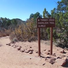
Timber Creek Overlook Trail
United States of America

Timber Creek Overlook Trail

2.5 mi
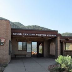
Kolob Canyons Visitor Center
United States of America

Kolob Canyons Visitor Center

4.2 mi
United States of America

Waterfall

9.7 mi
United States of America

Waterfall

2.4 mi
United States of America

2nd Falls End of Hike

8 mi
United States of America

Archangel Falls

9.7 mi
United States of America

Scenic viewpoint

2.5 mi
United States of America

Lava Point Overlook A

7.6 mi
United States of America

Scenic viewpoint

2.5 mi
United States of America

Scenic viewpoint

8.8 mi
United States of America

Lava Point Overlook B

7.6 mi
United States of America

Kolob Arch Viewpoint

0.3 mi
United States of America

Kolob Canyon Scenic drive

4.2 mi
United States of America

R1 - Bolted Rappel Anchor: 30 ft

9.7 mi
United States of America

R3 - Keyhole Falls - Bolted Rappel Anchor: 10 ft.

9.7 mi
United States of America

R2 - Bolted Rappel Anchor: 6 ft.

9.8 mi
Show the full map
Reviews
Share your experience

No review yet

Discussions
Start a discussion...

No discussion yet

« Kolob Arch - Natural arch in Washington County, Utah, US » is provided by Around Us (aroundus.com). Images and texts are derived from Wikimedia project under a Creative Commons license. You are allowed to copy, distribute, and modify copies of this page, under the conditions set by the license, as long as this note is clearly visible.

Discover hidden gems everywhere you go!

From secret cafés to breathtaking viewpoints, skip the crowded tourist spots and find places that match your style. Our app makes it easy with voice search, smart filtering, route optimization, and insider tips from travelers worldwide. Download now for the complete mobile experience.

Around Us App Screenshot
❝

A unique approach to discovering new places❞

— Le Figaro

❝

All the places worth exploring❞

— France Info

❝

A tailor-made excursion in just a few clicks❞

— 20 Minutes

Around Us
Travel Guide & Maps
Download

Send to your phone

QR Code
1

Open the camera app on your mobile.

2

Point at the QR code with your camera. A notification will appear.

3

Tap the notification to open the link.