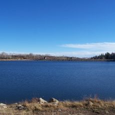
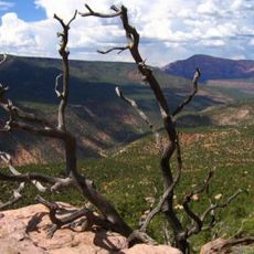
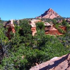
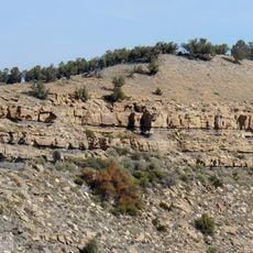
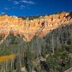
Kanarra Creek Canyon, Canyon and waterfall trail in Iron County, Utah
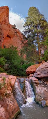
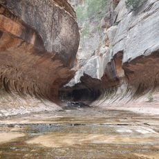
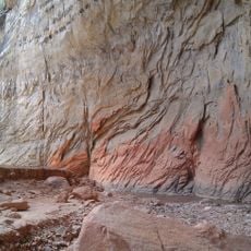
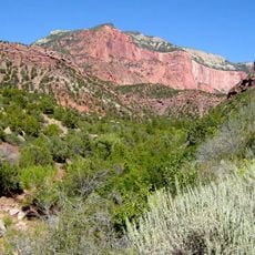
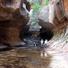
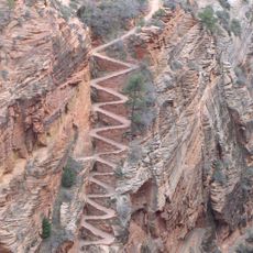
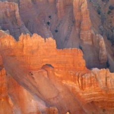
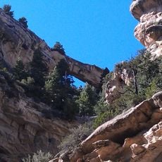
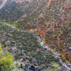
Kanarra Creek Canyon is a waterway passage carved through iron-colored sandstone, with rock walls rising on both sides and a creek flowing throughout. Multiple cascade points and water falls occur along the route as the stream descends through the canyon floor.
The sandstone layers formed over millions of years as flowing water carved channels through the bedrock. The canyon developed gradually into its current form through ongoing water-driven erosion.
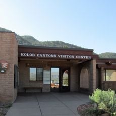
The management of Kanarra Creek Canyon implements visitor limitations to protect local water resources and maintain the natural environment for future generations.
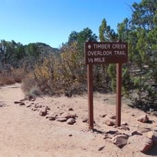
The hiking route spans about 4.5 miles and requires entry registration at the trailhead before starting. Wear proper footwear since the path involves wading through water and scrambling over rocks.
Two wooden ladders positioned at steep sections help hikers navigate vertical waterfall drops within the narrow passage. These structures allow visitors to climb through sections that would otherwise block the route.
Location: Iron County
GPS coordinates: 37.53774,-113.15261
Latest update: December 6, 2025 19:04
Utah preserves thousands of years of human history alongside some of North America's most varied geological landscapes. The region contains extensive rock art panels and Ancestral Pueblo ruins, including the 13th-century stone structures at Bears Ears National Monument and the 650-plus petroglyphs carved into Newspaper Rock over two millennia. Fremont Indian State Park displays more than 1,000 artifacts from the indigenous peoples who inhabited these lands, while fossilized dinosaur tracks near Moab record the passage of Allosaurus and Diplodocus across ancient mudflats 150 million years ago. The natural environment ranges from the sculpted sandstone formations of Goblin Valley, where erosion has created mushroom-shaped rocks rising 20 feet (6 meters) from the desert floor, to the narrow passages of Kanarra Creek Canyon with its red walls and cascading waterfalls. The Wedge Overlook reveals 1,000-foot (300-meter) cliffs above the San Rafael River, while Monroe's thermal springs emerge from the ground at 110°F (43°C). Whether exploring slot canyons, examining ancient handprints on rock walls, or walking among eroded sandstone formations, visitors encounter landscapes that document both geological processes spanning millions of years and the enduring presence of human cultures in this high desert region.
Kolob Arch
12.8 km
The Subway
27 km
Eccles Coliseum
16.8 km
Kolob Reservoir
15 km
Ashdown Gorge Wilderness
26.1 km
Horse Ranch Mountain
6.7 km
Zion Wilderness
24.5 km
Blackridge Wilderness
23 km
Iron Mountain
22.9 km
Red Butte Wilderness
19.9 km
Naturita Formation
23.3 km
Cedar Breaks National Monument Visitor Center
29 km
Fort Harmony
9.7 km
Cedar Breaks National Monument Caretaker's Cabin
28.9 km
Frontier Homestead State Park Museum
18.6 km
Daniel R. and Sophia G. Page House
23.7 km
West Rim Trail
30.6 km
Southern Utah Museum of Art
17.3 km
Timber Creek Overlook Trail
12.2 km
Adams Memorial Shakespearean Theatre
17.1 km
Alpine Pond Trail
31 km
Lava Point Campground
20.1 km
Cedar Canyon
17.7 km
Arch Canyon
28.4 km
Kolob Canyons Visitor Center
11.4 km
Square Arch
29.3 km
Flanigan Arch
22.6 km
Great West Canyon
30 kmReviews
Visited this place? Tap the stars to rate it and share your experience / photos with the community! Try now! You can cancel it anytime.
Discover hidden gems everywhere you go!
From secret cafés to breathtaking viewpoints, skip the crowded tourist spots and find places that match your style. Our app makes it easy with voice search, smart filtering, route optimization, and insider tips from travelers worldwide. Download now for the complete mobile experience.
A unique approach to discovering new places❞
— Le Figaro
All the places worth exploring❞
— France Info
A tailor-made excursion in just a few clicks❞
— 20 Minutes