Enable Location

We need your location to show you interesting places around you

Discover nearby places

Find interesting locations and hidden gems around you

Precise directions

Get accurate directions and distances to places

Your location is never shared with other users. It's only used when you tap the location button.

Eagle Falls Trailhead

Log in to your account

Start exploring — it's free

Trusted by 62,843 travelers worldwide

Continue with Google
Continue with Apple
or

We will send you a code to connect

By continuing, you accept our Terms and Conditions and our Privacy Policy

Check your inbox

We've sent a pincode in your inbox. Please enter the code below.

Eagle Falls Trailhead

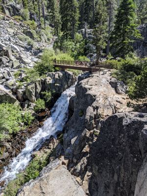
Eagle Falls Trailhead, Mountain trail at Lake Tahoe Basin, California

The two-mile roundtrip route climbs through granite formations and forest sections to reach Eagle Lake at 6,500 feet (1,980 meters), gaining roughly 400 feet (120 meters) in elevation while crossing varied terrain.

Native peoples inhabited the region for thousands of years, using resources around Lake Tahoe for seasonal camps and trade routes. The modern trail infrastructure was developed in the twentieth century as public access to wilderness areas became formally established.

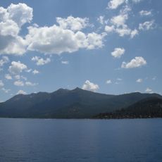
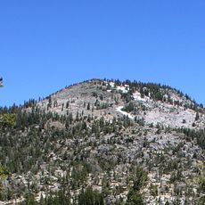
The path traverses the Desolation Wilderness, a federally protected area that serves to maintain the natural landscape of the Sierra Nevada while providing public access to alpine ecosystems.

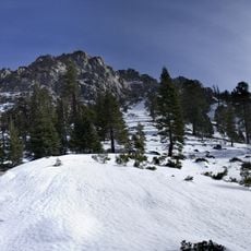
A wilderness permit and five-dollar parking fee are required. The trailhead sits along Highway 89 near Emerald Bay. The best visiting period runs from June through October, as winter snowfall makes the route inaccessible.

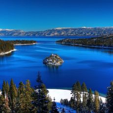
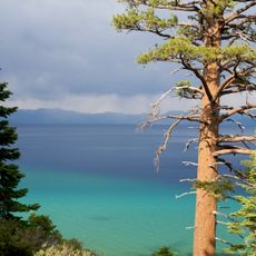
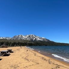
A stone staircase carved into bedrock marks the starting point and leads through several switchbacks, while hikers can observe views of turquoise Emerald Bay and surrounding peaks throughout their ascent.

The community of curious travelers

AroundUs brings together thousands of curated places, local tips, and hidden gems, enriched daily by 60,000 contributors worldwide.

Start exploring
Location
GPS coordinates
38.95194,-120.11194
Latest update
November 29, 2025 20:50
« Eagle Falls Trailhead - Mountain trail at Lake Tahoe Basin, California » is provided by Around Us (aroundus.com). Images and texts are derived from Wikimedia project under a Creative Commons license. You are allowed to copy, distribute, and modify copies of this page, under the conditions set by the license, as long as this note is clearly visible.

Discover hidden gems everywhere you go!

From secret cafés to breathtaking viewpoints, skip the crowded tourist spots and find places that match your style. Our app makes it easy with voice search, smart filtering, route optimization, and insider tips from travelers worldwide. Download now for the complete mobile experience.

Around Us App Screenshot

A unique approach to discovering new places

Le Figaro

All the places worth exploring

France Info

A tailor-made excursion in just a few clicks

20 Minutes

Around Us
Travel Guide & Maps
Download

Send to your phone

QR Code
1

Open the camera app on your mobile.

2

Point at the QR code with your camera. A notification will appear.

3

Tap the notification to open the link.