Enable Location

We need your location to show you interesting places around you

Discover nearby places

Find interesting locations and hidden gems around you

Precise directions

Get accurate directions and distances to places

Your location is never shared with other users. It's only used when you tap the location button.

Mount Tallac

Log in to your account

Start exploring — it's free

Trusted by 62,842 travelers worldwide

Continue with Google
Continue with Apple
or

We will send you a code to connect

By continuing, you accept our Terms and Conditions and our Privacy Policy

Check your inbox

We've sent a pincode in your inbox. Please enter the code below.

Mount Tallac

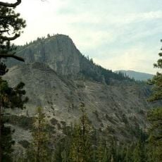
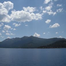
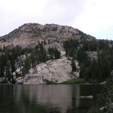
Mount Tallac, Mountain summit in El Dorado County, California.

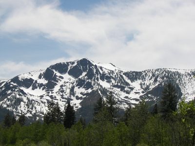
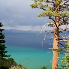
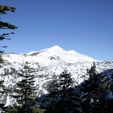
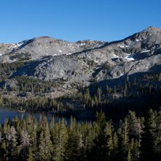
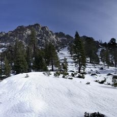
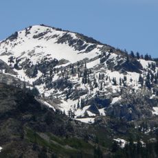
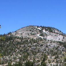
Mount Tallac rises 9,739 feet (2,969 m) above sea level with a distinctive snow cross pattern visible on its east-facing slope during winter and spring. The peak marks a geological boundary where granite rocks of the Sierra Nevada meet older metamorphosed stone formations.

The peak received its name Tallac in 1877 from the Wheeler Survey, derived from the Washoe word daláʔak meaning snowcovered mountain. Earlier mapping expeditions had labeled it differently as Crystal Peak.

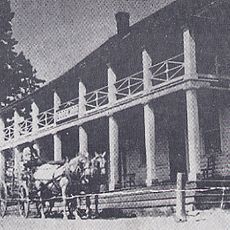
The mountain holds spiritual significance for the Washoe people and remains important in the beliefs of several contemporary religious communities. Visitors walking these slopes connect with a place that has long embodied meaning beyond its physical form.

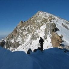
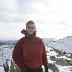
Hikers need a permit to enter Desolation Wilderness, with free self-issued passes available for day trips. Overnight trips require advance reservations due to quota limits on overnight camping.

A striking white snow cross naturally forms on the east-facing slope each winter, creating one of California's most recognizable seasonal displays. This formation emerges and fades on its own schedule independent of human influence.

The community of curious travelers

AroundUs brings together thousands of curated places, local tips, and hidden gems, enriched daily by 60,000 contributors worldwide.

Start exploring
Location
Part of
Sierra Peaks Section Peaks List
GPS coordinates
38.90597,-120.09902
Latest update
December 7, 2025 20:47
« Mount Tallac - Mountain summit in El Dorado County, California » is provided by Around Us (aroundus.com). Images and texts are derived from Wikimedia project under a Creative Commons license. You are allowed to copy, distribute, and modify copies of this page, under the conditions set by the license, as long as this note is clearly visible.

Discover hidden gems everywhere you go!

From secret cafés to breathtaking viewpoints, skip the crowded tourist spots and find places that match your style. Our app makes it easy with voice search, smart filtering, route optimization, and insider tips from travelers worldwide. Download now for the complete mobile experience.

Around Us App Screenshot

A unique approach to discovering new places

Le Figaro

All the places worth exploring

France Info

A tailor-made excursion in just a few clicks

20 Minutes

Around Us
Travel Guide & Maps
Download

Send to your phone

QR Code
1

Open the camera app on your mobile.

2

Point at the QR code with your camera. A notification will appear.

3

Tap the notification to open the link.