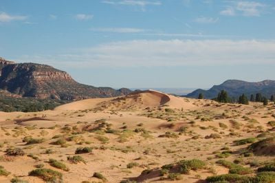
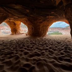
Coral Pink Sand Dunes State Park, State park in southern Utah, United States.
Coral Pink Sand Dunes State Park is a protected area in southern Utah between the Moquith and Moccasin mountain ranges. The colored sand dunes cover approximately 15 square kilometers (6 square miles) and sit at an elevation of around 1,800 meters (6,000 feet).
The sand deposits began forming around 15,000 years ago through weathering of Navajo sandstone from the surrounding mountains. The area was designated as a state park in 1963 to protect its geological features.
The name refers to the pink and orange grains created by the erosion of iron-rich Navajo sandstone. Visitors can watch how the wind shapes the dunes and how the colors shift throughout the day.
The grounds offer 34 camping spots with electricity and water hookups plus designated zones for off-highway vehicles and walking paths. The park lies roughly 16 kilometers (10 miles) west of Kanab and is reachable via a paved access road.
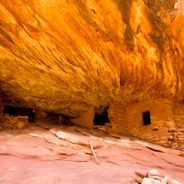
The Coral Pink Tiger Beetle lives only in these dunes and exists nowhere else in the world. Pictographs created by native peoples around 1200 remain on sandstone walls in nearby South Fork Indian Canyon.
The community of curious travelers
AroundUs brings together thousands of curated places, local tips, and hidden gems, enriched daily by 60,000 contributors worldwide.