Chest opened
+${chestReward.xp} XP
Explorer
NOUVEAU ×${chestReward.collectible.quantity}
tapez pour fermer
Chest locked

Open chests in the app

Around Us is built for your phone — chests unlock when you walk, explore and capture nearby places.

Enable Location

We need your location to show you interesting places around you

Discover nearby places

Find interesting locations and hidden gems around you

Precise directions

Get accurate directions and distances to places

Your location is never shared with other users. It's only used when you tap the location button.

Log in to your account

Start exploring — it's free

Trusted by 72,882 travelers worldwide

Continue with Google
Continue with Apple
or

We will send you a code to connect

By continuing, you accept our Terms and Conditions and our Privacy Policy

Check your inbox

We've sent a pincode in your inbox. Please enter the code below.

Daggett Pass
Discussion Reviews Photo
1.3k Popularity

Daggett Pass, Mountain pass in Douglas County, Nevada.

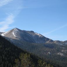
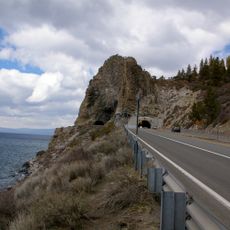
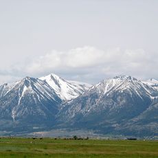
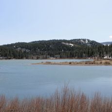
Daggett Pass is a mountain road in Douglas County, Nevada, where Nevada State Route 207 crosses at about 7,339 feet elevation. The route connects Stateline to Carson Valley and winds through mountainous terrain with steep sections and technical curves.

The first road through this mountain pass was built in 1919 as an unpaved route for vehicles and animals. Full paving was completed in 1957, making it a reliable connection for the growing communities on both sides.

The pass received its name from Charles Daggett, Nevada's first doctor, who came from Vermont and played an important role in the region's development. For local drivers, this route remains a key connection between communities on either side of the Sierra Nevada.

Driving through the pass takes about 25 minutes over the 11-mile route, with some steeper sections that require careful handling. Drivers should be prepared for changing weather conditions, especially in winter months when snow and ice can make the drive more difficult.

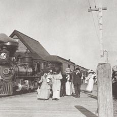
Sections of the historic Pony Express route run through the pass, where gold and valuables were transported in the 1860s. This old trading route is still visible in parts of the road today and recalls a time of intense economic activity in the region.

The community of curious travelers

AroundUs brings together thousands of curated places, local tips, and hidden gems, enriched daily by 60,000 contributors worldwide.

Start exploring
Location
GPS coordinates
38.97657,-119.88879
Latest update
December 14, 2025 18:12
Around this place
Freel Peak
United States of America

Freel Peak

13.3 km
Harveys Outdoor Arena
United States of America

Harveys Outdoor Arena

5.1 km
SS Tahoe
United States of America

SS Tahoe

14 km
De’ek wadapush
United States of America

De’ek wadapush

9.3 km
Jobs Peak
United States of America

Jobs Peak

13.4 km
Spooner Lake
United States of America

Spooner Lake

14.6 km
Dangberg Home Ranch Historic Park
United States of America

Dangberg Home Ranch Historic Park

9.2 km
Friday's Station
United States of America

Friday's Station

4.2 km
Pope Beach
United States of America

Pope Beach

12.9 km
Pope Estate
United States of America

Pope Estate

14.1 km
Lakeside Beach
United States of America

Lakeside Beach

5.7 km
United States of America

East Peak

4.1 km
Minden Flour Milling Company
United States of America

Minden Flour Milling Company

11.1 km
Gardnerville Elementary School
United States of America

Gardnerville Elementary School

13.2 km
Minden Elementary School
United States of America

Minden Elementary School

10.8 km
Douglas County Courthouse
United States of America

Douglas County Courthouse

11.1 km
Round Hill Pines Beach Resort
United States of America

Round Hill Pines Beach Resort

5.7 km
Minden Wool Warehouse
United States of America

Minden Wool Warehouse

11.1 km
Farmer's Bank of Carson Valley
United States of America

Farmer's Bank of Carson Valley

11.3 km
Nevada Beach
United States of America

Nevada Beach

5.6 km
Gardnerville Branch Jail
United States of America

Gardnerville Branch Jail

13.3 km
Carson Valley Improvement Club Hall
United States of America

Carson Valley Improvement Club Hall

11.1 km
Arendt Jensen House
United States of America

Arendt Jensen House

13.4 km
Farmer's Bank of Carson Valley
United States of America

Farmer's Bank of Carson Valley

11.2 km
Arendt Jensen Jr. House
United States of America

Arendt Jensen Jr. House

12.9 km
Reese-Johnson-Virgin House
United States of America

Reese-Johnson-Virgin House

4.9 km
Edgewood Tahoe Golf Course
United States of America

Edgewood Tahoe Golf Course

4.8 km
El Dorado Beach
United States of America

El Dorado Beach

8.3 km
Show the full map
Reviews
Share your experience

No review yet

Discussions
Start a discussion...

No discussion yet

« Daggett Pass - Mountain pass in Douglas County, Nevada » is provided by Around Us (aroundus.com). Images and texts are derived from Wikimedia project under a Creative Commons license. You are allowed to copy, distribute, and modify copies of this page, under the conditions set by the license, as long as this note is clearly visible.

Discover hidden gems everywhere you go!

From secret cafés to breathtaking viewpoints, skip the crowded tourist spots and find places that match your style. Our app makes it easy with voice search, smart filtering, route optimization, and insider tips from travelers worldwide. Download now for the complete mobile experience.

Around Us App Screenshot

A unique approach to discovering new places

Le Figaro

All the places worth exploring

France Info

A tailor-made excursion in just a few clicks

20 Minutes

Around Us
Travel Guide & Maps
Download

Send to your phone

QR Code
1

Open the camera app on your mobile.

2

Point at the QR code with your camera. A notification will appear.

3

Tap the notification to open the link.