Enable Location

We need your location to show you interesting places around you

Discover nearby places

Find interesting locations and hidden gems around you

Precise directions

Get accurate directions and distances to places

Your location is never shared with other users. It's only used when you tap the location button.

Log in to your account

Start exploring — it's free

Trusted by 62,531 travelers worldwide

Continue with Google
Continue with Apple
or

We will send you a code to connect

By continuing, you accept our Terms and Conditions and our Privacy Policy

Check your inbox

We've sent a pincode in your inbox. Please enter the code below.

Mona Reservoir

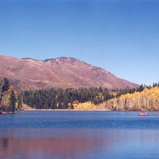
Mona Reservoir, reservoir in Juab County, Utah, United States

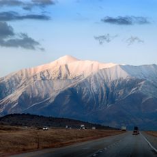
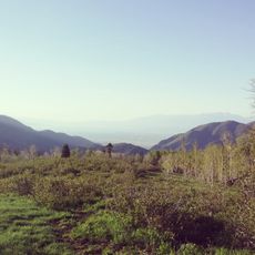
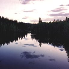
Mona Reservoir is a water storage lake in Juab County, Utah, located on Currant Creek and formed by an earthen dam. The body of water sits in the northern part of Juab Valley at an elevation of about 4,882 feet (1,488 meters) amid rolling hills and open land with minimal development nearby.

The reservoir was built in 1895 by constructing an earthen dam across Currant Creek to store water for farming and local needs. It has served as a key part of Utah's water management system for over a century, supporting agriculture and settlements in the region.

The reservoir is accessible from the nearby town of Mona and offers open space for picnicking, walking, and water activities like boating and fishing when water levels permit. Check conditions before visiting since water levels change with the seasons and affect what activities are possible.

The lake is surrounded by rolling hills that shift noticeably with the seasons, turning white with snow in winter while in summer the water flow helps keep the surrounding land green. This seasonal transformation offers visitors different visual experiences depending on when they arrive.

The community of curious travelers

AroundUs brings together thousands of curated places, local tips, and hidden gems, enriched daily by 60,000 contributors worldwide.

Start exploring
Location
GPS coordinates
39.85778,-111.86611
Latest update
February 9, 2026 08:20
Around this place
Mount Nebo
United States of America

Mount Nebo

9.9 km
Payson Utah Temple
United States of America

Payson Utah Temple

20.6 km
Tintic Standard Reduction Mill
United States of America

Tintic Standard Reduction Mill

11.1 km
Mammoth
United States of America

Mammoth

23.3 km
Peteetneet Museum and Cultural Arts Center
United States of America

Peteetneet Museum and Cultural Arts Center

24 km
West Mountain
United States of America

West Mountain

26 km
George Carter Whitmore Mansion
United States of America

George Carter Whitmore Mansion

16.8 km
Edwin Robert Booth House
United States of America

Edwin Robert Booth House

17.3 km
Juab County Jail
United States of America

Juab County Jail

16.8 km
Santaquin Junior High School
United States of America

Santaquin Junior High School

15.1 km
Payson Historic District
United States of America

Payson Historic District

23.6 km
Payson Presbyterian Church
United States of America

Payson Presbyterian Church

22.8 km
David Morgan House
United States of America

David Morgan House

10.5 km
Eureka LDS Church Meetinghouse
United States of America

Eureka LDS Church Meetinghouse

24 km
Oscar M. Booth House
United States of America

Oscar M. Booth House

16.7 km
John Dixon House
United States of America

John Dixon House

23.9 km
Christopher F. Dixon, Jr., House
United States of America

Christopher F. Dixon, Jr., House

23.9 km
Samuel Douglass House
United States of America

Samuel Douglass House

23.9 km
Eureka Lilly Headframe
United States of America

Eureka Lilly Headframe

20.3 km
Huish Theater
United States of America

Huish Theater

23.6 km
Mount Nebo Wilderness
United States of America

Mount Nebo Wilderness

8.9 km
Big Canyon
United States of America

Big Canyon

15.4 km
Devils Kitchen (Juab County, Utah)
United States of America

Devils Kitchen (Juab County, Utah)

16.4 km
Payson Canyon
United States of America

Payson Canyon

22.2 km
Homansville Canyon
United States of America

Homansville Canyon

21.3 km
Eureka Historic District
United States of America

Eureka Historic District

24 km
Big East Reservoir
United States of America

Big East Reservoir

21.1 km
McClellan Lake
United States of America

McClellan Lake

21 km
Show the full map
« Mona Reservoir - reservoir in Juab County, Utah, United States » is provided by Around Us (aroundus.com). Images and texts are derived from Wikimedia project under a Creative Commons license. You are allowed to copy, distribute, and modify copies of this page, under the conditions set by the license, as long as this note is clearly visible.

Discover hidden gems everywhere you go!

From secret cafés to breathtaking viewpoints, skip the crowded tourist spots and find places that match your style. Our app makes it easy with voice search, smart filtering, route optimization, and insider tips from travelers worldwide. Download now for the complete mobile experience.

Around Us App Screenshot

A unique approach to discovering new places

Le Figaro

All the places worth exploring

France Info

A tailor-made excursion in just a few clicks

20 Minutes

Around Us
Travel Guide & Maps
Download

Send to your phone

QR Code
1

Open the camera app on your mobile.

2

Point at the QR code with your camera. A notification will appear.

3

Tap the notification to open the link.