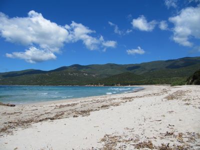
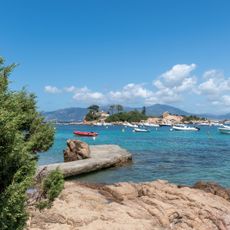
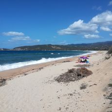
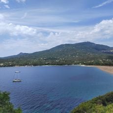
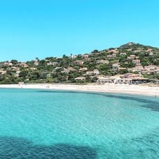
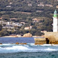
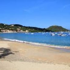
Plage de Cupabia, Sandy beach in Gulf of Valinco, Corsica, France
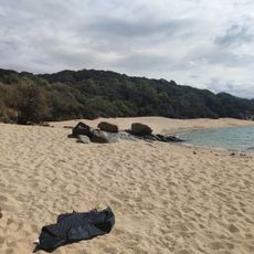
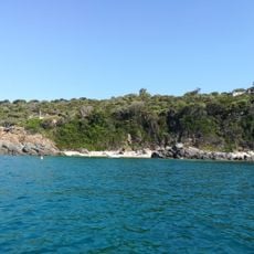
Cupabia Beach stretches along Corsica's southern coast and is divided into two sections by large rocky spurs that jut into the water. Both parts feature fine sand and together form a cohesive bathing area within the Gulf of Valinco.
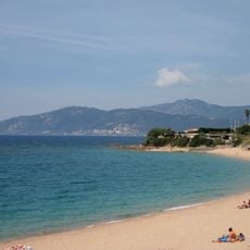
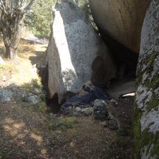
The beach's rocky formations took shape during the Variscan mountain-building period roughly 300 million years ago. The granite-type rock you see today is a remnant of that ancient geological process.
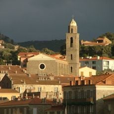
The beach is part of Serra-di-Ferro and serves as a gathering place where locals and visitors share the same sandy shores during the warmer months. You'll notice families and friends spending their days here, making it an everyday spot in the rhythm of Corsican coastal life.
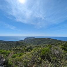
You can reach the beach via the D155 road with parking available nearby, though a short walk of 5 to 10 minutes brings you down to the sand. The shoreline and terrain can be rocky in places, so wear appropriate footwear when walking between sections.
The beach stands out geologically for its pegmatite formations containing reddish feldspar and milky quartz crystals scattered across the rocks. These mineral combinations are uncommon in the Mediterranean, making this spot interesting for those curious about stone and geology.
Location: Corsica
GPS coordinates: 41.74083,8.77778
Latest update: December 6, 2025 19:07
The Corsican coastline extends over 1,000 kilometers and features numerous sandy beaches, rocky coves and marine reserves. The waters around Porto-Vecchio in the southeast of the island display fine white sand and turquoise water. The Bonifacio region presents limestone cliffs and sheltered bays,...
Filitosa
7.8 km
Torra di Capu di Muru
8.5 km
Torra di Campomoru
11.6 kmTorra di a Castagna
8.3 km
Torra di Capannelle
2.1 km
Torra di Capu Neru
5.9 km
Turra di a Calanca
10.8 km
Plage d'Isolella
11.6 km
Torra di l'Isuledda
11.7 km
Castello de Contorba
7.8 km
Torra di Micalona
5.8 km
Tenutella Beach
6.2 km
Calzola Bridge
11 km
Plage de Portigliolo
7.1 km
Couvent Saint-Antoine d'Olmeto
12.1 km
Plage de Baraci
13 km
Col de Cannicciu
4 km
Église Santa Maria d'Olmeto
11.9 km
Église Saint-Jean-Baptiste de Coti-Chiavari
3.7 km
Église Notre-Dame de la Miséricorde de Propriano
12.8 km
Plage de Ruppione
8.5 km
Église Sant'Antonu de Serra-di-Ferro
2.2 km
Église Sainte-Monique de Pietrosella
10.8 km
Scogliu Longu Lighthouse
12.1 km
Plage de la Calanca
11.1 km
I Calanchi
6.2 km
Plage de Vetricella
11.5 km
Plage de Campomoro
12.7 kmVisited this place? Tap the stars to rate it and share your experience / photos with the community! Try now! You can cancel it anytime.
Discover hidden gems everywhere you go!
From secret cafés to breathtaking viewpoints, skip the crowded tourist spots and find places that match your style. Our app makes it easy with voice search, smart filtering, route optimization, and insider tips from travelers worldwide. Download now for the complete mobile experience.
A unique approach to discovering new places❞
— Le Figaro
All the places worth exploring❞
— France Info
A tailor-made excursion in just a few clicks❞
— 20 Minutes