Chest opened
+${chestReward.xp} XP
Explorer
NOUVEAU ×${chestReward.collectible.quantity}
tapez pour fermer
Chest locked

Open chests in the app

Around Us is built for your phone — chests unlock when you walk, explore and capture nearby places.

Enable Location

We need your location to show you interesting places around you

Discover nearby places

Find interesting locations and hidden gems around you

Precise directions

Get accurate directions and distances to places

Your location is never shared with other users. It's only used when you tap the location button.

Escalante

Log in to your account

Start exploring — it's free

Trusted by 72,883 travelers worldwide

Continue with Google
Continue with Apple
or

We will send you a code to connect

By continuing, you accept our Terms and Conditions and our Privacy Policy

Check your inbox

We've sent a pincode in your inbox. Please enter the code below.

Discussion Reviews 2 Photos
24.1k Popularity

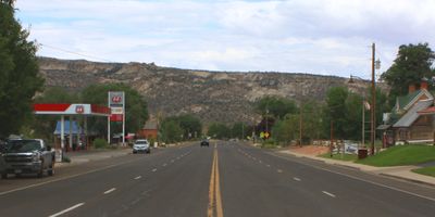
Escalante, City Center in Garfield County, Utah.

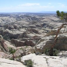
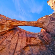
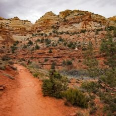
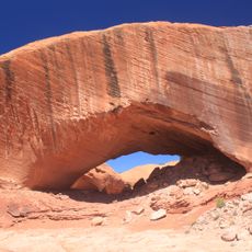
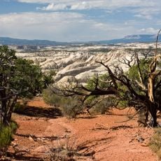
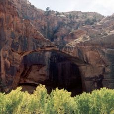
Escalante is a small city in Garfield County in southern Utah, situated along Scenic Byway 12 at roughly 1,774 meters (5,825 ft) in elevation. It serves as a base for exploring the surrounding canyon lands and remote desert terrain.

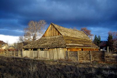
The settlement was established in 1875 as an agricultural community by early pioneers. Over time, it became a gateway for travelers seeking access to the natural landscape and outdoor areas surrounding it.

The historic core displays buildings and streets that mirror how early Mormon communities were organized and built. Walking through town, you can see how these settlers shaped the place around their needs and values.

The town is small and easy to walk around, with shops and services clustered in the center. Keep in mind that larger towns are far away and supplies can be limited, so plan ahead for what you might need.

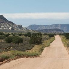
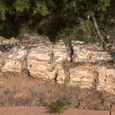
The Calf Creek area just outside town features hidden waterfalls and pools that many travelers passing through miss entirely. Few realize that short hikes from town lead to these quiet water features tucked into the red rock landscape.

The community of curious travelers

AroundUs brings together thousands of curated places, local tips, and hidden gems, enriched daily by 60,000 contributors worldwide.

Start exploring
Location
Inception
1875
Elevation above the sea
1,774 m
Shares border with
Loa
GPS coordinates
37.76944,-111.60139
Latest update
December 20, 2025 13:10
Around this place
Hole in the Rock Trail
United States of America

Hole in the Rock Trail

7.7 km
Escalante Petrified Forest State Park
United States of America

Escalante Petrified Forest State Park

2.8 km
Box-Death Hollow Wilderness
United States of America

Box-Death Hollow Wilderness

13.9 km
Escalante Natural Bridge
United States of America

Escalante Natural Bridge

13.8 km
United States of America

Wide Hollow Reservoir

3.8 km
Lower Calf Creek Falls Trail
United States of America

Lower Calf Creek Falls Trail

16.8 km
Phipps Arch
United States of America

Phipps Arch

16.9 km
McGath Point Bench
United States of America

McGath Point Bench

14.4 km
Escalante Natural Bridge
United States of America

Escalante Natural Bridge

13.8 km
United States of America

Phipps Arch

16.9 km
United States of America

Old Cabin

7.2 km
United States of America

Horizon Arch

6.4 km
United States of America

Covered Wagon Natural Bridge

12.6 km
United States of America

Maverick Bridge

16.8 km
United States of America

Cliff House Arch

13.4 km
United States of America

Pictographs

7.2 km
United States of America

Old Sheffield Road Butte

16.2 km
United States of America

Serenity Natural Bridge

8.2 km
United States of America

Upper Calf Creek Fall

16.2 km
United States of America

Mamie Creek Natural Bridge

8.4 km
United States of America

Hole-in-the-Rock

7.6 km
United States of America

Lookout Escalante

15.8 km
United States of America

Head Of The Rocks Overlook

13.2 km
United States of America

Cedar Wash Arch Photopoint

13.3 km
United States of America

Escalante Overlook

8.8 km
United States of America

Big Horn Viewpoint

16.6 km
United States of America

Scenic viewpoint

11 km
United States of America

Big horn canyon

16.2 km
Show the full map
Reviews
Share your experience

No review yet

Discussions
Start a discussion...

No discussion yet

« Escalante - City Center in Garfield County, Utah » is provided by Around Us (aroundus.com). Images and texts are derived from Wikimedia project under a Creative Commons license. You are allowed to copy, distribute, and modify copies of this page, under the conditions set by the license, as long as this note is clearly visible.

Discover hidden gems everywhere you go!

From secret cafés to breathtaking viewpoints, skip the crowded tourist spots and find places that match your style. Our app makes it easy with voice search, smart filtering, route optimization, and insider tips from travelers worldwide. Download now for the complete mobile experience.

Around Us App Screenshot

A unique approach to discovering new places

Le Figaro

All the places worth exploring

France Info

A tailor-made excursion in just a few clicks

20 Minutes

Around Us
Travel Guide & Maps
Download

Send to your phone

QR Code
1

Open the camera app on your mobile.

2

Point at the QR code with your camera. A notification will appear.

3

Tap the notification to open the link.