Chest opened
+${chestReward.xp} XP
Explorer
NOUVEAU ×${chestReward.collectible.quantity}
tapez pour fermer
Chest locked

Open chests in the app

Around Us is built for your phone — chests unlock when you walk, explore and capture nearby places.

Enable Location

We need your location to show you interesting places around you

Discover nearby places

Find interesting locations and hidden gems around you

Precise directions

Get accurate directions and distances to places

Your location is never shared with other users. It's only used when you tap the location button.

Abiquiú

Log in to your account

Start exploring — it's free

Trusted by 72,880 travelers worldwide

Continue with Google
Continue with Apple
or

We will send you a code to connect

By continuing, you accept our Terms and Conditions and our Privacy Policy

Check your inbox

We've sent a pincode in your inbox. Please enter the code below.

Discussion Reviews 2 Photos
36.2k Popularity

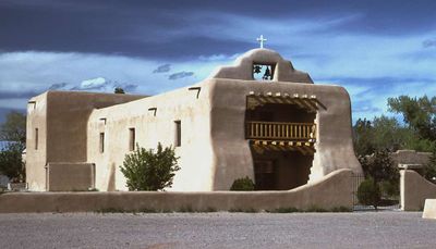
Abiquiú, Census-designated place in Rio Arriba County, New Mexico, US.

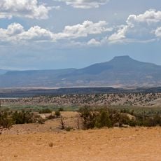
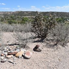
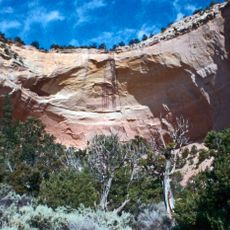
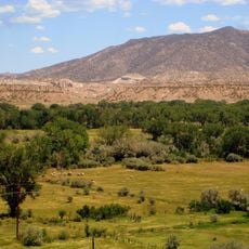
Abiquiú is a small settlement nestled in the high desert of northern New Mexico, surrounded by dramatic red cliffs and mesas. The community sits where the Rio Chama valley meets rolling desert terrain filled with earth tones and geological formations.

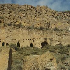
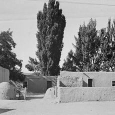
The settlement began in 1742 when Tewa Pueblo families were brought here by a Spanish priest to establish a defensive community. The location served an important role in regional conflicts and trade routes during the colonial period.

The red rock landscape here inspired Georgia O'Keeffe's most recognizable paintings after she chose this place as her home. Her former residence and studio have shaped how visitors see the area today.

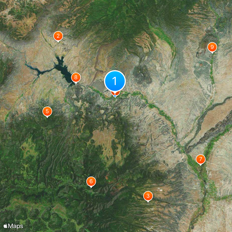
U.S. Route 84 runs through the area and connects the settlement to other parts of New Mexico for exploring nearby canyons and hiking trails. Plan for a remote location with limited services, so it helps to bring water and check conditions before heading out.

This settlement served as the starting point for one of the earliest overland expeditions to California, helping to map and connect the region during the 1800s. The journey linked remote desert communities and established a route that would later become an important pathway across the Southwest.

The community of curious travelers

AroundUs brings together thousands of curated places, local tips, and hidden gems, enriched daily by 60,000 contributors worldwide.

Start exploring
Elevation above the sea
1,849 m
GPS coordinates
36.20944,-106.31861
Latest update
December 19, 2025 21:53
Around this place
Ghost Ranch
United States of America

Ghost Ranch

19.3 km
Puye Cliff Dwellings
United States of America

Puye Cliff Dwellings

27.3 km
Georgia O'Keeffe Home and Studio
United States of America

Georgia O'Keeffe Home and Studio

215 m
Cerro Pedernal
United States of America

Cerro Pedernal

17.4 km
Chicoma Mountain
United States of America

Chicoma Mountain

23.2 km
San Gabriel de Yungue-Ouinge
United States of America

San Gabriel de Yungue-Ouinge

27.1 km
Abiquiu Dam
United States of America

Abiquiu Dam

10.2 km
Posi-ouinge
United States of America

Posi-ouinge

26.2 km
Tsama Pueblo
United States of America

Tsama Pueblo

9.4 km
Rio Grande Bridge at San Juan Pueblo
United States of America

Rio Grande Bridge at San Juan Pueblo

27.2 km
United States of America

Tomas Gonzales House

1.9 km
Echo amphitheatre
United States of America

Echo amphitheatre

25.2 km
Georgia O'keefe museum and home
United States of America

Georgia O'keefe museum and home

197 m
United States of America

Cerro Valdez

27 km
United States of America

Abiquiu Historical Marker

49 m
United States of America

La Cuchilla de la Monjonera

16.7 km
United States of America

Old Spanish Trail Historical Marker

254 m
United States of America

Delgado Hall Historic Site

19 km
United States of America

Tsi’pin Ruins trailhead (permit required via Coyote Ranger Station)

11.7 km
United States of America

Abiquiu Dam Visitor Center

10.4 km
United States of America

Pink Flamingo

212 m
United States of America

Mars Polar Lander

19.2 km
United States of America

Statue, Work of art

648 m
United States of America

Mural, Work of art

25.6 km
United States of America

Scenic viewpoint

10.4 km
United States of America

Scenic viewpoint

12.9 km
United States of America

Scenic viewpoint

10.3 km
United States of America

Scenic viewpoint

10.4 km
Show the full map
Reviews
Share your experience

No review yet

Discussions
Start a discussion...

No discussion yet

« Abiquiú - Census-designated place in Rio Arriba County, New Mexico, US » is provided by Around Us (aroundus.com). Images and texts are derived from Wikimedia project under a Creative Commons license. You are allowed to copy, distribute, and modify copies of this page, under the conditions set by the license, as long as this note is clearly visible.

Discover hidden gems everywhere you go!

From secret cafés to breathtaking viewpoints, skip the crowded tourist spots and find places that match your style. Our app makes it easy with voice search, smart filtering, route optimization, and insider tips from travelers worldwide. Download now for the complete mobile experience.

Around Us App Screenshot

A unique approach to discovering new places

Le Figaro

All the places worth exploring

France Info

A tailor-made excursion in just a few clicks

20 Minutes

Around Us
Travel Guide & Maps
Download

Send to your phone

QR Code
1

Open the camera app on your mobile.

2

Point at the QR code with your camera. A notification will appear.

3

Tap the notification to open the link.