Enable Location

We need your location to show you interesting places around you

Discover nearby places

Find interesting locations and hidden gems around you

Precise directions

Get accurate directions and distances to places

Your location is never shared with other users. It's only used when you tap the location button.

Pueblo County

Log in to your account

Join the adventure

Create your free account and start exploring (like 60k+ others)

We will send you a code to connect

or
Continue with Google
Continue with Apple
By continuing, you accept our Terms and Conditions and our Privacy Policy

Check your inbox

We've sent a pincode in your inbox. Please enter the code below.

Pueblo County

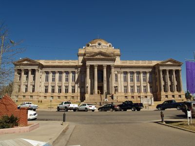
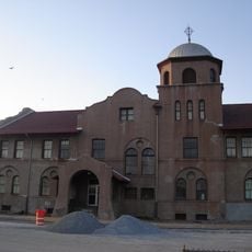
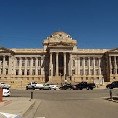
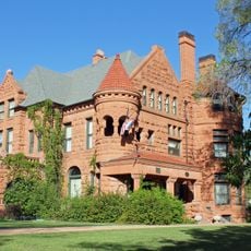
Pueblo County, County in southeastern Colorado, United States

Description

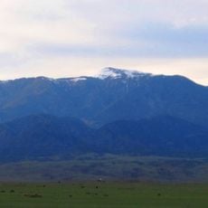
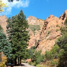
Pueblo County is an administrative region in southeastern Colorado with varied landscapes of plains, rolling hills, and mountain ranges. The Arkansas River flows through the territory and shapes the natural character of this large area.

History

The region was officially established on November 1, 1861, during Colorado's territorial period before statehood. The name comes from the Spanish word pueblo, meaning town or community.

Culture

The county administration maintains multiple educational institutions through District 60 and District 70, serving students across numerous communities and neighborhoods.

Practical

The main transportation routes are Interstate 25, U.S. Highway 50, and State Highway 96, offering quick connections to other regions and communities. Visitors should plan for travel time since the area is spread out across multiple locations and neighborhoods.

Did you know?

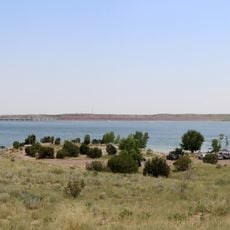
Lake Pueblo State Park is located within the county and features a large reservoir for swimming, boating, and other water activities. The water draws people seeking outdoor recreation and relaxation by the shoreline.

Location
Inception
November 1, 1874
Capital city
Pueblo
Shares border with
El Paso County, Huerfano County, Las Animas County, Lincoln County, Crowley County, Otero County, Custer County, Fremont County
GPS coordinates
38.15000,-104.51000
Latest update
December 14, 2025 20:26

AroundUs brings together thousands of curated places, local tips, and hidden gems, enriched daily by 60,000 contributors worldwide. Discover all places nearby (Colorado).

Around this place
Lake Pueblo State Park
United States of America

Lake Pueblo State Park

22.6 km
Huerfano Butte
United States of America

Huerfano Butte

52.1 km
Pueblo Weisbrod Aircraft Museum
United States of America

Pueblo Weisbrod Aircraft Museum

14.7 km
Greenhorn Mountain
United States of America

Greenhorn Mountain

53.3 km
North Cheyenne Cañon Park
United States of America

North Cheyenne Cañon Park

50.9 km
Pueblo Zoo
United States of America

Pueblo Zoo

18 km
Rosemount Museum
United States of America

Rosemount Museum

17.1 km
Buell Children's Museum
United States of America

Buell Children's Museum

15.8 km
Cathedral of the Sacred Heart
United States of America

Cathedral of the Sacred Heart

16.7 km
Union Avenue Historic Commercial District
United States of America

Union Avenue Historic Commercial District

15.6 km
El Pueblo History Museum
United States of America

El Pueblo History Museum

15.8 km
Pueblo City-County Library District
United States of America

Pueblo City-County Library District

15.5 km
Minnequa Steel Works Office Building and Dispensary, Colorado Fuel and Iron Company
United States of America

Minnequa Steel Works Office Building and Dispensary, Colorado Fuel and Iron Company

13.3 km
Pueblo City Park Carousel
United States of America

Pueblo City Park Carousel

17.8 km
Pueblo County Courthouse
United States of America

Pueblo County Courthouse

16.6 km
Orman-Adams House
United States of America

Orman-Adams House

15.5 km
Steelworks Museum of Industry and Culture
United States of America

Steelworks Museum of Industry and Culture

13.2 km
Sangre de Cristo Arts and Conference Center
United States of America

Sangre de Cristo Arts and Conference Center

15.7 km
Pueblo Levee Mural Project
United States of America

Pueblo Levee Mural Project

14.6 km
Pueblo Federal Building
United States of America

Pueblo Federal Building

16 km
First Methodist Episcopal Church
United States of America

First Methodist Episcopal Church

15.3 km
First Methodist Episcopal Church
United States of America

First Methodist Episcopal Church

15.3 km
Quaker Flour Mill
United States of America

Quaker Flour Mill

15.2 km
Charles H. Stickney House
United States of America

Charles H. Stickney House

15.5 km
St. John's Greek Orthodox Church
United States of America

St. John's Greek Orthodox Church

14.5 km
St. Charles Bridge
United States of America

St. Charles Bridge

6.5 km
First Congregational Church, Pueblo, Colorado
United States of America

First Congregational Church, Pueblo, Colorado

16.3 km
Colorado Building
United States of America

Colorado Building

16 km
Show the full map
Administrative divisions
« Pueblo County - County in southeastern Colorado, United States » is provided by Around Us (aroundus.com). Images and texts are derived from Wikimedia project under a Creative Commons license. You are allowed to copy, distribute, and modify copies of this page, under the conditions set by the license, as long as this note is clearly visible.

Discover hidden gems everywhere you go!

From secret cafés to breathtaking viewpoints, skip the crowded tourist spots and find places that match your style. Our app makes it easy with voice search, smart filtering, route optimization, and insider tips from travelers worldwide. Download now for the complete mobile experience.

Around Us App Screenshot

A unique approach to discovering new places

Le Figaro

All the places worth exploring

France Info

A tailor-made excursion in just a few clicks

20 Minutes

Around Us
Travel Guide & Maps
Download

Send to your phone

QR Code
1

Open the camera app on your mobile.

2

Point at the QR code with your camera. A notification will appear.

3

Tap the notification to open the link.