Chest opened
+${chestReward.xp} XP
Explorer
NOUVEAU ×${chestReward.collectible.quantity}
tapez pour fermer
Chest locked

Open chests in the app

Around Us is built for your phone — chests unlock when you walk, explore and capture nearby places.

Enable Location

We need your location to show you interesting places around you

Discover nearby places

Find interesting locations and hidden gems around you

Precise directions

Get accurate directions and distances to places

Your location is never shared with other users. It's only used when you tap the location button.

Log in to your account

Start exploring — it's free

Trusted by 72,874 travelers worldwide

Continue with Google
Continue with Apple
or

We will send you a code to connect

By continuing, you accept our Terms and Conditions and our Privacy Policy

Check your inbox

We've sent a pincode in your inbox. Please enter the code below.

Devil's Slide
Discussion Reviews Photo
12.4k Popularity

Devil's Slide, Vertical limestone formation in Morgan County, United States.

Devil's Slide is a geological formation consisting of two parallel limestone slabs projecting 40 feet from the mountainside and separated by 25 feet of eroded softer rock. This formation sits in Weber Canyon and creates a distinctive landmark visible from the interstate highway.

This rock formation originated 170 million years ago when sediments accumulated in an ancient seabed. About 75 million years ago, these layers were tilted to a nearly vertical position during the mountain-building process that shaped the region.

The name refers to the steep angle and dark color of the limestone cliffs, which resemble a sliding surface. Visitors immediately recognize this distinctive shape when traveling along Interstate 84 and understand why early settlers chose this descriptive name.

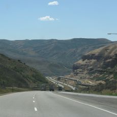
The best viewing locations are the designated parking areas along Interstate 84 near the formation. From these spots you can observe the rocks clearly while the Weber River flows between the highway and the limestone slabs.

Unlike most limestone layers that stack horizontally, these slabs stand nearly vertical as a result of the mountain-building forces that affected this region. This unusual arrangement helps visitors understand the powerful geological processes that reshaped this area millions of years ago.

The community of curious travelers

AroundUs brings together thousands of curated places, local tips, and hidden gems, enriched daily by 60,000 contributors worldwide.

Start exploring
Location
GPS coordinates
41.06360,-111.54800
Latest update
March 21, 2026 19:17
Reviews
Share your experience

No review yet

Discussions
Start a discussion...

No discussion yet

« Devil's Slide - Vertical limestone formation in Morgan County, United States » is provided by Around Us (aroundus.com). Images and texts are derived from Wikimedia project under a Creative Commons license. You are allowed to copy, distribute, and modify copies of this page, under the conditions set by the license, as long as this note is clearly visible.

Discover hidden gems everywhere you go!

From secret cafés to breathtaking viewpoints, skip the crowded tourist spots and find places that match your style. Our app makes it easy with voice search, smart filtering, route optimization, and insider tips from travelers worldwide. Download now for the complete mobile experience.

Around Us App Screenshot

A unique approach to discovering new places

Le Figaro

All the places worth exploring

France Info

A tailor-made excursion in just a few clicks

20 Minutes

Around Us
Travel Guide & Maps
Download

Send to your phone

QR Code
1

Open the camera app on your mobile.

2

Point at the QR code with your camera. A notification will appear.

3

Tap the notification to open the link.