Enable Location

We need your location to show you interesting places around you

Discover nearby places

Find interesting locations and hidden gems around you

Precise directions

Get accurate directions and distances to places

Your location is never shared with other users. It's only used when you tap the location button.

Thousand Mile Tree

Log in to your account

Start exploring — it's free

Trusted by 62,835 travelers worldwide

Continue with Google
Continue with Apple
or

We will send you a code to connect

By continuing, you accept our Terms and Conditions and our Privacy Policy

Check your inbox

We've sent a pincode in your inbox. Please enter the code below.

Thousand Mile Tree

Thousand Mile Tree, Railroad landmark tree in Weber Canyon, US

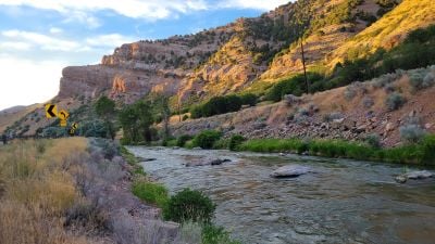
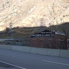
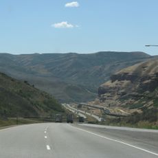
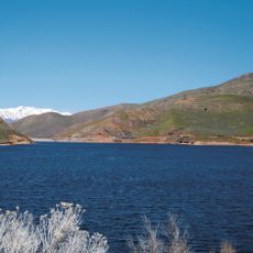
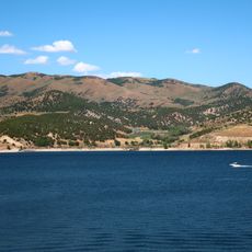
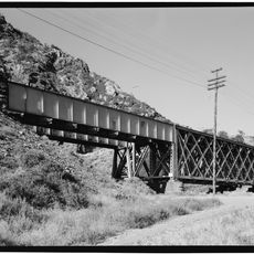
The Thousand Mile Tree is a pine growing near the Union Pacific Railroad tracks within Weber Canyon, marking a historically significant distance point along the transcontinental route. The site sits in a narrow canyon where steep rock walls frame both the railroad line and the highway that run side by side.

In January 1869, railroad workers identified this spot as exactly one thousand miles west of the eastern terminus in Omaha during transcontinental railroad construction. The distance measurement was recorded as workers surveyed the route westward.

The tree has been documented through photographs by notable photographers such as Eadweard Muybridge and Carleton E. Watkins during the western expansion period.

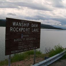
The site is reachable via Interstate 80 or U.S. Route 30, which both run parallel to the railroad tracks through the canyon. You can spot the tree from the road, but stay cautious if approaching the active rail area.

The original tree stood about 90 feet tall and was replaced in 1982 with the pine you see today still growing on site. Early photographers including notable artists captured the original specimen, creating a photographic record of the landmark.

The community of curious travelers

AroundUs brings together thousands of curated places, local tips, and hidden gems, enriched daily by 60,000 contributors worldwide.

Start exploring
Location
Address
Croydon, UT 84018, USA
GPS coordinates
41.05306,-111.52926
Latest update
December 10, 2025 20:03
Around this place
Causey Reservoir
United States of America

Causey Reservoir

27.7 km
East Canyon State Park
United States of America

East Canyon State Park

17.6 km
Bonneville Shoreline Trail
United States of America

Bonneville Shoreline Trail

30.3 km
Abbey of Our Lady of the Holy Trinity
United States of America

Abbey of Our Lady of the Holy Trinity

25.8 km
Rockport Reservoir
United States of America

Rockport Reservoir

31.1 km
BomBora
United States of America

BomBora

31.4 km
Bat
United States of America

Bat

31.4 km
Farmington Rock Chapel
United States of America

Farmington Rock Chapel

31 km
Summit Stake Tabernacle
United States of America

Summit Stake Tabernacle

20.2 km
Devil's Gate-Weber Hydroelectric Power Plant
United States of America

Devil's Gate-Weber Hydroelectric Power Plant

31.3 km
Echo Church and School
United States of America

Echo Church and School

11.2 km
Echo School
United States of America

Echo School

10.7 km
Thomas L. Allen House
United States of America

Thomas L. Allen House

18.5 km
Samuel P. Hoyt House
United States of America

Samuel P. Hoyt House

23.6 km
Annie Birch House
United States of America

Annie Birch House

21.5 km
Farmington Tithing Office
United States of America

Farmington Tithing Office

31.1 km
Thomas and Jane Beech House
United States of America

Thomas and Jane Beech House

18.9 km
Morgan High School Mechanical Arts Building
United States of America

Morgan High School Mechanical Arts Building

12.4 km
Summit County Courthouse
United States of America

Summit County Courthouse

18.6 km
Hector C. Haight House
United States of America

Hector C. Haight House

31 km
Farmington Main Street Historic District
United States of America

Farmington Main Street Historic District

31.2 km
John Boyden House
United States of America

John Boyden House

18.9 km
Daniel Heiner House
United States of America

Daniel Heiner House

12.4 km
Richards House
United States of America

Richards House

30.7 km
Echo Canyon
United States of America

Echo Canyon

11.9 km
East Canyon Reservoir
United States of America

East Canyon Reservoir

16.9 km
Echo Reservoir
United States of America

Echo Reservoir

15.6 km
Devil's Gate Bridge
United States of America

Devil's Gate Bridge

29.4 km
Show the full map
« Thousand Mile Tree - Railroad landmark tree in Weber Canyon, US » is provided by Around Us (aroundus.com). Images and texts are derived from Wikimedia project under a Creative Commons license. You are allowed to copy, distribute, and modify copies of this page, under the conditions set by the license, as long as this note is clearly visible.

Discover hidden gems everywhere you go!

From secret cafés to breathtaking viewpoints, skip the crowded tourist spots and find places that match your style. Our app makes it easy with voice search, smart filtering, route optimization, and insider tips from travelers worldwide. Download now for the complete mobile experience.

Around Us App Screenshot

A unique approach to discovering new places

Le Figaro

All the places worth exploring

France Info

A tailor-made excursion in just a few clicks

20 Minutes

Around Us
Travel Guide & Maps
Download

Send to your phone

QR Code
1

Open the camera app on your mobile.

2

Point at the QR code with your camera. A notification will appear.

3

Tap the notification to open the link.