Chest opened
+${chestReward.xp} XP
Explorer
NOUVEAU ×${chestReward.collectible.quantity}
tapez pour fermer
Chest locked

Open chests in the app

Around Us is built for your phone — chests unlock when you walk, explore and capture nearby places.

Enable Location

We need your location to show you interesting places around you

Discover nearby places

Find interesting locations and hidden gems around you

Precise directions

Get accurate directions and distances to places

Your location is never shared with other users. It's only used when you tap the location button.

Log in to your account

Start exploring — it's free

Trusted by 72,879 travelers worldwide

Continue with Google
Continue with Apple
or

We will send you a code to connect

By continuing, you accept our Terms and Conditions and our Privacy Policy

Check your inbox

We've sent a pincode in your inbox. Please enter the code below.

Wind River Pass
Discussion Reviews Photo
1.3k Popularity

Wind River Pass, Mountain pass in Larimer County, United States

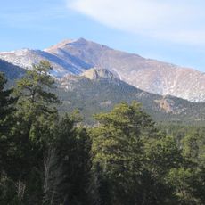
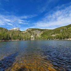
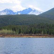
Wind River Pass is a mountain pass in Larimer County that connects Allenspark to Estes Park via State Highway 7 at an elevation of 2,790 meters. The fully paved, two-lane route cuts through the Front Range of the Rocky Mountains and provides access to hiking areas and mountain communities.

The pass developed as a vital route through the Front Range to connect mountain communities in northern Colorado. State Highway 7 later standardized crossing the pass and made it more reliable and frequently traveled.

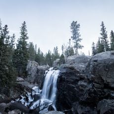
Local outdoor enthusiasts regularly traverse this mountain pass while engaging in activities such as hiking, photography, and wildlife observation.

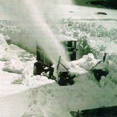
The road is passable year-round, though winter and early spring conditions require caution and can reduce visibility. Drivers should prepare for changing weather at elevation and travel slower, especially when snow or fog develops.

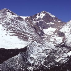
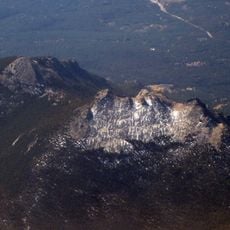
Proximity to Twin Sisters Peaks creates distinct weather patterns with sudden temperature shifts that differ sharply from surrounding lowlands. Visitors often notice dramatic differences in weather conditions while crossing the pass, especially compared to adjacent valleys.

The community of curious travelers

AroundUs brings together thousands of curated places, local tips, and hidden gems, enriched daily by 60,000 contributors worldwide.

Start exploring
Location
GPS coordinates
40.29580,-105.54400
Latest update
December 14, 2025 18:09
Around this place
The Stanley Hotel
United States of America

The Stanley Hotel

10 km
Longs Peak
United States of America

Longs Peak

7.6 km
Chapel on the Rock
United States of America

Chapel on the Rock

5.5 km
Twin Sisters Peaks
United States of America

Twin Sisters Peaks

2.3 km
Mount Meeker
United States of America

Mount Meeker

7.4 km
The Baldpate Inn
United States of America

The Baldpate Inn

1.7 km
Bear Lake Trailhead
United States of America

Bear Lake Trailhead

8.8 km
Lake Estes
United States of America

Lake Estes

10.2 km
Beaver Meadows Visitor Center
United States of America

Beaver Meadows Visitor Center

8 km
Agnes Vaille Shelter
United States of America

Agnes Vaille Shelter

7.6 km
East Longs Peak Trail – Longs Peak Trail – Keyhole Route – Shelf Trail
United States of America

East Longs Peak Trail – Longs Peak Trail – Keyhole Route – Shelf Trail

5.5 km
Fern Lake Trail
United States of America

Fern Lake Trail

9.8 km
Moraine Park Museum and Amphitheater
United States of America

Moraine Park Museum and Amphitheater

7.8 km
Snogo Snow Plow
United States of America

Snogo Snow Plow

7.7 km
Park Theatre
United States of America

Park Theatre

9.2 km
William Allen White Cabins
United States of America

William Allen White Cabins

7.5 km
Wild Basin Ranger Station
United States of America

Wild Basin Ranger Station

9.9 km
Glacier Basin Campground Ranger Station
United States of America

Glacier Basin Campground Ranger Station

5.8 km
Rocky Mountain National Park Utility Area Historic District
United States of America

Rocky Mountain National Park Utility Area Historic District

7.7 km
Wild Basin House
United States of America

Wild Basin House

9.9 km
Moraine Park Discovery Center
United States of America

Moraine Park Discovery Center

7.7 km
Lily Lake
United States of America

Lily Lake

1.3 km
Copeland Lake
United States of America

Copeland Lake

8.6 km
Alberta Falls
United States of America

Alberta Falls

8 km
Estes Park Museum
United States of America

Estes Park Museum

9.4 km
Fun City
United States of America

Fun City

8.6 km
Chasm Meadow Patrol Cabin
United States of America

Chasm Meadow Patrol Cabin

6.2 km
Glacier Basin Campground
United States of America

Glacier Basin Campground

5.6 km
Show the full map
Reviews
Share your experience

No review yet

Discussions
Start a discussion...

No discussion yet

« Wind River Pass - Mountain pass in Larimer County, United States » is provided by Around Us (aroundus.com). Images and texts are derived from Wikimedia project under a Creative Commons license. You are allowed to copy, distribute, and modify copies of this page, under the conditions set by the license, as long as this note is clearly visible.

Discover hidden gems everywhere you go!

From secret cafés to breathtaking viewpoints, skip the crowded tourist spots and find places that match your style. Our app makes it easy with voice search, smart filtering, route optimization, and insider tips from travelers worldwide. Download now for the complete mobile experience.

Around Us App Screenshot

A unique approach to discovering new places

Le Figaro

All the places worth exploring

France Info

A tailor-made excursion in just a few clicks

20 Minutes

Around Us
Travel Guide & Maps
Download

Send to your phone

QR Code
1

Open the camera app on your mobile.

2

Point at the QR code with your camera. A notification will appear.

3

Tap the notification to open the link.