Chest opened
+${chestReward.xp} XP
Explorer
NOUVEAU ×${chestReward.collectible.quantity}
tapez pour fermer
Chest locked

Open chests in the app

Around Us is built for your phone — chests unlock when you walk, explore and capture nearby places.

Enable Location

We need your location to show you interesting places around you

Discover nearby places

Find interesting locations and hidden gems around you

Precise directions

Get accurate directions and distances to places

Your location is never shared with other users. It's only used when you tap the location button.

Log in to your account

Start exploring — it's free

Trusted by 72,893 travelers worldwide

Continue with Google
Continue with Apple
or

We will send you a code to connect

By continuing, you accept our Terms and Conditions and our Privacy Policy

Check your inbox

We've sent a pincode in your inbox. Please enter the code below.

Never Summer Wilderness
Discussion Reviews Photo
2.9k Popularity

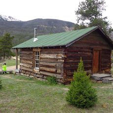
Never Summer Wilderness, Protected wilderness area in Colorado, United States.

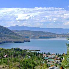
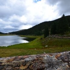
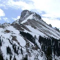
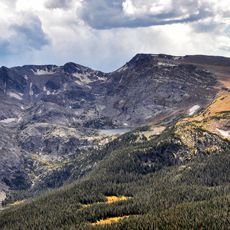
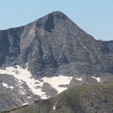
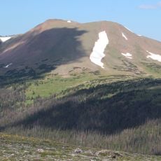
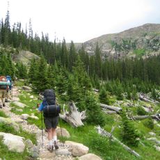
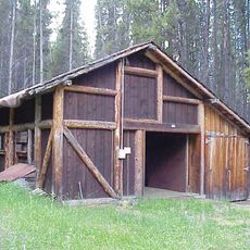
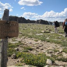
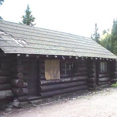
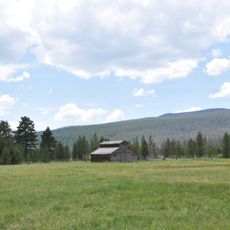
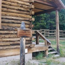
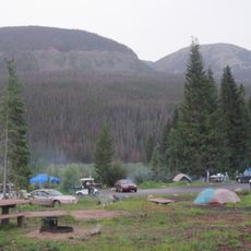
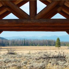
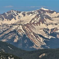
Never Summer Wilderness is a protected mountain area with alpine lakes, dense forests, and high peaks along the Continental Divide. The terrain rises from about 8,900 feet to 12,500 feet and contains multiple trails for hiking and backpacking.

The United States Congress protected this forest area in 1980 as part of a broader effort to preserve wilderness lands. The designation placed it under the management of the Arapaho National Forest.

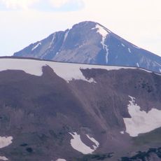
The peaks here carry names inspired by cloud formations - Cirrus, Cumulus, and Stratus - reflecting how people understood this mist-covered landscape. Hikers soon realize that clouds are a constant part of the experience, making the wilderness's name come alive.

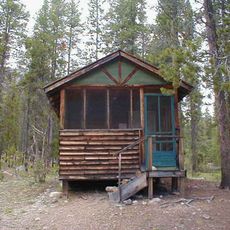
The best conditions for hiking are during warmer months when snow has melted and trails are accessible. Visitors should wear good hiking boots and prepare for rapidly changing weather at high elevation.

This area supplies water to three major rivers - the Colorado, the North Platte, and the Cache la Poudre through its constant precipitation. This hidden role as a water source is often overlooked by visitors focused on the landscape itself.

The community of curious travelers

AroundUs brings together thousands of curated places, local tips, and hidden gems, enriched daily by 60,000 contributors worldwide.

Start exploring
Location
Inception
1980
GPS coordinates
40.35000,-105.93300
Latest update
December 12, 2025 12:05
Around this place
Trail Ridge Road
United States of America

Trail Ridge Road

14.7 km
Grand Lake
United States of America

Grand Lake

15.3 km
Shadow Mountain Lake
United States of America

Shadow Mountain Lake

15.6 km
Milner Pass
United States of America

Milner Pass

12.9 km
Mount Richthofen
United States of America

Mount Richthofen

13.7 km
Nokhu Crags
United States of America

Nokhu Crags

15.4 km
Mount Ida
United States of America

Mount Ida

13.3 km
Holzwarth Historic District
United States of America

Holzwarth Historic District

6.5 km
Mount Julian
United States of America

Mount Julian

15.1 km
Specimen Mountain
United States of America

Specimen Mountain

14.9 km
Shadow Mountain Lookout
United States of America

Shadow Mountain Lookout

16.7 km
United States of America

Braddock Peak

14.6 km
Shadow Mountain Trail
United States of America

Shadow Mountain Trail

15.2 km
Kauffman House
United States of America

Kauffman House

14.8 km
North Inlet Trail
United States of America

North Inlet Trail

14.5 km
Timber Creek Road Camp Barn
United States of America

Timber Creek Road Camp Barn

12.6 km
Timber Creek Campground Comfort Stations
United States of America

Timber Creek Campground Comfort Stations

7.7 km
Tonahutu Creek Trail
United States of America

Tonahutu Creek Trail

14.4 km
Milner Pass Road Camp Mess Hall and House
United States of America

Milner Pass Road Camp Mess Hall and House

12 km
Little Buckaroo Ranch Barn
United States of America

Little Buckaroo Ranch Barn

6.7 km
Fleshut Cabin
United States of America

Fleshut Cabin

7.1 km
Timber Creek Campground Comfort Station No. 247
United States of America

Timber Creek Campground Comfort Station No. 247

7.5 km
Timber Creek Campground Comfort Station No. 245
United States of America

Timber Creek Campground Comfort Station No. 245

7.6 km
Timber Creek Campground Comfort Station No. 246
United States of America

Timber Creek Campground Comfort Station No. 246

7.6 km
La Poudre Pass Ranger Station
United States of America

La Poudre Pass Ranger Station

16.7 km
Timber Creek Campground
United States of America

Timber Creek Campground

7.6 km
Harbison Picnic Area
United States of America

Harbison Picnic Area

11 km
Mount Stratus
United States of America

Mount Stratus

5.1 km
Show the full map
Reviews
Share your experience

No review yet

Discussions
Start a discussion...

No discussion yet

« Never Summer Wilderness - Protected wilderness area in Colorado, United States » is provided by Around Us (aroundus.com). Images and texts are derived from Wikimedia project under a Creative Commons license. You are allowed to copy, distribute, and modify copies of this page, under the conditions set by the license, as long as this note is clearly visible.

Discover hidden gems everywhere you go!

From secret cafés to breathtaking viewpoints, skip the crowded tourist spots and find places that match your style. Our app makes it easy with voice search, smart filtering, route optimization, and insider tips from travelers worldwide. Download now for the complete mobile experience.

Around Us App Screenshot

A unique approach to discovering new places

Le Figaro

All the places worth exploring

France Info

A tailor-made excursion in just a few clicks

20 Minutes

Around Us
Travel Guide & Maps
Download

Send to your phone

QR Code
1

Open the camera app on your mobile.

2

Point at the QR code with your camera. A notification will appear.

3

Tap the notification to open the link.